
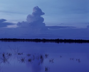
FABIO COLOMBINIAraguaia river: 25% more water alreadyFABIO COLOMBINI
Cutting down forests does not merely cause local changes, such as soil erosion. It can also cause broader changes, first increasing and then reducing the volume of water in the main rivers in a region. The reduction in the rainfall that should follow may also affect areas that are far away from the deforested regions, because of the circulation of air masses in the lower atmosphere, according to recent studies on the Amazon Forest by researchers from the state of Minas Gerais and from the United States. “Without the native vegetation, which releases part of the rainfall into the atmosphere in the form of vapor, more water will run into the rivers, even if the volume of rainfall doesn’t increase,” says Marcos Costa, a professor at the Federal University of Viçosa (UFV), Minas Gerais. Costa is one of the authors of the article published in May of this year in the Journal of Hydrology about these results, obtained by means of field observations and mathematical simulations of the impact of changes in the use of land and in the atmosphere upon the rainfall system. Greater fluctuation of the level of rivers may have serious consequences for those who live near them – since heavy flooding can precede more dramatic droughts – and for the generation of electric energy – since the design of hydroelectric power stations is planned based on regular fluctuations of the waterflow in rivers.
Rivers near deforested land are already carrying more water, in response to the environmental changes in the last few decades. In a study from 2003 published in the Journal of Hydrology, Costa and two colleagues from the University of Wisconsin found that the volume of water had increased by an average of 25% in the main rivers of the Araguaia-Tocantins hydrographic basin relative to the 1949-1968 and 1979-1998 periods. “This waterflow increase is important because we are talking about long-term averages, covering 20 years or more, on a time scale in which the variation should have been minimal or null,” says Costa. This river network irrigates some 10% of Brazil – an area equal to three times the state of São Paulo. “Nobody had imagined that these effects were already occurring.”
Another conclusion is that in the last two decades, the Tocantins river flow was at its most intense one month early, which could, potentially, change the power generation capacity of the four hydroelectric power stations on the Tocantins – one of which, Tucuruí, is Brazil’s second largest. “This information is important and must be taken into account in the planning of the use of water resources,” says Benedito Braga, director of ANA, the National Water Agency, who became aware of these results at a seminar held in Sweden in 2007. The strategic plan for the Araguaia and Tocantins hydrographic basin that ANA presented this year predicts the construction of 13 hydroelectric power stations by 2016.
Vulnerable areas
The Amazonian basin may lose 25% to 40% of its native forest by 2050 if the pace of deforestation is kept up, according to a study published by Britaldo Soares-Filho, from the Federal University of Minas Gerais, in 2006, in Nature. “The more heavily deforested areas are likely to suffer more,” states Soares-Filho. In the basin of the Tocantins river, one of those that have been most heavily transformed by crop and livestock farming, the loss of native vegetation may rise from the current level of 58% to 80%, in the case of strong government control of deforestation, or 90%, if governance is weak. Rivers such as the Araguaia, the Xingu, the Tapajós and the Madeira, which flow across areas of heavy deforestation, are also subject to drastic change by the middle of the current century. Even the Juruá river basin, which at present is almost entirely covered by forest, may lose 21% to 43% of its natural vegetation by 2050.
Adaptations to ease the impact of heavier flooding, which will now affect the atmosphere, may be useless at a second period of time, when the problem will be the rivers’ decreased waterflow, another outcome of the reduction of natural vegetation. In a more recent study, Costa, Soares-Filho and Michael Coe, a researcher at the Woods Hole Research Center in the United States, describe the sequence of phenomena that causes this: deforestation will diminish the volume of water vapor released by plants into the atmosphere by transpiration, as there will be grass where previously there were trees. As a result, rainwater will flow into the rivers without returning to the clouds to form new rainfall.
As the air near the deforested land becomes warmer than before, the heat flow and air circulation will probably change. It may rain less even in areas that are far away from the deforested regions, since the wind will carry drier air for longer time spans. The deforestation of Goiás or Mato Grosso may reduce the waterflow in the Negro river by as much as 10%. This also applies to other rivers north and northeast of the Amazon region that flow through virtually untouched territories.
The extent of the deforestation determines the impact on the rainfall system. Coe, Costa and Soares-Filho concluded that the amount of rain over a given region will tend to remain stable for as long as native woodland covers at least half the areas. “The deforestation forecast for 2050, even if the government undertakes action, is enough for rain to start decreasing,” says Costa. This reduction will happen once 40% to 65% of the area has been deforested. “The superficial effect of the deforestation will continue, but the waterflow in the rivers will not rise as it did before and, after a certain period, it will start to fall.”
Because it changes space and creates uncertainties as to the possible ways of using the territory, the rise and fall of the Amazonian rivers, on an even greater scale than at present “may make social and economic planning for the region unfeasible,” says economist Francisco de Assis Costa, from the Center of Studies of the Amazon Region of the Federal University of Pará, one of the editors of a recently published book, Um projeto para a Amazônia no século 21: desafios and contribuições [A project for the Amazon Region in the 21st Century: challenges and contributions]. The book’s editors, Bertha Becker, Costa and Wanderley Messias da Costa, believe the river network has great value and brings a competitive advantage to the Amazon Region in the transportation of cargo and inhabitants, but the possibility of a reduced water flow might harm its integration with other means of transport, such as air transport and in improved infrastructure in the cities, most of which lie along the banks of the rivers.
Scientific articles
COE, M. T. et al. The influence of historical and potential future deforestation on the stream flow of the Amazon River – Land surface processes and atmospheric feedbacks. Journal of Hydrology. No. 369, p.165-174. 2009.
COSTA, M. H. et al. Effects of large-scale change in land cover on the discharge of the Tocantins River, Southeastern Amazonia. Journal of Hydrology. No. 283, p. 206-216. 2003.