
My scientific career started with my first academic internship. In 1982, I enrolled on the physics course at PUC [Pontifical Catholic University] in São Paulo and started looking for a job that would help cover my basic expenses. I wanted an interesting activity that would add something to my education. In 1985, I signed up with FUNDAP [Administrative Development Foundation], which offered internships in state public services. I wrote down science, the environment, and informatics as my areas of interest. At age 25, I was assigned to the former São Paulo Forestry Institute with the climatology researchers in Albert Löfgren State Park. The experience was so rewarding that I couldn’t leave the institution. In 1987, I was hired as a researcher. Looking back, I’m one of those success stories. I started as an intern and went on to become director.
But my situation was not always stable. For a long time, I worked as a contracted researcher, with no financial or professional stability, my job completely reliant on the duration of the projects on which I was participating. For 18 years I waited anxiously for a permanent position to open up. Finally, in 2005, I became a public researcher. I worked as a high school physics teacher for 12 years in the interim. This experience proved to be really important; I recognized myself as an educator and absorbed a lot of knowledge.
In 1996, I started a master’s degree in forest sciences at ESALQ [Luiz de Queiroz School of Agriculture at the University of São Paulo] in Piracicaba. Under the supervision of Hilton Thadeu Zarate do Couto and with funding from FAPESP, I studied areas at risk of landslides in the Serra do Mar State Park in Cubatão. Couto was a research partner of mine at the Forestry Institute and always encouraged me to academically systematize the investigations I carried out in the field. I thus used data from other projects to develop a model based on geoprocessing and geostatistics for analyzing landslides in Cubatão. As the only physicist on my master’s course, people were a little puzzled by my presence at first. But my colleagues and I contributed to geotechnology tools becoming more used in forestry and ecological studies, encouraging the adoption of mathematical models and geostatistics. The use of geoprocessing in environmental research became my trademark. I was given the opportunity to lead the creation of a geoprocessing laboratory at the Forestry Institute.
In 2021, the Forestry Institute merged with the geological and botanical institutes, which previously operated independently. The result was the Environmental Research Institute [IPA], linked to the Infrastructure and Environment Department. We are undergoing a restructuring process that is already generating positive results. One example is the IPA’s work on the north coast of São Paulo after recent heavy rainfall in the region. Actions have been taken through an integrated approach by various technical areas. In the past, these interventions would have been fragmented, each institute responding to a different demand. I am currently director of the IPA’s Technical and Scientific Department. I manage 114 researchers and 202 technicians at various research centers and institutes, including 18 botany, forestry, and geoscience labs, overseeing seven biological, geological, and hydrological collections. A lot of my time is taken up by administrative tasks. My role is to ensure scientific investigations run smoothly and promote cooperation between the various areas involved. As president of the scientific council, I participate in the evaluation and approval of research proposals from conservation units outside the IPA, mainly submitted by universities. We also record and monitor research carried out at the IPA.
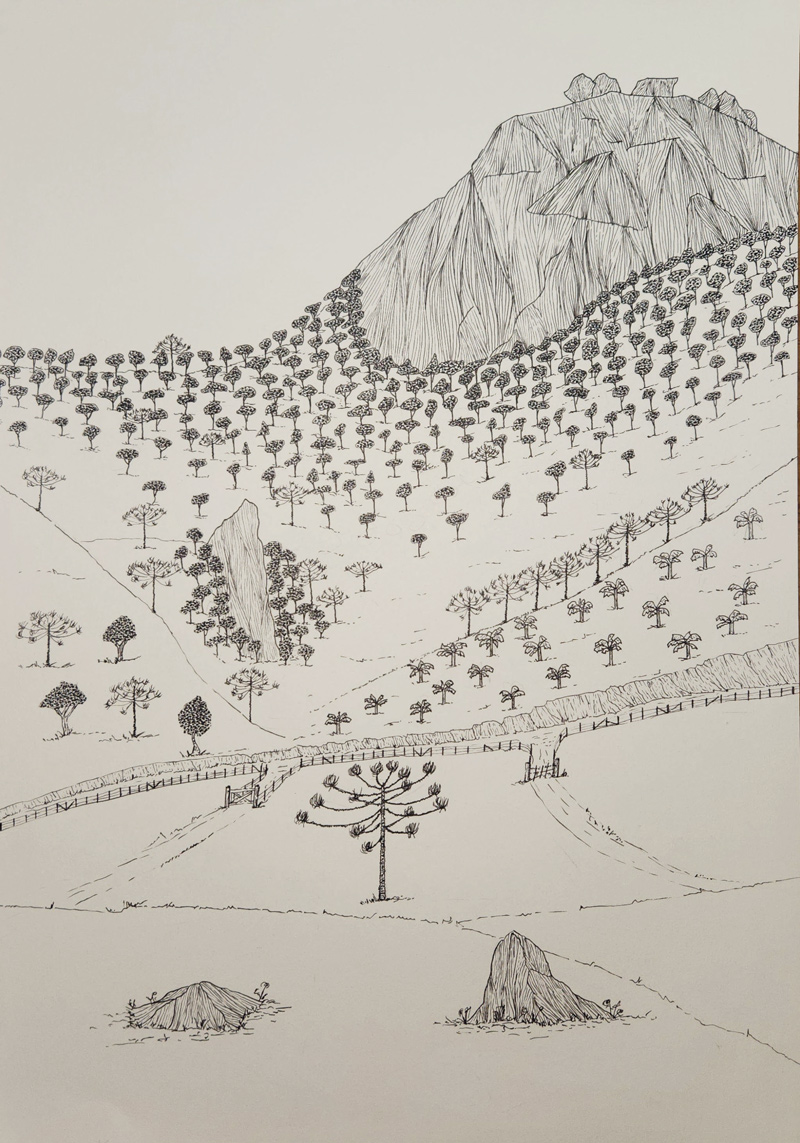
Personal archiveMountainous landscape drawn by the researcher in his spare timePersonal archive
One of the highlights of my career is the Forest Inventory of Native Vegetation in the State of São Paulo. Since the first year it was carried out in 1990, I have been part of the initiative’s team of researchers and authors. At first, when we did not have digital data-processing devices, the entire process was completely analog. In the second inventory, performed 10 years later, we were able to use geoprocessing techniques, which allowed us to create a digital map. This transition from paper to digital and the adoption of new methodological resources was made possible thanks to the Biota project, funded by FAPESP. The latest inventory, from 2020, includes a major refinement: the satellite images it is composed of are compatible with the images provided by Google. My current challenge as a researcher and director is to make it possible to update the inventory annually. The aim is to offer more up-to-date information on native vegetation cover in the state. We do not need a whole decade to complete a new survey.
The forest inventory is one of the IPA’s most important tools in biodiversity because it provides an up-to-date overview of the existing native vegetation. It highlights areas that need environmental restoration, maintenance, or even the creation of conservation units. It is also an important instrument for forest inspection activities and the development of public policies. Researchers who work in the field use the survey in their research and everyone has access to the data. Starting next year, the state government is going to grant tax breaks to municipalities that preserve 30% or more of the native forest outside conservation units. These ecological tax incentives will give municipalities with greater vegetation coverage, which are often less developed than largely deforested municipalities, a form of income for providing environmental services. The fiscal mechanism serves to compensate local authorities for environmental defense while also engaging them further in the process, and it would not be possible without data from the forest inventory.
My four decades of working at an environmental institution reflect my connection with nature, which began in childhood, when I realized that my understanding of the world was based on contact with the natural world. I have been mountaineering since I was a teenager. The first mountain I climbed was Pedra do Baú in São Bento do Sapucaí, and since then I have also explored mountains in other countries across North and South America, as well as in Europe. In 2016, after several days of rain in the Cochamó Valley, Chile, I started sketching a mountainous landscape to stave off boredom. Since then, I have been using black ink to draw a variety of imagined mountains on paper.
Republish