
In January 1975, Ivo Karmann was a skinny teenager studying at Visconde de Porto Seguro College in the São Paulo State capital when he joined the support team for Operation Tatus, an experiment aimed at assessing the effects of the lack of sunlight in an underground space on the human organism. One of his tasks was to transport the body waste produced by the eleven volunteers who undertook to spend fifteen days in a cave in Vale do Ribeira, in the southeastern part of the state.
Around this time, the young student embarked upon expeditions to explore caves, and never looked back. He studied geology at the University of São Paulo’s Institute of Geosciences (IGc-USP), where he would become a professor, his work taking him on several trips around the states of São Paulo, Minas Gerais, Bahia, Mato Grosso, Goiás, Tocantins, Santa Catarina and, to a lesser degree, Amazonas. He charted unknown caves (the first while still an undergraduate), facing derision from colleagues who downplayed this type of geological formation, and created a pioneering discipline. Karmann also stimulated the first research into the climates of the past based on cave mineral histories, and was a participant in the discovery of bacteria capable of corroding carbonate rocks at considerable depths.
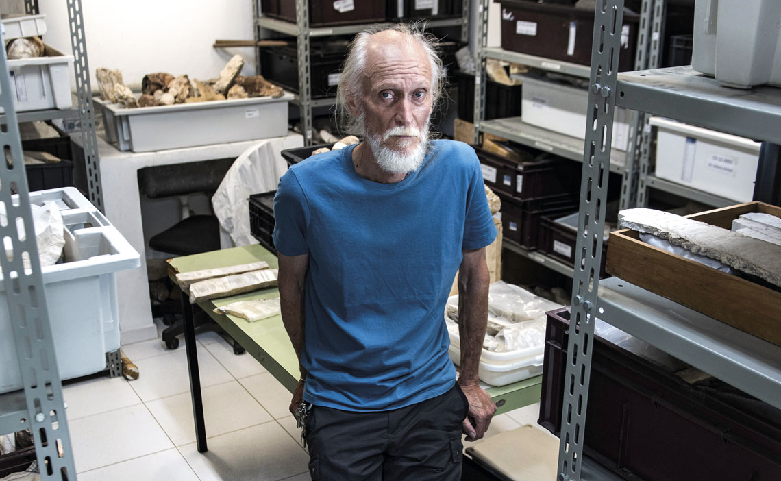
Over time, this paulistano (as people from the São Paulo State capital are known), a descendant of Germans arriving in the southern Brazilian state of Santa Catarina at the end of the eighteenth century, became an authority on scientific research into caves in Brazil. Married to a geologist, he has an architect son, and turns 68 in March. In an interview given to Pesquisa FAPESP, he talked about some of his experiences.
Cave geology
Institution
Institute of Geosciences at the University of São Paulo (IGc-USP)
Educational background
Bachelor’s degree in geology (1982), master’s (1987) and PhD (1994) in geosciences, at USP
When was the first time you ever entered a cave?
I was a teenager when I read a newspaper article about some French scientists exploring caves in the Vale do Ribeira region; the group included Guy Collet [1929–2004], Pierre Martin [1932–1986], Yugoslav Peter Slavec, and a group from the Brazilian Speleology Society (SBE), which these Europeans practically founded. I went to the headquarters in downtown São Paulo and told them I wanted to go with them. They asked me: “But have you ever been in a cave?” I answered: “No, never, I’ve only seen photos in magazines.” My family had a subscription to National Geographic, which ran a lot of articles on caves. At the time, Mammoth Cave in the US, one of the world’s biggest, was being explored. I was fifteen or sixteen years old, and they allowed me to go—Guy Collet practically adopted me. The first trip was to Itaoca, in Vale do Ribeira, more focused on archaeology. It was and still is an extremely important archaeological site, with proven signs of human occupation some 10,000 years ago, and we found several tombs. My first actual cave was the Sumidouro, in Ribeirão Grande, São Paulo. Another expedition with the SBE personnel took us to Iporanga, also in Vale do Ribeira, one of the Brazilian municipalities with most caves in Brazil: there are more than 300. During these trips I met people from the speleology group of the University Excursion Center (UEC), still operating today, including Geraldo Gusso [1953–1993], more commonly known by his nickname Peninha, and Mauro Stavale; these two really were cavers. The first cave I visited with them was the Gurutuva, also in the south of São Paulo State; it’s amazing, with waterfalls up to 10 meters (m) high. That was when I realized what exploration really is, because with Collet it was a lot gentler.
When did you decide to study geology?
During those days in the seventies, the caves Ouro Grosso, Água Suja, and others in Alto Ribeira State Tourist Park (PETAR) were being discovered; geology students were visiting as well, and I was attracted to this field. I started the course and continued on the UEC expeditions. On one trip we practically spent a month camping north of Brasília, in the region of Posse and São Domingos, studying the São Mateus-Imbira system, which has 20 kilometers [km] of galleries. We produced the first map of this cave system, which was featured in several articles. We had no money, but we did receive a lot of donations. Volkswagen and GM loaned us cars, which we pretty much destroyed on those roads full of stones and potholes.
Did you manage to study caves during your undergraduate course?
There wasn’t yet any course on cave geology. In the beginning it was difficult to find someone interested in doing scientific research into the theme of Karst [type of relief] and caves. We were inspired by Aziz Ab’Saber [1924–2012], a geographer. We spent hours talking in his classroom, and to this day I remember his recommendation: “You want to understand a cave? Go outside it, look at what surrounds it, understand the system.” This approach was very important; these days we talk about the Karst system, which includes the movement of water and materials, because part of what enters leaves, but the rest is retained. The geology people were more traditional; they said: “You’re into caves, so go to geography, you’re not a geologist.” But I was always somewhat single-minded and stubborn. I put together a research plan to apply for a scientific initiation grant from FAPESP, and presented it to geology professor Thomas Fairchild, who was always very open to new ideas. He read it and said: “Look, I’ve never been inside a cave, but I found your proposal very interesting, and I will advise you on it.” The project was totally new, a group scientific initiation with one advisor and six students, all covered by a grant.
Why six?
Because you don’t do cave work alone—you need a minimum of three to do the map. One has the tip of the tape measure, another holds its base, and the third does the sketch in the notebook. One is from the field of geology, the other looks more at the relief. We also have to understand the outside of the cave, through photointerpretation. That’s how we conducted a geological research project on the Ecos Cave in Corumbá, Goiás State, 60 km west of Brasília. The limestone does not show at the surface—it doesn’t outcrop—and there’s a large underground lake. We formulated a geological map showing these aspects, which were a novelty. At that time there were no other research groups of explorers dedicated solely to speleology. The Speleological Excursion Society of Ouro Preto, one of the oldest, operated more in Minas Gerais State, a paradise of limestones and caves. There was a professor there embarking upon a more scientific project: Victor Dequech [1916–2011], of the Federal University of Ouro Preto.
We see how caves are formed, with dissolution and corrosion at depth, opening up voids in the soluble rock
What did you all want to see at the Ecos cave?
We had already explored enormous limestone caves in the region of Posse and São Domingos, north of Brasília. I was starting the work at the Ecos cave. It’s enormous, not just in terms of kilometers, but in dimensions and volume, and it’s not just a limestone development. We saw that there was something different. To enter you have to negotiate a level difference of some 60 meters, and at the bottom next to the lake, we discovered noncarbonate rock (mica schists and quartzites) overlaid on the carbonate. We saw how caves are formed, with dissolution and corrosion acting at depth, opening voids in the soluble rock, and thereby connecting to the surface. Very few occurrences of this type had been described at that time. Years later we published this discovery in the Journal of Cave and Karst Studies, and it became a reference in interstratal Karst, where insoluble rocks overlap underground Karst, which, by processes of slump and erosion, connects the porosity to the surface and opens an access way.
Can we use cave as a synonym of Karst?
No. Karst is a type of relief predominated by soluble rocks. The surface is shaped by chemical dissolution, generating the cavities; in other words, Karst is where caves emerge. The Karst system includes underground water circulation structures with inlets, springs, sinks, and outlets. The water that feeds the system originates from rainfall, and primarily from the river system catchment. Therefore we also need to map the flow routes, the conduits, as if it were plumbing within the rock.
Who were your companions at this time?
Luís Sánchez, known as “Luizão,” who’s now at Poly [Polytechnic School of the University of São Paulo], Peter Milko, Antônio Montanheiro, who no longer practices geology, having moved to Pernambuco (northeastern Brazil) and decided to do medicine, and Spaniard Juan Carlos, a diver, because there was a lake in the Ecos Cave and no one knew how to explore it.
It seems your time as an undergraduate was very busy.
It was. And on top of that we gave talks at geology schools in Rio Claro [São Paulo], Ouro Preto [Minas Gerais], and Brasília, making the most of our exploration trips. We wanted to encourage future geologists to visit the caves and put geological maps together, which we still didn’t have. People got very interested—they asked why caves are important, they suggested that they were just voids, that there was nothing there. That’s why, over time, I started saying that I am a geologist of nothing. I have to explain the absence of rock, not the rock itself. Once, at the University of Brasília (UnB), Mylène Berbert, now a speleologist at the Brazilian Geological Service, asked: “How are we going to study caves? Where are the caves in Brazil? What are they like?” Luizão and I approached Aziz, and the proposal came from him: “Why don’t you do a survey where there are favorable rocks for the development of caves and Karst?” We got the maps from DNPM [National Mineral Production Department] and the SBE; everything was done by hand at the time, and we made the first map on areas of occurrence of carbonates and cave regions. We finished in 1979, still undergraduates, and published a piece in the journal Espeleotema, of the SBE. We mapped some 500 caves, and today we have 23,000 registered with the National Center for Cave Research and Conservation of the Chico Mendes Biodiversity Conservation Institute (ICMBio). The number has grown considerably with the inclusion of caves in the iron formation, of which there are many, albeit small.
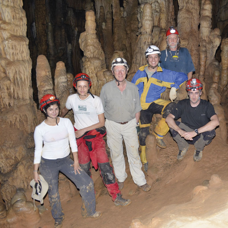
Valdir Felipe Novello / USPIn the Diabo cave, 2012: Veronica Ruiz, Bruna Cordeiro, Paul Williams, Bruno Lenhare, Karmann, and William Sallun FilhoValdir Felipe Novello / USP
How was this mapping received?
This work in the speleological provinces had a significant impact, primarily in terms of regionalizing the type and size of caves associated to different rock types. We started to produce results, gaining credibility and the support of other Institute of Geosciences (IGc) professors, such as Aldo Rebouças [1937–2011], Oscar Rösler, and Roland Trompette, who was my advisor and frequently visited the institute. During my master’s degree I submitted a proposal for a speleology discipline. I tried several times until the department’s council gave it the green light as an optional study area, and mindful that speleology is not just geology but also includes the environment, biology, and archaeology, I invited Eleonora Trajano, of the Institute of Biosciences, who also worked with caves. I had known her since before I graduated, as she also frequented the CEU. In January and February 1975, we participated together in Operation Tatus.
What was Operation Tatus?
It was an experience of living in a cave; I was part of the outside support team. We wanted to know what it would be like to live in an underground environment; it was a novelty at the time, to understand how sunlight influences the cycle of wakefulness and sleep. Experiments were being run in France, and the UEC personnel decided to do it here as well, with eleven people in the Santana cave, Iporanga, at the state park (PETAR), for fifteen days. They stayed in the very sizeable São Paulo cavern, with only artificial light, primarily carbide, some gas lamps, and a cooker to prepare food, along with a system for waste collection. Telephone communication was only possible from the inside out, to ensure that nobody inside knew what was happening outside. While they slept, we made notes of what was happening down there. Some slept more, some less. We saw that sleep and wakefulness periods lasted for 73 hours, with almost 30 hours of sleep or rest, and 30-plus hours of activity. After fifteen days had passed, those inside thought that they were still on their seventh or eighth day. They had lost all sense of time.
Over time, I started saying that I am a geologist of nothing. I have to explain the absence of rock, not the rock itself
And how was the discipline?
It began as a novelty, with geology, biology, and geography students, because it offered vacancies to other units and even to the general public. There were also the field activities, so Eleonora, as a biologist, showed us things we often overlooked, such as the blind catfish (Pimelodella kronei) and other animals adapted to life in the caves (see Pesquisa FAPESP issue nº 224). I later changed the focus and the name to Karstland Geology, with a geological emphasis, but also with vacancies for students from other units. The course continues to run, it’s very sought-after, and I participate in it to this day, now as a senior professor. Every October we go to the Iporanga caves.
How did the idea that caves may provide the history of past climates come into being?
In 1982, in a German journal to which I then subscribed, Bild der Wissenschaft [Image of science], I read an article by Wolfgang Dreybrodt, of the University of Bremen. This was one of the first studies into paleoclimate [climates of the past] in speleothems [structures formed by water circulation among cave rocks, for example stalactites and stalagmites]. It was such a novelty, but it was difficult to date the material—the method we use today, with uranium-thorium, had not yet been developed. Dreybrodt tried dating with carbon-14, which went wrong several times, but put the idea out there. You see a stalagmite growing gradually, you look at the dripping, and you think: why does it stop dripping? It’s because when it doesn’t rain, there is no recharge. You look at the internal structure of a stalagmite, it’s a sedimentary basin, with various layers, colors, and thicknesses. The composition also varies: it could be calcite, aragonite, or whatever. Why so? What controls the formation and growth of speleothems is the environment surrounding the cave. They record sedimentation processes—the chemical precipitation of minerals, such as calcite. In the Taqueupa cavern of the Santana cave, there are drinking straw-like formations two or three meters long, with very different stratigraphies [distribution of layers].
How did you resolve this?
We only really took off when geologist Chico Bill [Francisco Cruz] arrived from Rio Grande do Norte [in northeastern Brazil], came into my office, and declared: “I want to work with large caves.” Yay, I hooked one more. Well-known large caves during this time were in the region of Iraquara, Chapada Diamantina, Bahia State. I had done part of my PhD in Canada with Derek Ford, a reference in geospeleology, and I learned to use isotopes [variations of the same chemical element] for dating. I proposed to Chico Bill: “Let’s deep-dive into climate histories in speleothems. This area is going to really take off.” We put together a research plan and went in search of a speleothem that might have climate records. It’s important to make the point that you cannot just take anything from caves, because they are protected by law; we always carry ICMBio authorization for research and sample collection. We had a lot of help from a colleague at the institute, Marly Babinski, who knew the rock geochronology people. She spoke to Warren Sharp, then at the University of Minnesota [currently at the University of California, Berkeley], who used uranium-thorium dating: exactly what we wanted. We made contact, Chico Bill took a trip out there, and then we were able to do our dating. We measured the proportions of oxygen and carbon isotopes in liaison with the people from USP’s Center for Nuclear Energy in Agriculture (CENA) in Piracicaba. We ran our first isotope variation curve, indicating climate variation, on speleothems in the Botuverá cave in eastern Santa Catarina, and the Santana cave in southeastern São Paulo. A beautiful curve, also showing the solar cycle and insolation variation (see Pesquisa FAPESP issue nº 111). It was one of the most important projects I have participated in. I very much liked seeing how the rain modifies drip activity within caves, and how the Karst system functions. For me, fieldwork is the most exciting part of research.
You also researched the role of microbial activity in the formation of caves, did you not?
At the time of the Ecos Cave, we already had this question in mind: what dissolves rocks at depth, if carbonic acid doesn’t get down there? There must be another corrosive agent, or other mechanism for producing some kind of acid, that doesn’t seep in with water. People were considering the possibility of it being bacterial action, which could transform sulfide into a type of acid. Limestone rock has no sulfur, which is found in sulfide. We decided to go looking for these bacteria and made advances, partly with chemistry PhD Murilo Andrade Valle, in 2010. I reached out to the microbiology people, and with Vivian Pellizari, currently at the USP Oceanographic Institute (IO), we looked into the microbiology of groundwater; in 2024, as part of master’s research by geologist Tom Dias Morita, we managed to partly trace the genome of the bacteria that acts deep in the caves of the Una group, Chapada Diamantina region, in Iraquara, Bahia State. These are anaerobic bacteria [they do not use oxygen as an energy source] that we call sulfur oxidizers and sulfur reducers. They obtain energy from digesting minerals containing sulfur, such as pyrite and galena, which are iron and lead sulfides, whose decomposition produces the sulfuric acid corroding the rock.
How many caves have you discovered?
We don’t talk about it that way, because it is always a group effort. The most relevant discoveries I have participated in were with the UEC at the caves in Goiás, north of Brasília, the region of Posse, São Mateus, Imbira, and Terra Ronca. The people in the region already knew of these. São Mateus had a doline—a depression in the ground—and they took us there. They said: “There’s a hole this side and another one over there.” The doline was in the middle. Down we went; it was a big space. Giant pearls [rounded limestone formations at ground level in caves], and stalagmites eight, ten meters high. We explored Vale do Ribeira, and saw new features such as caves with more vertical development, known as abysses. We descended using ropes and steel wire ladders. I participated in the discovery of the Ponta de Flecha abyss, also in Iporanga, which had bone remains of Pleistocene megafauna. We did a paleontological dig around 1980, with the support of Oscar Rösler. The team was made up of Clayton Lino [speleologist and architect], Eleonora Trajano, a student of zoologist Paulo Vanzolini [1924–2013], another of our sponsors, and archaeologists Erika Robrahn and Paulo de Blasis, of USP’s Museum of Archaeology and Ethnology (MAE). We found the tip of a flint arrow in a very small conduit beside a large tooth from a toxodon, in its time a very large megafauna animal. We had already seen animal bones with cut marks, indicating that people took meat off the bones.
Do you remember any moments of elation?
The craziest to date was in São Mateus de Imbira, state of Goiás, a long time ago. It was pretty overwhelming, a place so full of things that you didn’t know where to look first; a show of speleothems, with mineral aragonite formations of all sizes, helictites [speleothems in the form of a fan, either protruding from the ceiling or the walls] growing, that floor of stars, and the underground river, a natural dam of giant travertines [barriers of calcite or other minerals]. It was like something from another world. Then, at the Torrinha Cave, Lapa Doce, in the Chapada Diamantina area, I saw things I’d never have imagined. You get a bit dizzy at such beauty.
Aziz Ab’Saber always recommended: “You want to understand a cave? Go outside it, look at what surrounds it, understand the system”
Have you ever gotten lost?
Not lost, but I did have several moments when I asked myself: ‘Okay, where am I? How do I get back?’ One time, our lights went out. We were using helmets with a flame and flashlights with incandescent bulbs. Each team member carried a two-compartment cylinder on their belts: one with carbide stones, and the other with water that dripped upon them. When the carbide reacted with the water, acetylene was released, passing up through a small pipe to the helmet to fuel the flame. This was in the days before the superpowerful LED bulbs we have today, where you only need one to light a huge cavern very easily. The flame went out in the Santana cave and my lighter was soaked. We waited an hour or two, then someone turned up to light our flame. Another time, in 1990 or 1991, during research into the chemistry of quartzite dissolution in the Lapão cave in Lençóis, Bahia State, a block of rock dislodged and trapped my leg. I was with a colleague, who ran for help. After an hour or two, some people came, wanting to roll the rock back. I said: “No, stop, don’t roll the rock, or you’ll crush my leg! Get my hammer and chisel and cut it to free me.” I managed to come out of that with just a few deep scratches.
You must be a zero for claustrophobia, right?
It’s almost zero, because very narrow passages make me nervous, so I tend to avoid them. Some cavers are like worms—if they pass through and tell me it’s okay, then I go. I’ve said many times: “I can’t get through there, I’m not going.” We did a lot of crazy things, without equipment, or good ropes. We descended and ascended the Fóssil abyss, 40 meters vertical—the height of a 12-storey building—with a steel wire ladder, and we trained with it in the well of one of the CRUSP [USP halls of residence] buildings. At the Fóssil abyss I would descend using the ladder, but Peninha would rappel down, jumping onto the rope, then later ascend. Once he was entering to jump, and I looked over and warned him: “The rope is corroded halfway through. Stop, and go back real slow.” It would have been a vertical drop of 40 meters. Safety is a lot better these days.
What are the basic rules for exploring these kinds of places?
The first rule is never to enter alone—working in a group of three, including more experienced cavers, is ideal. The second is to know the region. People going into caves are very afraid of snakes. I’m not, but I am scared of bees. Rocky entrances, such as those in the state of Piauí, normally have bee clusters, so it’s good to be supported by local people who will tell you of any hazards. Another one is to always take reserve lighting. Beginners get excited, in they go, and if they only have one flashlight, it may be difficult to get back. You also need to let those outside know that you’re going in. As for the rest, it’s always good to have a bit of courage, enter with caution, be careful with fragile speleothems, respect the space, and relish the wonders you find.
Do you still go into caves?
Yes. We’re planning a water monitoring project in the Tapagem cave [official name of the Diabo cave in Eldorado, Vale do Ribeira], with colleagues from the IGc: Nicolas Stricks, Chico Bill, and students. Scenically and geologically speaking, this cave is sensational. And there are some interesting scientific questions yet to be well explained.
The story above was published with the title “Ivo Karmann: Geologist of the void” in issue in issue 349 of march/2025.
Republish