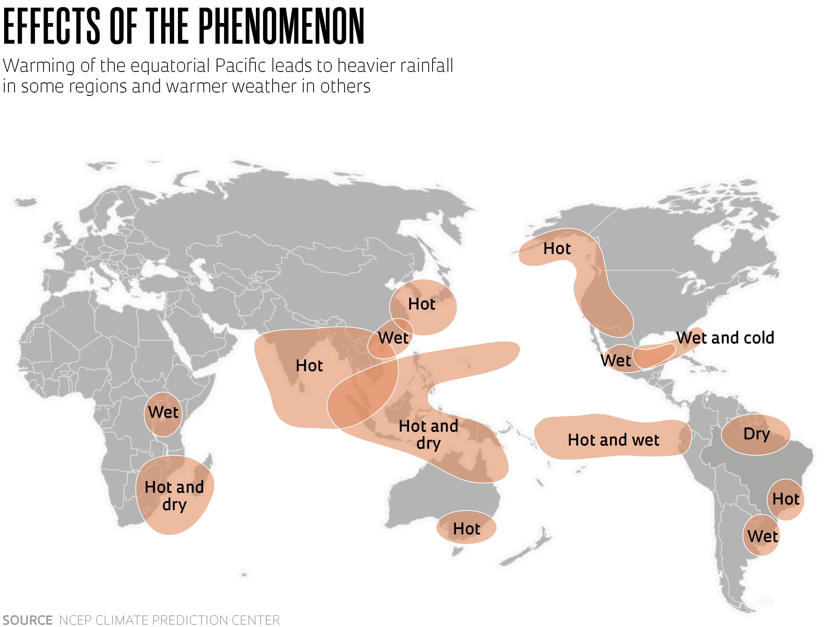
In early June, the Climate Prediction Center at the US National Oceanic and Atmospheric Administration (NOAA) reported on the emergence of El Niño, a climate pattern that describes above-average warming of the surface waters of the equatorial Pacific. The changes recorded in the ocean and atmosphere this year make it likely that the phenomenon will occur during the Northern Hemisphere’s next winter. According to the statement, there is a 56% chance that a strong El Niño will develop and an 84% chance of a moderate one. It could be one of the most intense of the last three decades. El Niño and La Niña — the opposite event, which describes cooling of the Pacific — are part of the same phenomenon, known as the El Niño – Southern Oscillation (ENSO), which causes changes in global moisture transport patterns, increasing rainfall in some regions and reducing it in others: the climate in Oceania and eastern and southern Africa becomes warmer and drier, while the winter in the USA becomes milder. In May, the Center for Weather Forecasting and Climate Studies (CPTEC) at Brazil’s National Institute for Space Research (INPE) warned about the impending El Niño and its likely effects in Brazil this year: higher temperatures and less rainfall in the North and Northeast regions, and more rainfall in the Southeast and South (INPE, May 24; NOAA, June 8).


