There will be more high areas, since the sedimentary basins are rising especially in these regions
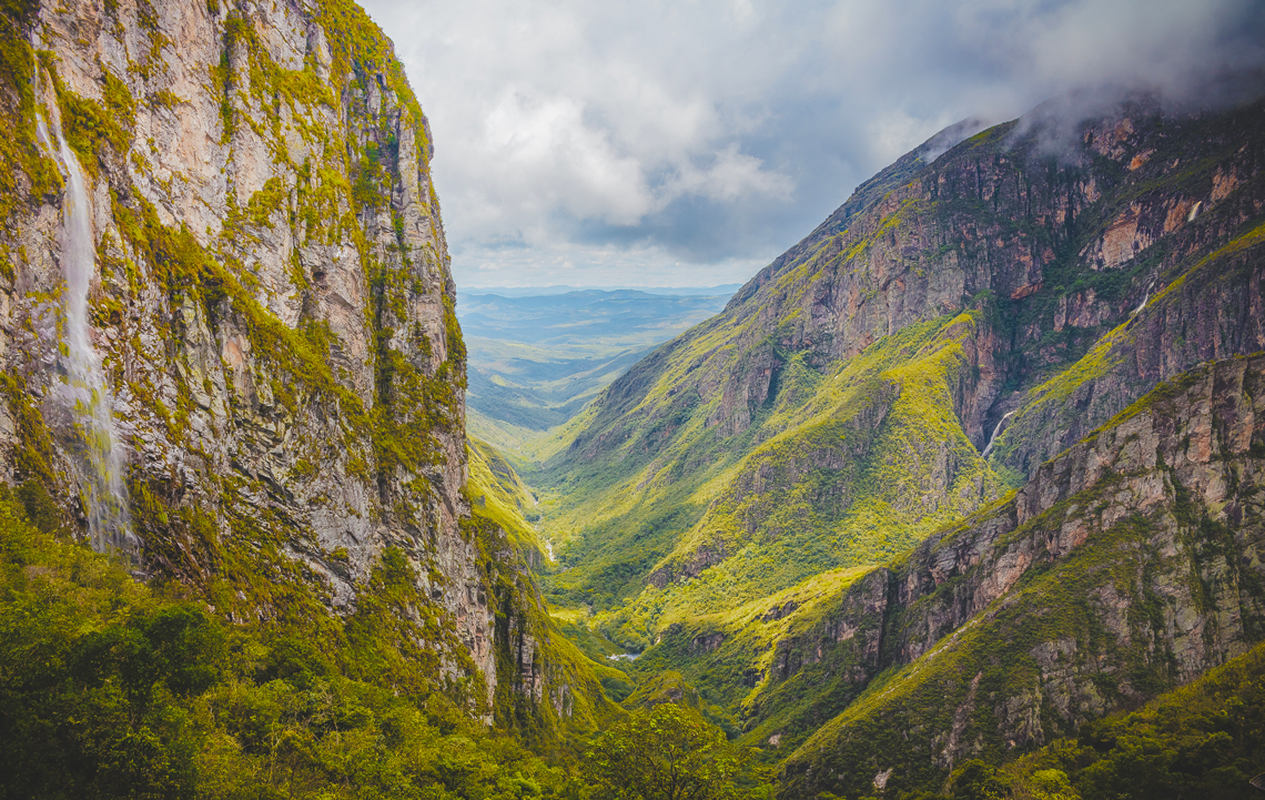
The Espinhaço Mountains, in Minas Gerais and Bahia, began to rise around 600 million years ago
UPSION/Wikimedia Commons
Brazil should have a more mountainous landscape in a few million years. With few mountain ranges and plateaus, the Northeast region is gaining more high areas, extremely slowly. A mountain range may also rise along the Brazilian coastline, also at a very slow pace.
It is possible to imagine a Northeast full of elevations because the so-called sedimentary basins, for millions of years, have suffered uplift, a result of the compression of the tectonic plates, the huge slabs of rock that make up the outermost surface of the earth.
Normally low, compared to the neighboring areas, the sedimentary basins generally form from the pulling apart of the denser geological structures. They accumulate fragments of rocks and the remains of animals and plants.
In Brazil, the sizes of the basins vary greatly: The Amazon basin is 7 million square kilometers (km2) and accumulates an estimated 20% of the planet’s fresh water, while the Taubaté basin, east of the state of São Paulo, is 4,200 km2. Both are being squeezed — or compressed — by the plates between which they were formed, according to a national survey published in April in the Journal of South American Earth Sciences.
Of the 72 terrestrial and marine sedimentary basins, which account for around 60% of Brazilian territory, at least 22 have suffered compression since the geological period known as the Late Cretaceous, from 100 to 66 million years ago.
The majority (12) of the basins in elevation are found along the Brazilian coastline, a region already well studied by geologists due to the possibility of containing oil. It is the case of the Santos and Campos basins, the main oil- and natural gas-producing center with 352,000 km2, from the south coast of Rio de Janeiro to the north of Santa Catarina.
Alexandre Affonso / Revista Pesquisa FAPESP
Led by geologist Francisco Hilário Bezerra, of the Federal University of Rio Grande do Norte (UFRN), the study also mentioned a further 51 sedimentary basins being squeezed and elevating in the world. The work had support from two National Institutes of Science and Technology — for Tectonic Studies (INCT-ET) and for Petroleum Geophysics (INCT-GP) — and from the Brazilian National Council for Scientific and Technological Development (CNPq).
“The inversions do not occur, especially where the crust is thinner, like in some areas in the North and Northeast of Brazil,” says Bezerra. It is called tectonic inversion as it consists of the pressure — or compression — of the tectonic plates in the opposite direction from the pulling apart that first created the basins. This movement slowly changes the relief, whereas volcanoes and earthquakes cause sudden changes. It can also divert rivers and create conditions for the formation of underground reservoirs of water or oil, trapped by the dislocation of the blocks of rock.
Alexandre Affonso / Revista Pesquisa FAPESP
“Inversion of sedimentary basins is a little-explored topic, especially in Brazil,” says geologist Claudio Riccomini, of the institutes of Energy and Environment (IEMA) and Geosciences (IGC), both of the University of São Paulo (USP), who did not participate in the study. “In extreme cases, it creates mountain ranges.”
The Chapada do Araripe, a plateau which extends for around 200 kilometers (km) in the states of Ceará, Pernambuco, and Paraíba and is up to 1000 meters (m) in height, for example, was once a sedimentary basin with a low topography. Formed around 150 million years ago, this area began to sink — movement associated with the formation of sedimentary basins — around 110 million years ago in response to changes in the direction of the forces of the tectonic plates resulting from the separation between South America and Africa. Much later, at least since the period known as the Late Cretaceous, around 60 million years ago, it began to rise, also as a reaction to the compression of the denser structures that surround it.
Geologist Norberto Morales, from the Institute of Geosciences and Exact Sciences of São Paulo State University (IGCE-UNESP), who visited the Chapada do Araripe for the first time in 1997, observes that the formation of the chapada not only changed the relief but also favored human settlement.
“The regions of Crato, Juazeiro do Norte, and Barbalha, and others in the Cariri valley, in Paraíba, have lots of water and plantations as a result of the inversion of the Araripe basin,” he says. “The plateau acts as a barrier to moisture and makes the rain runoff. Water infiltrates into the ground, accumulates in porous rocks such as sandstone and supplies the groundwater.” In the most recent study, published in January in the journal Tectophysics, the group from UNESP show that, like other basins in the Northeast, the Araripe basin was created by divergent forces and still in the Cretaceous period was also subjected to inversion, influenced by forces of compression.
Jacob Pereira / Wikimedia CommonsThe formation of the Chapada do Araripe blocked the moisture and helped the growth of vegetationJacob Pereira / Wikimedia Commons
Another example is the Espinhaço mountain range, which extends for around 1000 km in the states of Minas Gerais and Bahia, with a maximum altitude of 2,072 m in the southern peak, in the municipality of Catas Altas, in Minas Gerais. This area began to elevate around 600 million years ago, when sedimentary and volcanic rocks buried at huge depths began to rise, pressed by the neighboring rock slabs.
“The Andes was also once a low altitude sedimentary basin, it even has marine fossils,” adds Riccomini. The mountain range on the western edge of South America began to form around 60 million years ago, as a result of the subduction — or diving — of the Nazca plate under the South American plate, which pushed the relief upwards. With the basins situated between the limits of the tectonic plates, like those of the continental portion of Brazil, the process is different: it is the quantity of accumulated sediments, not the pressure of the plates, that will determine the amount an area can elevate.
According to this reasoning, the sedimentary basins of the Northeast, due to not housing so much sediment, are not likely to undergo a sharp uplift. But it is possible to think that, in hundreds of millions of years, the Brazilian coast will be surrounded by more elevated areas than the current relief, since the basins are deeper along the coast, with more sediment.
“Some theoretical models about the evolution of the continents indicate that a subduction zone could form on the Brazilian coast, which marks the edge of the continental crust and the oceanic crust,” comments Morales. “Because it is denser, the oceanic crust will dive under the continental crust. That was how the Andes started.”
Looking at South America and Africa on a map helps to understand why the sedimentary basins rise instead of sink. “When South America separated from Africa, a mountain range formed in the middle of the Atlantic, the Mid-Atlantic Ridge, which pushes the South American plate to the west,” explains Bezerra.
He adds that, on the other side of the continent, the Nazca plate dives under the South American plate and, after having formed the Andes, pushes the blocks of rock that form the continent to the east. “As a result, the continental section of the South American plate, which is in the middle, is compressed and throws the less dense parts upwards, which are the sedimentary basins,” says Bezerra.
Morales adds: “We should also consider the Caribbean plate, which is small but decisive for the geological formation of the Amazon.” According to him, the movement of the Caribbean plate resulted, for example, in the vast deposits of oil in Venezuela.
According to geologist David Vasconcelos, of the Federal University of Campina Grande (UFCG), who took part in the study, there have been three great periods of elevation of the Brazilian basins: From 100 million to 70 million years ago, from 50 million to 40 million years ago, and from 20 million years ago until today. The two last phases coincided with the greatest growth of the Andes, in response to the pressure from the Nazca plate.
As some basins are larger, it is not possible to verify how much each basin has elevated, but in some areas this phenomenon and its consequences are visible. It is the case of the Serra do Mel mountain, a central part of the Potiguar basin, in Rio Grande do Norte. Pressures identified by different geological and geophysical techniques have resulted in an elevation of 273 m in height, with 40 km in width and 70 km in length, surrounded by areas at sea level.
“As a consequence of the compression at Serra do Mel, the coastal cliffs, already over 100 m, are also rising up and the rivers are receding,” comments Bezerra. In his opinion, the mountain is pushing the Mossoró river to the west, and the Açu river to the east. The plains beside the rivers show this displacement. Around the mountain, other parts of the Potiguar basin are moving in different directions in response to the pressure of the plate tectonics.
The clearest view of the state and trends of the Brazilian landscape results from studies started in the 1980s, when geologists and geophysicists from around the world verified that the regions between the tectonic plates were being squeezed. The result was the production of a map of geological forces, initially published in 1992, with the participation of geophysicist Marcelo Assumpção, of the University of São Paulo (USP); the most recent version, from 2016, records 42,000 points of tension between blocks of rocks, within and outside the basins.
This article may be republished online under the CC-BY-NC-ND Creative Commons license. The Pesquisa FAPESP Digital Content Republishing Policy, specified here, must be followed. In summary, the text must not be edited and the author(s) and source (Pesquisa FAPESP) must be credited. Using the HTML button will ensure that these standards are followed. If reproducing only the text, please consult the Digital Republishing Policy.