On May 10, 2018, Mayotte Island, a French territory northwest of Madagascar, was hit by the first of a series of earthquakes. For months, hundreds of near-daily earthquakes had been putting the local population on edge. On May 15, a magnitude 5.9 earthquake damaged several buildings. Scientists were perplexed, since the region is not thought to be in an area of high seismic risk. In May 2019, researchers aboard the oceanographic research vessel Marion Dufresne identified the source of the earthquakes: an undersea volcano named Fani Maoré, located 50 kilometers (km) from the islands. At a depth of 3,500 meters (m), the 800 m volcano was undergoing intense activity, expelling up to 400 cubic meters (m3) of lava per second. Over the past three years, 30 oceanographic campaigns have revealed hundreds of underwater volcanoes that form a previously unknown volcanic province, stretching along a 600-km-long, 200-km-wide corridor. Mayotte now has 11 seismic stations and GPS references used to track deformations in the Earth’s surface. The data arrives in real time at the observatory on Piton de la Fournaise volcano, Réunion Island, east of Madagascar, which monitors the area 24 hours a day (Comptes rendus Géoscience, January 17; CNRS News, March 22).
RepublishGeophysics
The undersea volcano that shook an island
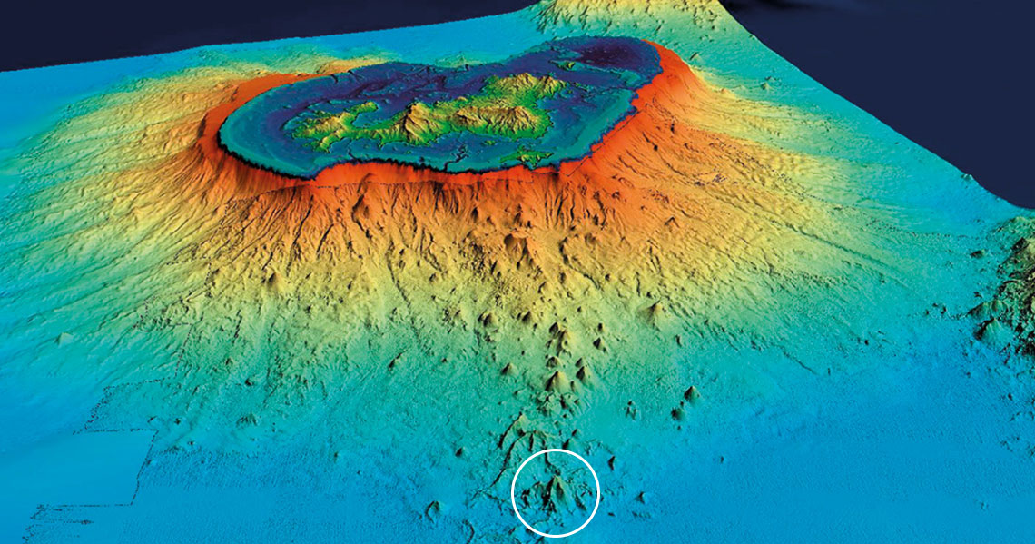
Identified in 2019, Fani Maoré (white circle) is 50 km from Mayotte (top of the image)
MAYOBS – IPGP / CNRS / Ifremer / BRGM