
Luciano Queiroz / Getty ImagesThe Parnaíba delta, gaining sand in some areas but losing it in othersLuciano Queiroz / Getty Images
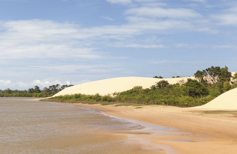
In the form of a delta with several channels flowing into the sea, the mouths of three rivers in Brazil’s Northeast region are undergoing major transformations, according to rainfall records and satellite images from 1984 to 2021. The São Francisco delta, on the border between the states of Sergipe and Alagoas, suffered severe erosion during this period, losing between 15 meters (m) and 50 m per year. The Jequitinhonha delta, in Bahia, experienced less erosion, at 10 m per year, which still equates to a loss of 990 m of its 5.5 kilometers (km). Conversely, the Parnaíba delta, between the states of Maranhão and Piauí, accumulated sediment (34% of its area) in a process known as progradation, gaining 500 meters (m) along a 9 km stretch of coastline; erosion was lower (23%), with losses of up to 15 m per year, while 43% of the coastline remained stable. Researchers from the Federal University of Rio Grande do Norte (UFRN) who carried out the analyses attributed the accumulation of sediment in Parnaíba to human action and rainfall peaks between 1991 and 2005 and the loss in Jequitinhonha and São Francisco to the Itapebi and Xingó dams respectively, which are close to the mouths of the rivers. Erosion can lead to the destruction of homes, lighthouses, and communities near the sea, as well as reducing the amount of nutrients brought to rivers (Ocean & Coastal Management, February).
Republish