
In his office at his apartment, inside map-covered walls, geographer Jurandyr Luciano Sanches Ross rediscovered Brazil as he examined data from the Brazilian Institute of Geography and Statistics (IBGE) with colleagues from other states. What they found were three versions of Brazil: what they called the Brazil of nature, with large green areas; the semiarid Brazil, in the northeastern sertão (badlands); and the Brazil of greater economic activity, related mainly to agriculture and livestock. “This is likely my last large project,” he says, at 73.
An expert in geomorphology—the study of landforms and their origins—in the 1980s Ross published an elevation map of Brazil. Using information from the RadamBrasil Project, in which he participated, his work followed the versions of geographers Aroldo de Azevedo (1910–1974), from 1949, and Aziz Ab’Saber (1924–2012), from the 1960s.
Born in Promissão, in the northwest region of the state of São Paulo, and raised in Rolândia, in Paraná, he moved to São Paulo in the 1960s. A widower with two daughters (an electronic engineer and a dentist) and three grandchildren, Ross granted us the following video interview in February.
Area of expertise
Geomorphology
Institution
University of São Paulo (USP)
Educational background
Undergraduate degree in geography (1972), master’s degree (1982) and PhD (1987) from USP
Published works
45 articles and 8 books
What have you been working on?
I have been coordinating a three-year project to study the spatial planning of Brazil, meaning how the country’s territory is organized. This work, funded by CNPq (Brazilian National Council for Scientific and Technological Development), involves my team from the USP Geomorphology Laboratory, colleagues from the State University of Londrina and from the federal universities of Paraíba and Uberlândia, and a sociologist from the Ministry of Economy. We have produced a lot of data and acquired a clearer notion of who we are in terms of national land use.
Does Brazil have a land use plan?
We have had one since 1993, as a result of Rio-92, which led to a state policy and the establishment of the Ministry of the Environment and conservation units, mainly in the Amazon. It also led to ecological-economic zoning in some states and regions and to the establishment of water management plans and municipal master plans. That was until 2002. Then came another land use policy, which decreased the importance of the Ministry of the Environment and deprioritized spatial planning.
Why is spatial planning important?
Because it helps prevent mistakes in land use and occupation. The first goal of a land use plan is figuring out the areas that are favorable for agriculture or livestock, and those that should not be touched or converted. People often say deforestation is unnecessary in Brazil—and they are right because there is a lot of underutilized land. But what are these lands; where are they, what are their terrain and soil conditions? We must figure out whether they are favorable to some economic use. The occupation of Brazilian territory is spontaneous, ruled by the purchase and incorporation of lands. I once visited Parauapebas, in the eastern region of Pará. There are no trees there, only pastures. There is nearly nothing left of the native vegetation and riparian forests; according to the law, at least 50% of the area should have been protected. Now, the legal reserve covers 80% of the area. I helped develop an ecological zoning plan for the state of Rondônia, which ended in 2000. Approximately 10 areas were identified for different types of occupation or preservation, but the plan was either lost or not adequately applied. Today, there is very little forest left—only within conservation units. Most of the state was taken up by coffee, banana, and cocoa plantations, and mainly pasture.
What are you seeing now?
We are focusing on rural Brazil and analyzing agriculture, forestry, livestock, and mining practices. We thought about surveying the current conditions of land use and occupation, based on statistical data from IBGE at the municipal level and maps from MapBiomas Brasil (a non-governmental organization that monitors changes in native vegetation and land use in the country) of deforestation and other environmental issues. The maps cover Brazil’s 5,570 municipalities. We were able to trace the evolution of soy plantations since they have been cultivated in Rio Grande do Sul and São Paulo from the first decades of the twentieth century. Now, they can be found in Maranhão and Piauí, nearly reaching the sea. Sugarcane can be found in São Paulo, but also in the Triângulo Mineiro (Mineiro Triangle, an area in western Minas Gerais), in Goiás, and in the Northwest of Paraná.
What about in the northeast region of Brazil?
Unlike in Alagoas, sugarcane is not as strong as it was in Pernambuco. The Pernambuco plateaus are not as flat and large as those in Alagoas, and the mechanized planting and cutting of sugarcane require flat lands. Because of mechanization, terrain is as essential to agriculture as soil and climate conditions. On another map, when examining the GDP of the municipalities according to their main economic activity, we noticed that in the Amazon, especially in the semiarid region, the main source of income is public funds distributed to municipal governments and to the people, through retirement pensions, the Bolsa Família social welfare program, and other welfare benefits. I visited the sertão of Ceará two years ago; what I saw there surprised me. Young people have largely left and are still leaving the countryside, meaning only older people remain in rural areas. They are beneficiaries of rural retirement payments or Bolsa Família, and they are the ones to care for animals and grow small crops of beans, corn, and manioc. GDP per capita is highest in the Southeast, not counting northern Minas Gerais, because of agribusiness, industrial activity, and services. I am showing you these original maps to illustrate what we call the three Brazils, or the spatial planning units our analyses revealed.
What are the three Brazils you are proposing?
One belongs to nature, one represents the semiarid region, while the third is economically productive. The first has an extensive area of preserved land and enormous biodiversity, but it is permanently under threat from the expansion of other activities, mainly livestock. The area covers the Amazon, the Pantanal (wetlands), the Araguaia River, and the coastline, including the Serra do Mar. The semiarid region is the opposite. It does not cover all of the Northeast, just the areas that have extreme climate. While the Amazon has a low-density population, with many migrants, the semiarid region results from 500 years of occupation, with population emigration. When the coast was covered with sugar cane plantations, the semiarid region was taken over by livestock. Today, the population there is stagnant or declining. The third Brazil is essentially that of agriculture and industrial activities, with emphasis on agroindustry and sugar-energy industries, concentrated in the Mid-West; in western Bahia, Maranhão, and Piauí; in the southern and eastern portions of the northern region; in the entire Southeast and southern regions; and along the Brazilian coastline, from eastern Northeast to Rio Grande do Sul. It is the version of Brazil that generates the most jobs and income in the three segments of the economy: industry, agriculture, and services.
What we call the three Brazils are vastly different realities, which require different approaches
What did you make of these differences?
They are completely different realities—both in terms of biodiversity and geodiversity—that reveal structural problems and require different approaches. In the semiarid region, an area where the population is stagnant or declining, we must ask: “Are we just going to let everyone go?” The ideal solution would be to start generating more income and jobs, with a more dynamic economy.
What about the Amazon?
In 2019, I taught a course in Parintins, east of Manaus. After, we went on a boat ride. At one of our stops, there was a family that lived in a house on the river. I asked the man of the house, who must have been about 60 years old, what he did for a living. He said: “I still have a few cows that graze on the wetland. I milk them, make cheese, and sell the calves.” He had reduced his number of cows, because he was focusing his attention on a guarana farm in the forest, in an agroforestry system. He would sell guarana seeds at R$15 per kilogram—three times more than a kilogram of calf. “And it is much less work than the cows,” he said. “Because basically all I need to do is keep the area clear and harvest the seeds.” The forest holds more solutions than just cutting down trees for pasture.
What are your plans for these maps?
We will finish our report—which is already at 900 pages, including maps and text. We want to discuss these data with colleagues at the university, with people from government, with politicians, with as many people as possible, from any area. We want this information to be useful for the country.
Would you say this is the greatest work of your career?
It is probably my last significant piece of work. The others were the elevation map of Brazil, in the 1980s, the geomorphological map of the state of São Paulo, in the late 1990s (see Pesquisa FAPESP issue no. 35), with funding from FAPESP, and the geomorphological map of South America, finished in 2019 (see Pesquisa FAPESP issue no. 246). I advised many technoscientific projects in ecological-economic zoning—the process of determining which areas are to be occupied with economic activities and which are to be preserved—on the coast of Paraná and in the states of Paraná and Mato Grosso, in the Upper Paraguay basin, and in Tocantins.
Why did you decide to make the elevation map of Brazil?
When I was studying geography as an undergraduate, I would teach in schools and it bothered me when I had to teach outdated facts about Brazilian terrain. I was familiar with a large part of Brazil. During my January holidays, I would travel with friends and we would hitchhike on trucks. We visited Argentina, Uruguay, southern Brazil, Goiás and Mato Grosso, the Pantanal, and the Northeast. After I finished my degree, I decided to get a master’s in geomorphology. In the middle of that process, the chance to work with geomorphology for the RadamBrasil project came up. That was where I established myself professionally as a geographer.
What was the Radam project about?
The Radam was a large effort to survey the natural resources of Brazil, including terrain, and which began in 1970. I began working for the Ministry of Mines and Energy, which managed the project through the DNPM (National Department of Mineral Production). While the INPE (National Institute for Space Research) used satellite images, the Radam produced thematic maps of geology, geomorphology, soils, vegetation, and climate using radar images, which were easier to work with because the radar microwaves pass through clouds, limiting their interference in the surveying efforts. The work began in the Amazon; this is why it was called Radam—from Radar da Amazônia (Amazon Radar). It later became RadamBrasil. At that time, the government was facing a lot of pressure, because the territory was not well known, and natural resources needed to be surveyed. I lived with my family in Goiânia and worked at Radam from 1977 until 1983, in the midwestern and southern portions of the Amazon.
It bothered me when I had to teach outdated facts about Brazilian terrain in schools
What was the fieldwork like?
We had radar images that were slightly less than 1 meter long, derived from plane flyovers, which revealed basic terrain patterns. We would then do field trips to identify the types of terrain, geology, and types of soil and vegetation. We traveled either by land, in a Ford Willys, or in a twin-engine plane flying low, at an altitude of 200 meters, zigzagging over the area of interest. The field trips were long, lasting from 25 to 30 days; we had to sleep in hammocks, tents, or small roadside hotels. I had a great time pitching the tents and tying the hammocks; I loved it. We would take photos when traveling by both land and air, in helicopters and airplanes; we would use those big tape recorders and then transcribe our findings and draw the maps. I worked on three major areas in Goiás and in the area that now belongs to Tocantins, Mato Grosso, Mato Grosso do Sul, and the Triângulo Mineiro. Each area was covered by 16 sheets of radar images. Each sheet, using the international standard on the millionth scale, contained 16 maps on a scale of 1 to 250,000, so 48 maps total for all three areas, for each research topic.
Why did you decide to leave Radam for USP?
My master’s and PhD advisor, Adilson Avansi de Abreu, alerted me to the fact that Radam would come to an end one day, and that I should finish my master’s and seek other work. I followed his advice. He later let me know about a public competition at USP, to fill the position of Ab’Saber, who had recently retired. I started at USP in January 1983 and gradually saw the type of work I could do there. I rewrote my PhD thesis to incorporate the Radam material and study an interesting mountain province, close to Cuiabá [Mato Grosso State]. At the same time, I started teaching undergraduate students. I began offering an extracurricular course for students interested in radar imaging. The geomorphology laboratory at the USP Department of Geography had the complete collection of Radam images, which had been requested by Ab’Saber before his retirement. These classes became an optional course, and I was encouraged to do two things, which took all my time for the next 10 years. The first was outlining Brazil’s terrain, and the second was putting together the geomorphological map of the state of São Paulo, both based on radar images and RadamBrasil reports. Both were practically a continuation of the work done at Radam, now at the Geomorphology Laboratory of the USP Department of Geography.
In your terrain map of Brazil, what are the innovations in relation to what Aroldo de Azevedo and Ab’Saber had done before you?
We all took different approaches. Aroldo de Azevedo focused on terrain differences and his map depicted only plateaus and plains; it was pretty much a drawing, an illustration. Ab’Saber mapped the so-called morphoclimatic zones, which combine vegetation and terrain. I explored macroforms. One of my innovations was incorporating depressions, the low-elevation corridors between plateaus—which had been known since the 1930s but had not yet been mapped. The work done at RadamBrasil identified the depressions, from north to south. I worked on it for three years and the map came out in 1989; in 1990, it was published in the Revista do Departamento de Geografia [Department of geography journal], here at USP.
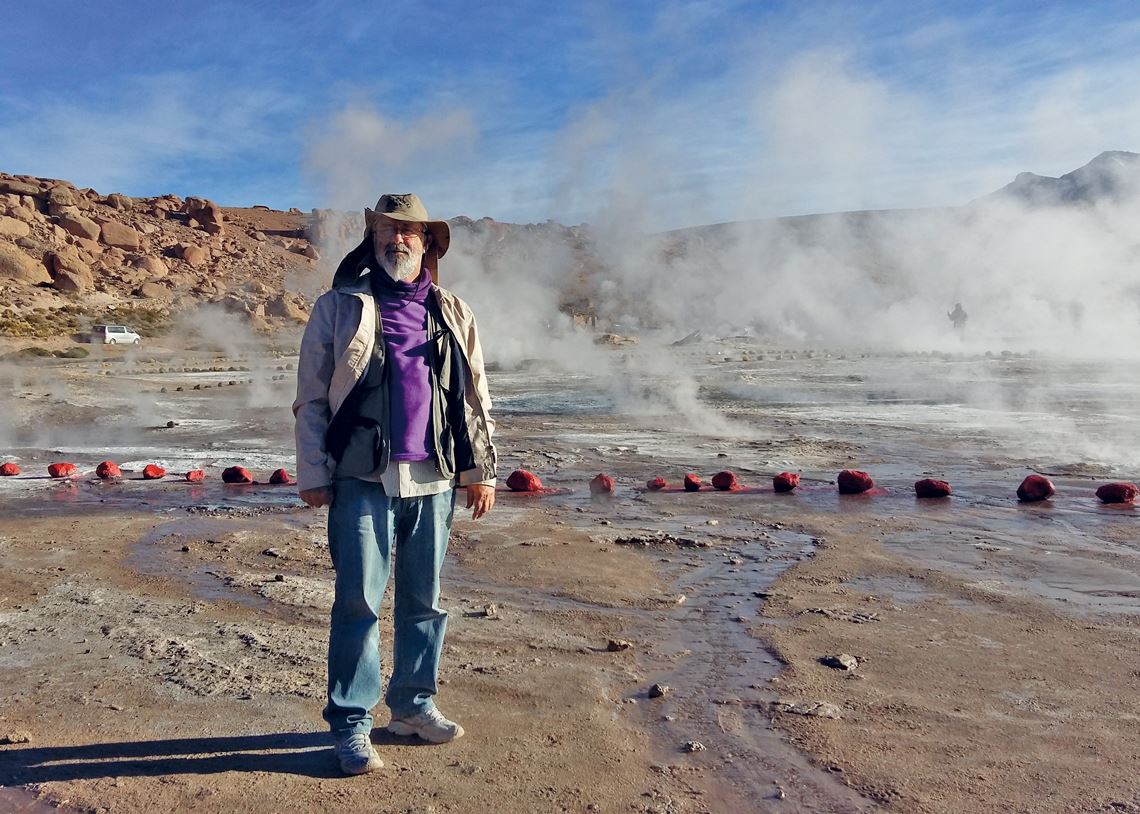
Personal archives
Ross among geysers in the Andes, 2015Personal archivesWhen did you present it to your colleagues?
A year earlier, in 1989, at the physical geography symposium in Rio de Janeiro. Former colleagues of mine from Radam—which had been shut down four years earlier—were there. Around 300 people attended; back then, conferences were still small, and everyone was aware of each other’s work. After the presentation, my former boss asked me: “But where did you get these concepts of morphostructure and morphosculpture?” I told him they came from my PhD work, which followed a concept used by the Germans and the Russians, who approach the study of terrain using two perspectives: structural [from the inside out], such as tectonic movement, and sculptural [from the outside in], such as erosion. And he said: “Cool, I like it.” The map reached nonspecialized audiences through articles in the magazines Nova Escola and Veja. Through my coordination, it later came out in the book Geografia do Brasil [Geography of Brazil] (EDUSP, 1996), and publishers began including it in textbooks.
You were also a consultant during the construction of the hydroelectric plants on the Xingu, Madeira, Iguaçu, and Uruguay rivers. What was that experience like?
It was in the late 1980s, when the EIA-Rimas [studies and reports on environmental impact] began to be applied. Eletrobras had a national plan to build hydroelectric plants on all rivers in the eastern portion of the Amazon by 2010, as the ones on the western side do not have enough drop. Project Radam had already recommended some possibilities. I was asked to teach former students and company trainees to use radar imaging for geomorphological mapping and analysis. I helped with maps and reports.
The Radam field trips were long, lasting 25 to 30 days; we had to sleep in hammocks. I loved it
If you could get into a helicopter right now and the pilot asked “where shall we go?”, which places would you like to visit or revisit?
Let me be pragmatic; I need to fly over Chapada Diamantina, in Bahia. I have never been there, and I am currently advising a PhD thesis on this region. It is a remarkably interesting place, because among the mountains there are lowlands and flatlands, with a climate that transitions between Cerrado [wooded savanna] and Caatinga [semiarid scrublands], fertile soil, and intensely irrigated agriculture. I would love to visit the area.
Have you been to all the Brazilian states?
Yes, although not to the entire territory of each state. I have traveled from Macapá to Oiapoque by road; from Boa Vista, Roraima, to Pacaraima, on the border of Venezuela. In May 2019, I nearly died while climbing the Caparaó mountain range, on the border of Minas Gerais and Espírito Santo. During the pandemic, I have only been traveling to my home in Boituva. I am looking forward to traveling again as soon as I get the COVID-19 vaccine.