
In mid-2022, agricultural engineer Diego Siqueira was reunited with former college classmate Diogo Barbieri, each at the head of their own soil analysis companies in Jaboticabal, São Paulo State. Siqueira talked about the advances he had made with magnetic sensors, used to identify land suitable for growing specialty coffees, and suggested his colleague use the same technique in sugarcane fields, which are commonplace where they live in the north of the state of São Paulo. Barbieri liked the idea, which he saw as an opportunity to expand his business by offering tests at lower costs than the methods he had been using at the time, which were based on chemical reactions.
Magnetic sensors and other equipment, such as satellites, drones, and spectrophotometers (which measure the intensity of light absorbed and reflected by a material) provide a kind of X-ray of the soil, differentiating between apparently identical soils and helping farmers to better take care of their land.
They also expose problems, such as water and nutrient loss, and sometimes, soil fragility. Siqueira gives an example: the red dust clouds that frightened residents of north and west São Paulo in September 2021 were formed by strong winds sweeping across areas with exposed soil, low humidity, and lacking the minerals that foster aggregation and prevent dispersion.
Ecossistemas de Inovação: A Revolução AgroMagnet attracts nanoparticles of magnetic minerals from the soilEcossistemas de Inovação: A Revolução Agro
Siqueira, co-owner of Quanticum since 2019 (see Pesquisa FAPESP issue nº 299), and Barbieri, one of the partners of Athenas since 2008, completed their master’s degrees and doctorates with fellow agronomist José Marques Júnior, head of a soil analysis laboratory at São Paulo State University (UNESP), Jaboticabal campus. In 2006, Marques Júnior began work on refining the technique used to identify minerals in soil, such as maghemite and magnetite, both formed by iron oxide, which has magnetic properties.
The UNESP group based their work on studies conducted in the early 2000s by Spanish agronomist José Torrent of the University of Córdoba, Spain, who used magnetic and color sensors to identify iron oxides, using the concepts of German chemist Udo Schwertmann (1927–2016). These minerals define not only the shades of red, but also the aggregation level of the soil; sandy and yellowish soils, which contain low volumes of these compounds, are less compact.
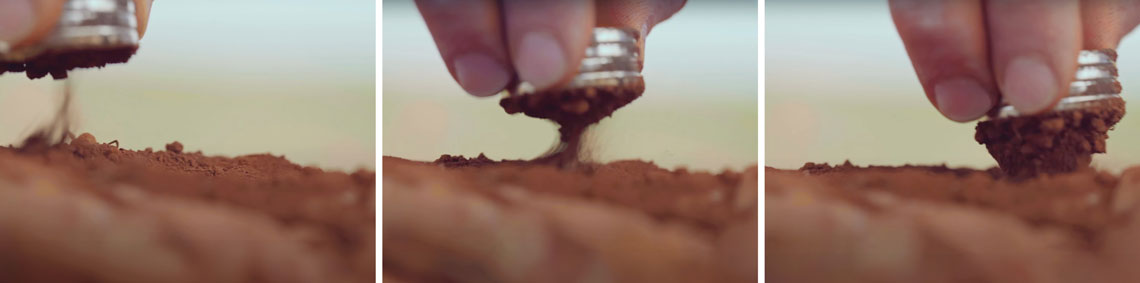
“Like color, magnetism is a sign of complex interactions, which determine the soil’s ability to retain water and nutrients,” says Marques Júnior. “With magnetic sensors, which these days are only slightly bigger than a cell phone, we can determine maghemite and phosphorus levels on the spot with more than 80% accuracy, and organic matter with 75%.”
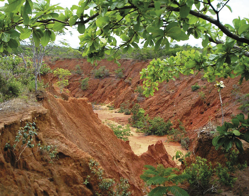
Claudio Lucas Capeche / Embrapa SoilsMapping soil irregularities can help mitigate erosion like this case in Mato GrossoClaudio Lucas Capeche / Embrapa Soils
Marques Júnior and his team analyzed the iron oxide content of 42 samples of latosol (one of the 13 basic soil types) from two sugarcane farms that use mechanical harvesting in the municipalities of Guatapará and Guariba, near Ribeirão Preto. Despite having similar geological histories, the proportion of iron oxide in the soils varied by as much as ten times, from 22 grams per kilogram (g/kg) to 253 g/kg. In the study, described in the journal Geoderma Regional in August 2015, a type of soil color analysis called reflectance spectroscopy proved capable of recording crystalline iron oxide contents below 5% and providing results within 20 minutes, while X-ray diffraction took 55 hours.
In another article, published in Scientia Agricola in 2022, an analysis of 88 soil samples showed that sugarcane fields with higher levels of iron oxide in Luiz Antônio — also in the central-north of São Paulo State — had greater potential for sugar and alcohol production.
“After 40 years of research in this area, there is still an absence of official, detailed, up-to-date maps, but we already have relatively satisfactory knowledge of the variation in Brazilian soils,” says Marques Júnior.
Together with other experts from the Luiz de Queiroz School of Agronomy at the University of São Paulo (ESALQ-USP), UNESP, and research centers in France and Australia, he participated in a nationwide project that mapped soils rich in iron oxide in Paraná, Pará, São Paulo, Mato Grosso, and Goiás (see map).

“Soils with a higher iron content have the best physical characteristics, such as good water infiltration, consistency, and aggregation,” he explains. The results of the project, which analyzed 30,344 samples from across the country, were described in Geoderma in April 2023.
Drones
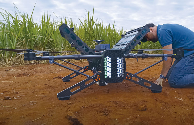
The more detail a map reveals, the greater the potential for improving agricultural productivity. In an experimental sugarcane farm in the interior of São Paulo, UNESP agronomist José Eduardo Corá identified which areas needed higher or lower doses of nitrogen fertilizer based on images taken by a drone that he flew over the farm.
“The multispectral sensor, with adapted cameras capable of generating images of the same object at different electromagnetic wavelengths, shows what the human eye cannot see,” he says. According to Corá, knowing how the plants interact with the soil and the effects of pests and the climate allows farmers to intervene before potential problems worsen, thus saving time and money. The technique, which has been widely adopted by farmers in the USA and is incipient in Brazil, also indicates areas with compacted soil, which limits sugarcane growth.
Another example is given in an article published in Revista Ciência Agronômica in September 2023. A team of scientists from the Federal University of Rio Grande do Sul (UFRGS), the Federal University of Goiás (UFG), and Instituto Federal Goiano in Rio Verde used a drone fitted with a 12-band camera (for different electromagnetic wavelengths) and identified areas of soil infested with nematodes, which are common pests on soybean farms.
Ecossistemas de inovação: A revolução agro Brazil makes drones used to disperse herbicidesEcossistemas de inovação: A revolução agro
To give farmers more precision in their work, Cromai Tecnologias Agrícolas, based in São Paulo, developed an AI program that processes aerial images taken by drones to identify potential problems, such as weeds among sugarcane crops. “The resulting files are compatible with most fertilizer tractors and drones: they just have to be uploaded to the equipment, which then applies the product in the correct locations,” explained mechatronic engineer Guilherme Barros Castro, director of the company, to Agência FAPESP. According to Castro, the technique, which was refined as part of a project funded by FAPESP’s Innovative Research in Small Businesses program (PIPE), means herbicide is only applied where necessary, reducing costs by 65% and minimizing environmental impacts.
At ESALQ, agronomist José Alexandre Demattê characterizes soils using satellite sensors, which can differentiate soils according to the colors they reflect. Each soil type has its own color, since they reflect light differently. Color variations indicate changes in the basic elements of soil: the composition or proportion of certain minerals, organic matter, microorganisms, water, and air.
The researchers examined images produced by the USA’s Landsat satellites between 1982 and 2019, with a resolution of 30 square meters (m2), from an area of 735,000 square kilometers (km2) in seven states — the Federal District, Goiás, Minas Gerais, Mato Grosso do Sul, Mato Grosso, Paraná, and São Paulo. As described in an article published in Scientific Reports in July 2023, infrared imaging, used to detect a nonvisible band of light, indicated that 14% of the land occupied by pasture or soybean crops were previously springs or wetlands that had been covered to increase the economically productive space.
“Environmental legislation states that water sources or reserves must be preserved and cannot be covered,” he points out. This is something he himself recommends for soil conservation when talking to public agencies, farming cooperatives, and companies in the Piracicaba region.
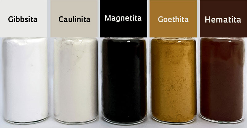
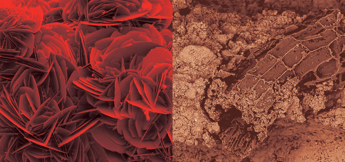
José Marques Júnior / UNESPPure minerals found in soils in Brazil, from the UNESP Jaboticabal archiveJosé Marques Júnior / UNESP
Using Landsat images from 1985 to 2020, ESALQ agronomist Rodnei Rizzo examined the issue of erosion, a natural phenomenon caused by rain and exacerbated by the transformation of native vegetation into cropland or pasture. According to an analysis by researchers in China published in Environmental Science & Technology in June 2022, agriculture, which occupies around 11% of the world’s surface, accounts for 50% of global eroded land. China, India, the USA, and Brazil account for 65% of soil erosion in agricultural areas.
“The greater the erosion, the lower the vegetation cover, the greater the degradation, and the lower the soil fertility,” says Rizzo. Demattê adds: “In Brazil, soil degradation rates have fluctuated over the last 40 years. It is still high on the agricultural frontiers of the North, but it is lower in the Southeast, with the increasing use of planting directly on straw and the mechanized harvesting of sugarcane.”
The USP group participated in a global project that mapped exposed soil, without forests, corresponding to 38.5% of the Earth’s surface and 82.2% of the area occupied by agriculture, as described in the journal Remote Sensing of Environment in December 2023. Analyzing color changes over time proved efficient at detecting not only global but also local soil surface changes — the soil becomes brighter when it loses vegetation cover as a result of erosion. Demattê emphasizes that the more the soil is exposed, the more intensely it suffers the effects of temperature, the greater the risk of erosion, and the lower its productivity.
“Based on detailed knowledge of the soil, we were able to identify areas with different agronomic potential,” says one of the users of the new research, agronomist Luís Gustavo Teixeira, who is director of agriculture and technology at São Martinho, one of the largest sugar and ethanol producers in Brazil. According to Teixeira, knowing the iron oxide content helps the company better plan the use of soil, water, fertilizers, and herbicides.
Barbieri from Athena notes, however, that small-scale producers are more resistant to soil analysis, even when the cost is less than R$80, and are more inclined to use fertilizers, even when they are unnecessary. But he also points out that soil conservation practices have advanced. “It was previously thought that the more contour lines [plateaus built in steep terrain to reduce the flow of rainwater and prevent flash floods], the better,” he says. “Today it is the exact opposite. The less you disturb the soil, the better.”
Projects
1. Use of remote sensing, modeling, and productivity maps to increase efficiency of nitrogen fertilization in sugarcane (nº 16/13461-4); Grant Mechanism Thematic Project; Program Bioen; Principal Investigator José Eduardo Corá (UNESP); Investment R$2,207,987.60.
2. Geotechnologies in detailed digital pedological mapping and spectral library of soils in Brazil: Development and applications (nº 14/22262-0); Grant Mechanism Thematic Project; Principal Investigator José Alexandre Melo Demattê (USP); Investment R$2,607,462.45.
3. Quality of soils in Brazil via geotechnologies: Mapping, interpretation, and agricultural/environmental applications: A legacy for society (nº 21/05129-8); Grant Mechanism Thematic Project; Principal Investigator José Alexandre Melo Demattê (USP); Investment R$1,123,028.90.
4. Clay quality and soil magnetism: Production environments for tropical coffee farming (nº 19/16421-1); Grant Mechanism Innovative Research in Small Businesses (PIPE); eScience and Data Science Program; Principal Investigator Diego Silva Siqueira (Quanticum Technology in Analysis & Mapping); Investment R$149,736.41.
5. Cromai agricultural diagnostic system: Diagnosis of coffee maturation and plant development of different cultures based on computer vision analysis (nº 21/03663-7); Grant Mechanism Innovative Research in Small Businesses (PIPE); Principal Investigator Guilherme Barros Castro (Cromai Tecnologias Agrícolas); Investment R$309,259.70.
Scientific articles
ARANTES, B. H. T. et al. Detection of nematodes in soybean crop by drone. Revista Ciência Agronômica. Vol. 54, e20217810. Sept. 2023
BAHIA, A. S. R. de S. et al. Procedures using diffuse reflectance spectroscopy for estimating hematite and goethite in Oxisols of São Paulo, Brazil. Geoderma Regional. Vol. 5, pp. 150–6. Aug. 2015.
CATELAN, M. G. et al. Sugarcane yield and quality using soil magnetic susceptibility. Scientia Agricola. Vol. 79, no. 4, e20200329. 2022.
CUI, H. et al. Production-based and consumption-based accounting of global cropland soil erosion. Environmental Science & Technology. Vol. 56, no. 14 pp. 10465–73. June 28, 2022.
MELLO, F. A. O. et al. Remote sensing imagery detects hydromorphic soils hidden under agriculture system. Scientific Reports. Vol. 13, 10897. July 5, 2023.
RIZZO, R. et al. Remote sensing of the Earth’s soil color in space and time. Remote Sensing of Environment. Vol. 299, 113845. Dec. 15, 2023.
ROSIN, N. A. et al. Mapping Brazilian soil mineralogy using proximal and remote sensing data. Geoderma. Vol. 432, 116414. Apr. 2023.