
Eduardo CesarA world of water: dark clouds over the Negro River and Manaus on February 18, 2014, harbingers of another Amazon rainfallEduardo Cesar
From Manaus, Brazil
Here in the city of Manaus and throughout this vast region of the North it rains a great deal throughout the year, but the rains are not all alike. Early in the year—February and March—it rains nearly every day, bathing the forest and the cities in showers that last for hours at a time but feature few instances of lightning. Late in the year—September to November—the storms are more intense and accompanied by enough electrical activity to awaken childhood fears, but the rainfall is localized and shorter in duration. In an effort to confirm and analyze the mechanisms of rain formation—which differs in each region of Brazil, and even within regions—and the effect of pollution in Manaus on climate in the Amazon, a group of 100 researchers from Brazil, the United States and Germany has begun to examine the sky around Manaus using radar and aircraft, under the auspices of the Green Ocean Amazon (GOAmazon) program. GOAmazon was officially launched on February 18, 2014 in Manaus, with a budget of R$24 million funded by FAPESP, the Amazonas Research Foundation (FAPEAM), the US Department of Energy and the National Science Foundation (NSF).
The term “green ocean” was coined in 1999, during the first major campaign of the Large-Scale Biosphere-Atmosphere Experiment (LBA). While flying over the Ji-Paraná Forest in the state of Rondônia, researchers—many of them now working under this new program—noticed that the clouds were not behaving as expected. The clouds in this area of Amazonia near Bolivia were thought to be as high as 20 kilometers (km) and to contain a high concentration of particulates and droplets of rain—characteristic of what are known as continental clouds. Instead, they had features of ocean clouds, with few particulates, more rapid formation and relatively low tops, as is typical in ocean areas. It was an ocean, but green rather than blue due to its position over the forest. Antonio Manzi, a researcher at the National Institute for Research in the Amazon (Inpa), who took part in that expedition and others for the LBA and is now a member of the GOAmazon team, remembers that 1999 was also the year in which they ascertained that so-called warm clouds, which do not form ice crystals, were prevalent in the region—a surprising occurrence in continental areas.
 INFOGRAPHIC ANA PAULA CAMPOS ILLUSTRATION FABIO OTUBO The volume of rain that falls over the Amazon Basin is equivalent to an ocean—27 trillion metric tons of rain each year on average, according to Manzi. Viewed in more concrete terms, were the rain to accumulate instead of filtering into the soil, it would form a sheet of water 2.3 meters deep along the 6.1 million square kilometers of the Amazon Basin, which extends through Brazil and several neighboring countries. Luiz Augusto Machado, a researcher at the National Institute for Space Research (INPE), calculated the average volume of rainfall throughout Brazil at 14 trillion metric tons per year. If the rain accumulated, it would submerge the entire country under a layer of water 1.7 meters deep. Machado also coordinates Projeto Chuva (the Rain Project), a component of GOAmazon, and now, in Manaus, he will conduct the final phase of a survey of the types and distribution of rain clouds in Brazil.
It is not yet clear how this aerial ocean forms. “Clouds may or may not produce rain,” says Gilberto Fisch of the Aeronautics and Space Institute (IAE) in São José dos Campos, a researcher with Projeto Chuva. “We often say that when there is water vapor, rain forms and then falls, but that is not always the case.” Most cloud-forming droplets, which are tens of micrometers in diameter, disperse in the form of vapor. Only a small number grow in volume and become drops of one to five millimeters that fall because of gravity. Understanding how clouds form and grow, and in which ones rain actually forms, is one of the goals of the GOAmazon team.
At one of the data collection points in the municipality of Manacapuru, 80 km west of Manaus, 120 instruments are operating day and night—some of them exposed, others housed inside 15 containers—collecting regional climate data. These are augmented by weather balloons released every six hours. Atop one of the containers is a radar instrument with a 100-km range that studies the shape and composition of rain-forming clouds. This type of instrument has performed the same service in other Brazilian cities since 2010. The cloud data will be collated with the data from the GPM (Global Precipitation Measurement) satellite, which is expected to be launched on February 27, 2014 from Japan and remain in orbit at an altitude of 400 km, sending data on rain clouds over nearly the entire planet. “The GPM will pass over Manaus twice a day, supplementing our data,” Machado says.
A research aircraft from the United States arrived in Manaus on February 16 and was expected to begin flying in the next few days to directly examine the types of ice crystals inside the clouds and measure levels of carbon dioxide (CO2) and particulates. Plans are for the US plane and another aircraft from Germany to fly over the city and the forest in September to measure any climate changes in the dry season.
The experiments, to be completed in December 2015, are expected to generate short-term (two-hour) weather forecasts and more accurate computer models of atmospheric circulation. In some areas of Brazil, rainfall monitoring, which relies on weather satellites, is still very inaccurate, causing delays in alerts that could save lives before heavy rains arrive.

Eduardo CesarSweeping the sky: cloud radar (left) and rain radar instruments in Manacapuru, 80 km from ManausEduardo Cesar
A metropolis in the forest
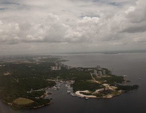
With a strong industrial base, 700,000 vehicles and nearly two million residents, Manaus, capital of the state of Amazonas, is the world’s largest tropical metropolis and is surrounded by hundreds of kilometers of forest. How does the pollution plume produced by this megacity in the middle of Amazonia alter the life cycle of the aerosols and clouds in forest preserve areas, and how do these elements interact in the atmosphere and cause more or less rain in the region?
These are the key questions that the international GOAmazon experiment will attempt to answer in the years to come. A detailed set of measurements of aerosols, trace gases (carbon dioxide, methane and other gases) and clouds will be taken at six different sites. Three are located to the east, ahead of the prevailing winds over Manaus, so the atmosphere over these sites is not yet contaminated by the city’s pollution plume. A fourth measurement station will be located in the city itself, and the remaining two are to the west in Iranduba and Manacapuru, where the atmosphere is already laden with the effect of the pollutants emitted in Manaus.
“No other city has a scenario like that of the capital of Amazonas,” notes Paulo Artaxo, coordinator of the thematic project linked to GOAmazon. “We know that pollution alters precipitation, but in what type of cloud and under what circumstances?” Studies conducted by Scott Martin, a researcher at Harvard University and member of the GOAmazon team, have indicated that the effect of aerosols on climate in the Amazon varies depending on the time of year. It has also been observed that clouds passing over the city take on pollution and have higher reflectivity than those without pollution. The clouds over the forest have a particulate load equivalent to that of pre-industrial times.
Maria Assunção da Silva Dias, a researcher at the Institute of Astronomy, Geophysics and Atmospheric Sciences at the University of São Paulo (IAG-USP), who coordinated the LBA campaign in 1999, is going to model the influence of the river breeze from the Negro, Solimões and Amazon rivers on the wind that carries the pollution plume from Manaus. The breeze blows landward from the river during the daytime, and in the opposite direction at night. “In rivers with broad banks such as the Negro, the breeze can be a factor that can change the direction and intensity of the winds, and thus modify the precipitation regime in nearby areas,” says Silva Dias, who did a similar study on the Tapajós River breeze in Santarém, state of Pará, in 2004.
Snow in the Northeast
Eager to better understand rain formation throughout the country and prevent climate tragedies, over the past four years the INPE team has collected data at five sampling points in five different states: Alcântara, in Maranhão; Fortaleza, in Ceará; Belém, in Pará; São José dos Campos, in São Paulo; and Santa Maria, in Rio Grande do Sul. A radar instrument and other equipment now set up in Manaus measure the size of the drops in clouds and the types of crystals that form them. The shapes of the drops, in fact, differ considerably. They may be horizontal, elliptical or oblong, but all of them are far from the tear shape normally used to represent raindrops.

Eduardo CesarWeather balloons is prepared to be releasedEduardo Cesar
“This is the first survey of the distribution of raindrops and ice crystals in the national territory,” says Machado. In general terms, what we observed was that different types of clouds (higher or lower) with different types of ice crystals (in the shape of stars, columns or cones) form and break up continually in every region of the country. We also saw that there are regional peculiarities that point to distinct processes of rain formation and surprising phenomena. The diversity of forms and moods of rain throughout Brazil over the course of a year call to mind the poem “Caso pluvioso” (A Matter of Rain), in which the poet Carlos Drummond de Andrade discovers that it was Maria who was raining (he does not say who Maria was), and he calls her fleeting, stormy, gloomy, unrelenting and frightful. He goes on to say, “Maria rained so much in my abode / that the stream took flight / and became a river, or maybe an ocean, / I only know that in the deluge I went under.”
Reality, too, offered a bit of poetry. “We discovered snow in the highest clouds over the city of Fortaleza,” Machado says. Unbeknownst to local residents, however, the snow melts and falls as normal rain. Most prevalent in the Northeast are warm clouds, referred to as such because the tops are below the 0o Celsius (ºC) temperature line, and therefore ice crystals cannot form, as would occur in the highest parts of other types of clouds. Since they contain no ice, these clouds go undetected by weather satellites and microwave equipment used to predict rain formation, resulting in inaccurate measurements. Measurements in warm clouds taken by radar in Alcântara indicated that the calculations of water volume, when compared with the measurements taken by satellite, were underestimated by more than 50%, as described by Carlos Morales, a USP researcher and Projeto Chuva team member.
The 0ºC line, or isotherm, separates ice crystals (above) and liquid water (below); it is a kind of invisible rain gateway, at which ice melts into water. It is not a very rigid boundary, however, because in the Southeast, strong rising currents enable the water to remain liquid at temperatures of up to minus 20 degrees, above the layer at which ice melts. “The combination of water and ice at higher altitudes is the main reason for the higher incidence of electrical discharges in the Southeastern region,” Machado says.
Eduardo Cesarraining in ManausEduardo Cesar
Using radar, scientists can examine the proportion of water and ice in cloud interiors, and in this way capture data that escape the satellites used in weather forecasting. “Satellites do not detect the large drops of water in low concentrations that come from the Atlantic and form clouds in the Northeastern and Southeastern regions,” Machado explains. In the Northeast, the clouds, which cluster along coastal areas, are fed by air masses coming from regions near the Equator and moving from ocean to continent. In the South and the Southeast, the rains are generated principally by cold air masses (cold fronts) coming from Argentina. Experts say that satellites also fail to detect phenomena that radar would not miss, such as the transformation that occurred when a warm wind from the ocean cooled rapidly as it hit colder areas high in the mountains of southern Brazil and descended as a relentless rain over Blumenau and the entire eastern portion of the state of Santa Catarina in 2008.
Dual polarization radar, in conjunction with other instruments, sends out horizontal and vertical waves that measure reflectivity to detect the shapes of ice crystals and raindrops, and thus reveal cloud composition and the mechanisms of formation and intensification of electrical discharges (lightning) during storms. The researchers found that clouds with many electrical discharges are higher and contain a greater diversity of ice crystals and more hail (ice stones) than clouds that produce less lightning. In addition, according to the survey, negative electrical charges stay at the same height, just above the 0oC line, and positive charges can be higher, around the tops of clouds and associated with increased electrical activity (see details in the infographic.
“Who doesn’t want to know where it’s going to rain before leaving home?” Machado asks. Experts believe that the collected data, combined with computer models already used for weather forecasting, can create a solid base of theoretical knowledge applied to continental rainfall. In one of the offshoots of Projeto Chuva—the Severe Weather Observation System (SOS)—the group at INPE worked with teams from Civil Defense and universities in each of the cities where instruments were set up to forecast rain two hours in advance, with a spatial resolution that identifies potential neighborhood flood points, as a supplement to forecasts provided by supercomputers such as the Tupã at INPE. Based on these experiences, Machado believes that radar, combined with a geographic information system (GIS) and existing rain-forecasting technologies that use resolutions as high as hundreds of meters, is paving the way for immediate forecasting of storms and climate disasters, so that a resident of one neighborhood can know whether or not it is raining in the next neighborhood before he leaves home on his way there. “In order to do that,” he says, “we need to learn the size of the raindrops and the phenemona occurring inside the clouds, as we are doing already.” And as they go on with their work, the “waters of March,” made famous in the song by Antonio Carlos Jobim, are now signaling the end of summer.
In collaboration with Marcos Pivetta.
Projects
1. Cloud processes of the main precipitation systems in Brazil: a contribution to cloud-resolving modeling and to the GPM (Global Precipitation Measurement) (nº 2009/15235-8); Grant mechanism Thematic project; Principal Investigator Luiz Augusto Toledo Machado – INPE; Investment R$2,188,914.06 (FAPESP).
2. GOAmazon: interactions of the urban plume of Manaus with biogenic forest emissions in Amazonia (nº 2013/05014-0); Grant mechanism Thematic project; Principal Investigator Paulo Eduardo Artaxo Netto – IF-USP; Investment R$3,236,501.79 (FAPESP).