INSTITUTO DE GEOCIÊNCIAS / UNICAMPDigital image of the northern region of Minas Gerais: new deposits of lead and zinc INSTITUTO DE GEOCIÊNCIAS / UNICAMP
A little hammer in the hand and a lot of willingness for field work still characterize the activity of the geologist, although in recent years geology has gained several high technology tools that make easier the identification of deposits of gold, silver, platinum or even granite. The word that marks this new phase is geotechnology, a technique that gathers together a major part of the studies based on remote sensing carried out using sensors that are portable or installed in aircraft or satellites.
At the forefront of this technology are instruments called spectroradiometers, sensors capable of measuring the behavior of light (radiation), considering the wavelengths of the visible range and fractions of the infrared range. The interaction of light with natural (rocks, soils) or artificial (concrete, asphalt) materials produces a signal that is called reflectance, which is the fraction of the falling light that is reflected by the surface. This measurement, when compared with a pattern that totally reflects the falling light (100% of reflectance), indicates what is called in remote sensing a curve (or signature) of spectral reflectance. This signature indicates the physicochemical properties of materials, allowing them to be easily differentiated amongst themselves.
In Brazil, one of the centers that has most dedicated itself to these studies is in the State University of Campinas (Unicamp). More precisely, in the Reflectance Spectroscopy Laboratory (LER) and the Processing of Georeferenced Information Laboratory (LAPIG), linked to the Geology and Natural Resources Department (DGRN) of the Geosciences Institute (IG). “Reflectance spectroscopy, based on spectroradiometers, is a rapid and non-destructive technique that measures the spectral signature of natural or artificial surfaces”, explains geologist Carlos Roberto de Souza Filho, the professor who coordinates the laboratories.
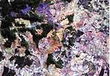
The research carried out at Unicamp has already assisted with important discoveries, such as, for example, of the deposits of lead and zinc, in an area located in the north of Minas Gerais, between the municipalities of Itacambira and Monte Azul. This region is exploited by the Companhia Vale do Rio Doce, which corroborated in field research the existence of the deposits detected by remote sensing. The characterization of these deposits was a result of the researches of students Tati de Almeida and Lucas de Melo Melgaço, from the Geosciences Institute. The objective of these researches was to create a method for detecting metallic mineral deposits using remote sensors and the integration of data in Geographical Information Systems (SIG) – software that works with data georeferenced to a system of coordinates (latitude and longitude, for example).
Another important achievement of the group of Professor Souza Filho was the mapping of a large area with rocks associated with the platinum deposit in Carajás, in the state of Pará, close to the former gold prospecting area of Serra Pelada. “To identify this deposit, we used data from the ETM+ sensors, on board the American Landsat satellite, and from Aster (Advanced Spaceborne Thermal and Reflection Radiometer), an orbital radiometer (which measures elecromagnetic radiation), developed in conjunction between the United States and Japan, and embarked on the Terra satellite, of the American space agency, NASA”, the researcher says. He makes a point of stressing: “Spectral characterization by remote sensing has not come to replace the work of the geologist in the field, but to assist him in mapping the deposits”.
National benchmark
It is not new for geologists to use advanced technological resources as tools for discovering deposits of gold, silver and other precious metals. In Brazil, a pioneering experience took place in the 70’s, with the Radam project, which had, among its objectives, the mapping of mineral reserves, using radar images from the American Gems sensor, a Goodyear system for environmental mapping, put on board an aircraft. Geological, geomorphological (topography) maps and those of land use and occupation were generated for Amazonia, thanks to the project, which ended up extended to the whole of Brazil. “The radars operating in the microwave band, like those by the Radam project, reveal the physical properties, such as rugosity and geometry, and the electrical ones, such as conductivity.”
At Unicamp, the Reflectance Spectroscopy Laboratory started to be set up in 1995, when Souza Filho finished his Ph.D. in remote sensing and digital image processing at the Open University in England and returned to Brazil, under contract to Unicamp. “In the following year, I had a project approved under FAPESP’s Young Researcher Program, which had the main objective of creating a emergent nucleus for the spectral characterization of materials and the consolidation of a reflectance spectroscopy laboratory as a national and international benchmark. To do so, we purchased a spectroradiometer called FieldSpec Full Resolution, which cost about US$ 100,000. This apparatus was for several years the only one in South America, and it allowed us to have the best and most complete infrastructure in the country for the spectral characterization of materials, with an emphasis on geological materials”, claims Souza Filho. This spectroradiometer is a portable piece of equipment, 50 centimeters by 40, and weighing some 4 kilos. For being so small, it can be carried to do field analyses, or can be installed in helicopters and planes for aerial measurement.
The workings of the apparatus are relatively simple: exchangeable lenses coupled to an optical fiber cable record the signal of light. This information is sent to a computer coupled to the apparatusand decoded in the form of a graph of spectral reflectance curves. The apparatus makes measurements in the interval of the spectrum, which runs from 350 to 2,500 nanometers – from visible to short wave infrared -, and “sees” 1,512 spectral bands, against the six bands of the sensor installed in Landsat, for example. “The more bands the apparatus registers in a given range of the spectrum, the greater its resolution and, therefore, the more complete the spectral (and physicochemical) characterization of the material.”
Although the main focus of the researchers from the IG is geological mapping, the reflectance spectroscopy technique can have other applications, such as environmental monitoring and the spectral characterization of vegetation cover. “We are working on a job to characterize sugarcane, in conjunction with Professor Teodoro Almeida, from the Geosciences Institute of the University of São Paulo (USP), associating spectral behavior with productivity”, says Souza Filho. Another project, in partnership with Petrobras and the Pontifical Catholic University (PUC) of Rio de Janeiro, intends to use the reflectance spectroscopy technique to detect small leaks in oil pipelines, which are difficult to notice and highly damaging to the environment.
To do so, three pipes 80 meters in length were buried in Unicamp’s experimental farm. Being planted over them are crops that usually cover areas where the oil pipelines are buried, in other words, sugarcane, corn, beans, soya and pastures.The next step will be to simulate small leaks of gasoline and diesel in two of the trenches, keeping the third one as a standard. The impact of the leak will be accompanied, with continuous measurements in the plantations. “From then on, we are going to see what happens with the spectral signature of the contaminated areas. If we find alterations in specific ranges of the electromagnetic spectrum, Petrobras may adapt the technology to monitor small scale leaks in their oil pipelines, using airborne sensors”, explains Souza Filho.
The works carried out by the group have been well received on the part of the international scientific community. “A proof of this is that both I and Professors Álvaro Penteado Crósta and Adalene Moreira Silva, both from the Geosciences Institute, are constantly being invited to take part in research programs to assess data from remote sensing and geophysics, produced by new sensors. “In my case, amongst other things, I am also the chief researcher for Aster, which has brought about some interesting partnerships between the academic and private sectors, nationally and internationally”.
Article in Science
It was the use of images from Aster, incidentally, that allowed the scientist to make an important discovery on the probable impact of meteorites on the Argentinean pampas some 500,000 years ago. The work was reported in the pages of the Science magazine of May 2002. The results of the research, led by English geologist Philip Bland, from the Open University, created some conflicts with the internationally accepted hypothesis to explain the existence of a series of elongated depressions near to the town of Río Cuatro.
According to scientist Peter Schultz, of Brown University, in the United States, one of the greatest scholars in the impacts of meteorites on the Earth, the craters were the result of the impact of a meteorite, skimming along at a low angle, which took place between 5,000 and 10,000 years ago. According to Schultz, the meteorite crashed into the surface of the Earth at 20,000 kilometers a second, at an angle of 5 degrees, an event that is difficult to happen, since the majority of collisions takes place at angles of over 30 degrees. The result of the crash was the formation of dozens of craters, some of around 5 kilometers in length, with pieces of meteorite and “tektites”, fragments of glass formed from the impact of meteorites of the surface of the Earth.
Impact of the wind
Using images from Aster and photographs from the American spy satellite Corona, taken in the 60’s, Bland and Souza Filho found some 400 depressions with the same profile in areas adjacent to the one researched by Schultz. To start with, the scientists imagined they were looking at the largest field of craters formed by the low angle impact of a meteorite. But, after complementary studies, they arrived at the conclusion that these features were not the fruit of an impact. Analyzing data from Argentina’s meteorological center, they concluded that the elongated features discovered by Schultz ran in the same direction as the winds of the region. And the dating of the “tektites” revealed ages of around 480,000 years.
“We concluded, then, that Schultz’s ‘craters’ are, in fact, the fruit of eolian erosion, and that the tektites found within a radius of 800 kilometers result from a great impact, but one that happened almost 500,000 years ago”, Souza Filho explains. The next step in the research is to locate the crater that resulted from this collision, which should be between 5 and 6 kilometers in diameter and be buried at some spot between the cities of Buenos Aires and Córdoba. “We are working on areas where there is strong evidence of the presence of this crater, and we believe that it is only a question of time before we corroborate it.”
The project
Spectral Characterization of Zones of Hydrothermal Alteration and Other Geological Materials and Implementation of the Spectroradiometry Laboratory at IG-Unicamp (nº 96/11139-2); Modality Young Researcher Support Program; Coordinator Carlos Roberto de Souza Filho – Geosciences Institute of Unicamp; Investment R$ 80,342.68 and US$ 99,038.25