The more erratic the course of a river, with seemingly illogical deviations, the greater the interest it holds for geographer André Salgado, of the Federal University of Goiás (UFG). Over the past 15 years, using satellite imagery, soil analysis, and many hours of walking and observation, he has identified advances and retreats in several river networks in Brazil, expanding areas of research begun in the 1950s.
His studies suggest that the course of the São Francisco River was once 250 kilometers (km) longer, before its headwaters were taken over by the Grande River, the main tributary of the Paraná River. Conversely, the course of the Poti, the main tributary of the Parnaíba, between the states of Ceará and Piauí, has extended since taking over the majority of the upper and middle stretch of the Acaraú. In Rondônia, the Branco River absorbed tributaries of the Essequibo, the largest river in Guyana, and in Santa Catarina the Itajaí-Açu took possession of tributaries of the Uruguay and Iguaçu. “River basins are constantly changing,” says Salgado.

Through what is known as ‘river capture,’ rivers act like cannibals, engulfing parts of others which will shrink or disappear. In an article from May 2013 in Science, Sean Willett and other geologists from the Swiss Federal Institute of Technology in Zurich called rivers participating in this slow-moving phenomenon ‘aggressors’ and ‘victims,’ reflecting their contrasting roles. The rate of surface or underground changes to water flow depends on the type of soil, the nature of the rocks (the less resistant they are, the easier water can erode them), and the slope of the terrain, since water tends to flow toward lower areas.
Climate is also a factor, with the level of rainfall directly influencing the erosive power of rivers, as are tectonic movements, such as the uplifting of the Earth’s outermost layer of soil and rock. “River capture is like a cake being eaten from both ends. The one that eats faster reaches the other side first,” compares Salgado.
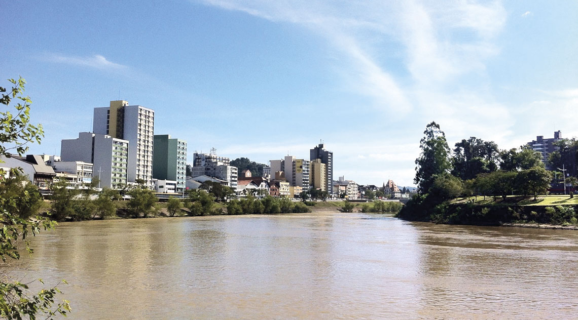
Raphael dos Passos Borba / WikipediaThe Itajaí-Açu River crosses Blumenau (Santa Catarina) after capturing tributaries of the Uruguay and Iguaçu riversRaphael dos Passos Borba / Wikipedia
By changing paths and merging segments of their courses, rivers increase or reduce the amount of water that irrigates a region. As a consequence, the climate, types of vegetation, and human occupation may change. “The Parnaíba captured the Poti, at some point between 23 million and 2.5 million years ago, leaving the current state of Ceará drier than it would have been without this diversion of water toward Piauí,” says Salgado, one of the authors of the May 2024 article in Revista Brasileira de Geomorfologia which describes these episodes.
US Geographer William Morris Davis (1850–1934) began studying this phenomenon when describing, in 1896, the capture of a river in northeastern France. Other analyses have explained the diversions of the Ohio and James rivers in the USA, the Thames River in London, the Nile in Egypt, and the Yellow River in China, among others. In Brazil, starting in the 1950s, geographers Aziz Ab’Saber (1921–2012), of the University of São Paulo (USP), and Antonio Christofoletti (1936–1999), of São Paulo State University (UNESP), Rio Claro campus, proposed some possibilities of river capture, although still with limited arguments due to the less refined analytical techniques available at the time compared to today.
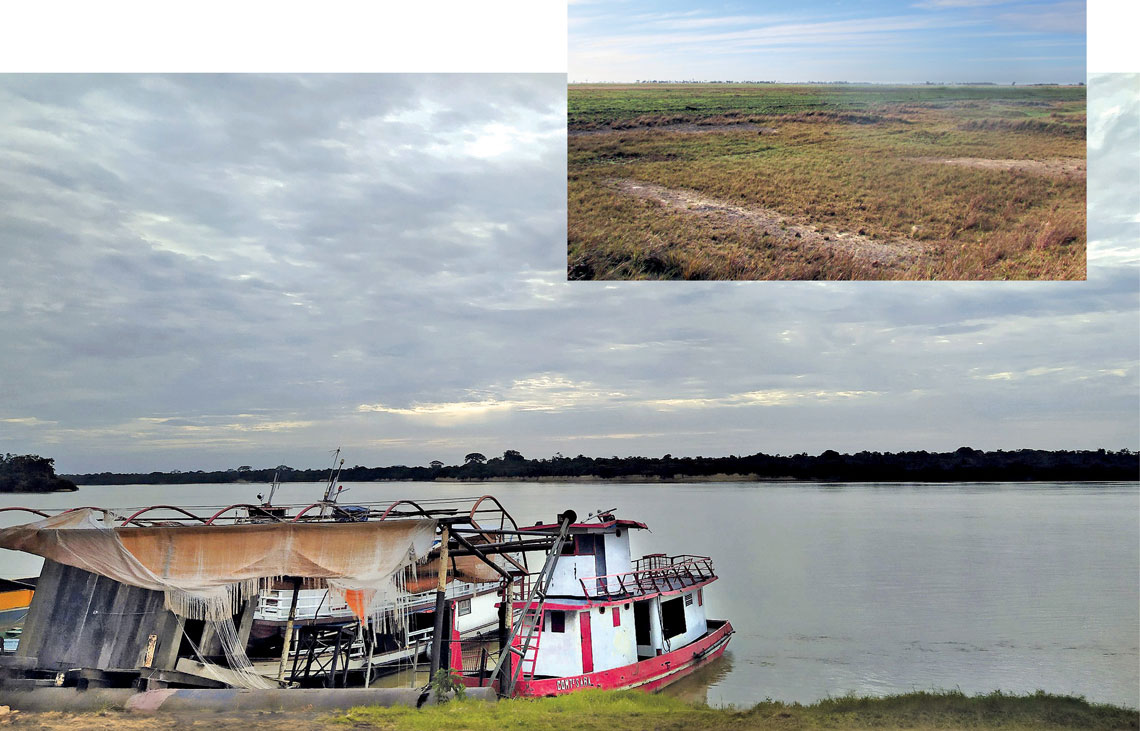
Tulio F / Wikimedia | André Salgado / UFG The Branco River (in the larger photo), in Caracaraí (Roraima), swelled as it gained waters from the Essequibo River, leaving behind traces of an ancient river on the boundary between the two basins (above)Tulio F / Wikimedia | André Salgado / UFG
Over time, the reshaping of rivers took on political significance in terms of defining territorial boundaries, as happened with the Branco River. Its main tributaries were once part of the Essequibo River basin, which rises in a mountain range on the border between the states of Roraima and Pará, crosses Guyana, and flows northward into the Atlantic Ocean. In December 2021, in the Journal of South American Earth Sciences, Salgado and colleagues from the Federal University of Minas Gerais (UFMG), where he taught until 2022, argued that the Branco River captured the Uraricoera, one of the tributaries of the Essequibo, and later the Tacutu, likely due to subsidence of the Earth’s crust in southern Roraima, which would have changed the river’s course and expanded its drainage area.
“If the Branco had continued in a northeastern direction instead of shifting its course to the southwest, Brazil would have lost all of central and northern Roraima to Guyana, because the borders between the countries in this region were essentially defined by the boundaries of the river basins,” says Salgado. “As the European colonizers entered the Amazon by the rivers, if the capture hadn’t happened, the first to reach the interior of Roraima would have been the English.”
Analyses of sediments from the riverbanks indicate that this change likely occurred during a relatively recent geological period, between 18,000 and 10,000 years ago. Using other methodologies, fellow geographer Fábio Alves, of the Federal University of Western Bahia (UFOB), studied the region and confirmed the findings of the teams from UFG and the National Institute for Space Research (INPE), concluding that the capture of the Branco River must have started around 18,700 years ago.
“The Amazon basin formed and expanded through successive river captures,” says Alves, based on an article from October 2018 in Neotropical Ichthyology. In that study, biologist James Albert, from the University of Louisiana at Lafayette, in the USA, and geologists Carina Hoorn, from the University of Amsterdam, in the Netherlands, and Pedro Val, from the City University of New York (CUNY), argue that the network of rivers crossing the Amazon rainforest is the result of river capture that occurred between 5.6 million and 4.9 million years ago, accelerating the diversification of plant and animal species in the region (see Pesquisa FAPESP issue n° 334).
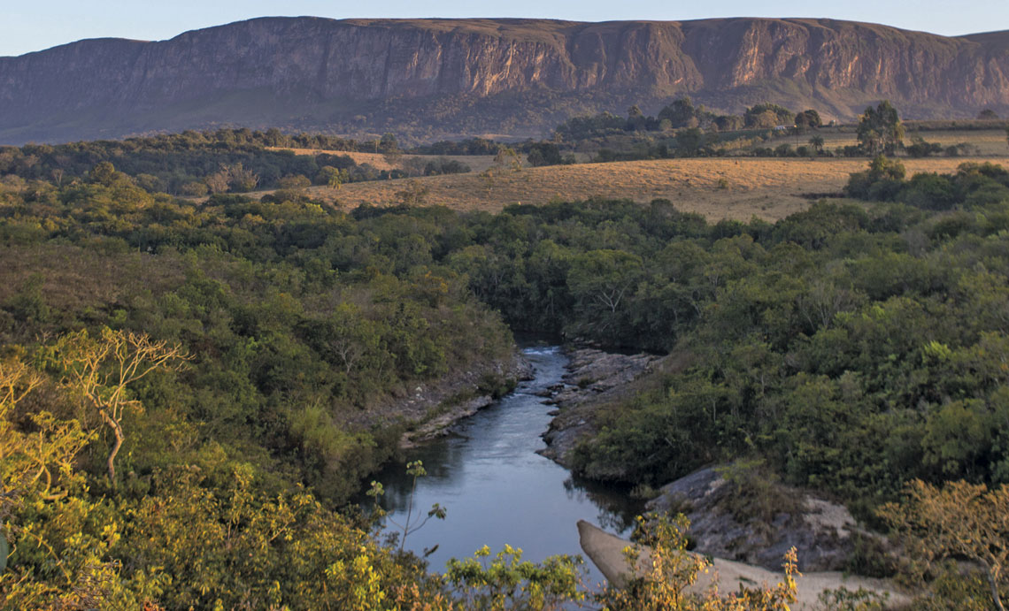
Fellipe Abreu / Getty Images Serra da Canastra and the upper stretch of the São Francisco River, just after its sourceFellipe Abreu / Getty Images
Losses and diversions
Research in this field has increased the interest in certain tourist attractions. Managers of Itatiaia National Park, for example, could place a sign near the trickle of water that emerges at an altitude of 1,980 meters, in the municipality of Bocaina de Minas, in the state of Minas Gerais, where the Grande River originates, noting that around 5 million years ago this was the source of another river: the São Francisco. Today, the Velho Chico, the affectionate nickname given to the São Francisco River, begins in the Serra da Canastra mountain range, also in Minas Gerais, about 250 km away.
Salgado became interested in this river capture after a remark by geographer Éric Andrade Rezende, who was doing his PhD at the time. “In 2015, Éric was on a road going to Pimenta, in Minas Gerais, and noticed something strange,” he says. “There, the Grande River, the main headwater of the Paraná River, made a curve on a flat area. He went back and said: ‘What if this used to be the São Francisco and not the Grande River, like it is today?’” Salgado, who until then had studied smaller and less prominent rivers, decided to pursue the idea.
Rezende, currently working in the municipal government of Contagem, in Minas Gerais, says: “The older the process is in geological time, the harder its evolution is to reconstruct, because the evidence gets erased by erosion or tectonic activity.” Salgado, a PhD student at the time, and his advisor, geologist Paulo de Tarso Amorim Castro, published the hypothesis in an article in June 2018 in Revista Brasileira de Geomorfologia, based on sediment analysis, geological structures, and surface movements in the region.