
Mario Assine / Unesp
Serra do Tonã, in Bahia: signs of marine ingressionsMario Assine / UnespGeologist Mario Assine views the layers of sedimentary rocks that jut out on the Araripe Plateau, along the border between the Brazilian states of Ceará and Pernambuco, like the pages of a book in which a part of our planet’s history is recorded. “The deepest and oldest rocks are the initial pages, preserved beneath layers of younger rocks that tell the story of what happened later,” explains the researcher, a professor at São Paulo State University (Unesp) at Rio Claro who has studied the region for 30 years. He regards the layers of rocks containing marine fossils from Araripe as the best geological clue to what happened between 125 million and 100 million years ago in the region that is now the Brazilian Northeast. “The rocks there hold signatures of major events that help us understand how South America and Africa ended up separating and enabled the North Atlantic Ocean to connect to the South Atlantic,” he reckons.
During that period, the continents were configured quite differently than they are today. In the early Aptian age, which lasted from 125 million to 113 million years ago, the immense blocks of rock that today form South America and Africa were an integral part of the supercontinent Gondwana, which also included Antarctica, Australia and Madagascar (see map). After a long period in which they were conjoined, internal planetary forces caused them to break up and move apart. Gradually, the waters of primitive oceans occupied the space between the continents and contributed to the birth of the present-day oceans.
As South America and Africa drew apart, in a rift process that began in their southern reaches, the future South Atlantic was taking shape. Meanwhile, near the Earth’s Equator, to the north of Gondwana, the proto-North Atlantic was receiving the waters of an ocean called Tethys and expanding as the distance between North America, Europe and southern Africa grew. After millions of years, the separation was complete, resulting in a single Atlantic Ocean, but what is today Northeastern Brazil remained connected to Africa.
The rocks of the Araripe Plateau tell part of the story of the emergence of the Atlantic, but they don’t show all the details. Missing information could answer fundamental questions, such as how to identify the paths by which the waters of the oceans entered that region of the planet and connected the North and South Atlantic some 115 million years ago. At this time, the marine fossils found in Araripe suggest only that those waters originated in the North Atlantic.
Seeking more information on what might have occurred during that period, Assine and his colleagues extended their search for signs of those ingressions onto the rocky outcrops of the Serra do Tonã, a mountain range in the state of Bahia, 200 kilometers southeast of Araripe. The results of their search are the subject of the master’s thesis written by geologist Filipe Varejão under Assine’s advisorship and published in the journal Cretaceous Research in July 2016.
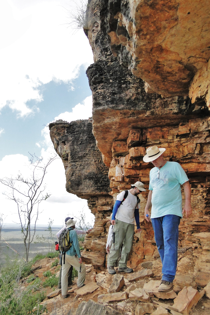
Mario Assine / Unesp
Unesp team examines limestone outcrop at the top of Serra do Tonã: rocks formed between 125 million and 113 million years agoMario Assine / UnespIn that work, Assine and his colleagues showed that the rock strata from that period that are preserved in Serra do Tonã suggest that the waters of the Tethys initially advanced southward by some unknown route east of the Brazilian coast. When they reached the region that is now southern Bahia, they are thought to have been diverted northeastward and advanced into Brazil’s inland Northeast.
That interpretation was based on the geological record preserved in the sedimentary basins and captured in petrified marks left there by currents in the then-existing rivers. This conclusion contradicts the paleographic reconstruction of ancient landscapes proposed by geologist and paleontology specialist Mitsuru Arai, based on his study of marine fossils found in the Northeast. Arai and Assine agree that the waters that occupied the region came from the North Atlantic, but they disagree on their route onto the ancient continent.
“As I see it, the conclusion that the marine ingression of the Northeast involved waters coming from the south is absurd,” says Arai, who worked at Petrobras for 37 years and is now a professor at Unesp in Rio Claro. Arai presented his paleographic scenario in 2014 in the Brazilian Journal of Geology. “The sea came from the north,” he maintains.
The impasse has sparked heated debates between them. Both scientists think more in-depth studies are needed in outcrops of the Aptian in the Parnaíba sedimentary basin, so that the question can be settled once and for all.
Pre-salt connection
Assine’s research in Araripe and Serra do Tonã was carried out under projects funded by FAPESP and Petrobras. The oil industry is interested in gaining a better understanding of the rocks from the late Aptian in the Northeast because they have the same age and chemical and geological composition as the rocks that hold the pre-salt oil reserves in the Santos and Espírito Santo sedimentary basins in the Northeast and along the Brazilian continental margin. “The rock formations from this period in the Northeast and along the continental margin hold records of the same sequence of events,” Assine explains. “Araripe and Serra do Tonã function as models for understanding the succession of pre-salt rocks to which we have limited access.”
Geologist Webster Mohriak, an expert in salt tectonics at Rio de Janeiro State University (UERJ), says that during the Aptian, between 125 million and 113 million years ago, the South Atlantic was an ocean that was open from Argentina to the present-day Pelotas sedimentary basin in the state of Rio Grande do Sul. There, a chain of volcanic mountains called the Rio Grande Rise guarded the entrance of a narrow ocean gulf that terminated to the north where the coastline now borders the states of Sergipe and Alagoas (see Pesquisa FAPESP Issue nº 224). The gulf had contours similar to those of the gulf of the Red Sea, which opens between Africa and the Arabian Peninsula. In 2014 and 2015 at international conferences, Mohriak presented evidence that the two were formed by identical mechanisms.

Mario Assine / Unesp
Stone quarry in Nova Olinda, in the Araripe Basin in Ceará: laminated limestones from the Aptian used as facing stoneMario Assine / UnespAt the end of the Aptian, the Earth’s climate became more arid, and the ocean gulf in Gondwana’s interior, where South America and Africa would come to be, may have completely dried up. As the water evaporated, the salt precipitated and formed a thick layer that sealed organic matter within the layers of sediment that then existed beneath, creating the reserves of pre-salt oil.
Above the layer of salt in the basins along the Brazilian coast, the geologists found layers of marine limestone, typical of shallow saltwater, covered by layers of sediment deposited in a deep-ocean environment. This succession indicates that after drying up, the gulf filled in once again, increasingly opening up until the continental crust between Brazil and Africa completely separated 100 million years ago, at the end of the Albian age.
Different interpretations
According to Assine, the principal reconstructions of the continents as they were configured in the past, such as those done by geologist Christopher Scotese of the University of Texas at Arlington, indicate that the waters of the North Atlantic and the South Atlantic did not meet until South America became completely separated from Africa. “These reconstructions, however, do not take into account that the ocean advanced into inland Gondwana during the Aptian, around 115 million years ago,” he explains. “The layers of stratified rock containing marine fossils that exist on top of the deposits of salt and laminated limestone on the Araripe Plateau are clear evidence of that ingression.”
More recently, Assine assembled clues that Araripe was once part of a larger sedimentary basin. The limestone deposits found in that area may have been remains of sediments that accumulated in a much more extensive region that included at least Araripe and Serra do Tonã. Nearly all of that area was eroded by rivers in the last 65 million years, after the Northeast rose above sea level. Assine compares the deposits from Araripe to the remains of a party cake. “It’s the largest piece left in the middle of the tray.”
Geologist Oscar Gross Braun had already identified two smaller pieces of the cake in the 1960s: the Serra Negra Mountains in Pernambuco, and Serra do Tonã in Bahia. Now, Assine, Varejão and geologists José Perinotto and Lucas Warren, also of Unesp, have revisited those formations to examine them in detail with modern tools. In collaboration with geologists Bernardo Freitas of the University of Campinas (Unicamp), Renato Paes de Almeida of the University of São Paulo (USP), and Virgínio Neumann of the Federal University of Pernambuco (UFPE), they identified two sequences of rock layers from the Aptian that were identical to the sequences of the same age that are found in Araripe. For Assine and his colleagues, this coincidence confirms that the Araripe Plateau and Serra do Tonã were once part of the same basin.
 These sequences of layers begin as deposits from fluvial environments and are succeeded by carbonate-clayey rocks formed in estuaries of rivers and lakes. On the basis of the structures and shapes of the layers of sandstone at Tonã, the researchers identified the direction of paleocurrents—ancient fluvial currents–and determined the direction of flow of the rivers existing there in that distant past. “The waters flowed southward, suggesting that there was higher land to the north of Araripe”, Assine says. “It’s clear that the inland Northeast featured a high relief that functioned as a drainage divide between the Parnaíba Basin, in the state of Maranhão, and the formation that encompassed the Araripe and Tucano basins, where Serra do Tonã is located. With that natural barrier, the ocean that advanced into the region could only have come from south to north, entering the continent along the bottom of the river valleys, against the direction of flow of the rivers.”
Since the analyses of fossils of microorganisms and fish suggest that the marine fauna of Araripe and Tonã were related to species from the Tethys Ocean—an indication that the waters came from the north, Assine is trying to reconcile the conflicting evidence. He speculates that there could be a passage along the Brazilian Equatorial Margin, a coastal region that runs from the present-day mouth of the Amazon River to the state of Rio Grande do Norte, through which the waters of the Tethys entered and crossed through the area that now comprises the coast of Rio Grande do Norte, Alagoas and Sergipe, and then finally headed southward and moved into the inland Northeast as far as Araripe. “That is an open question,” he acknowledges. “The Brazilian Equatorial Margin and the Parnaíba Basin are still not well known, and we could have some surprises.”
Mitsuru Arai disagrees on the existence of a drainage divide between the Parnaíba and Araripe basins. “The fossil content of the rocks found in the two basins is very similar,” he says. “If there had been a drainage divide, the fauna and flora in the two basins would be dissimilar.”
Arai also questions the direction of the currents of the primitive rivers of Tonã proposed by Assine and colleagues. The paleontologist believes that the sandstone deposits were formed not by the action of rivers, but by tidal currents that likely existed when the Parnaíba and Araripe basins were overrun by ocean water. Those waters, coming from the north, would have formed an immense ocean channel in the continental interior, similar to the English Channel that separates Great Britain and France.
“We need to consider the paleocurrents of the rivers and tides of the Parnaíba Basin as well,” Arai suggests. “If the paleocurrents from there moved southward, I win the bet. If they flowed northward, Assine can continue debating me.”
Projects
1. Geological reassessment of the Araripe Basin, Northeastern Brazil (nº 2004/15786-0); Grant Mechanism Regular Research Grant; Principal Investigator Mario Luis Assine (Unesp); Investment R$ 78,939.46.
2. Developing facies models for large river systems: processes and products in active bars in the Brazilian Amazon and implications for the paleogeographic reconstructions of the Neogene Amazon and the Mesozoic Gondwana in NE-Brazil and E-Australia (nº 2014/16739-8); Grant Mechanism Regular Research Grant; Principal Investigator Renato Paes de Almeida (IGc-USP); Investment R$ 224,884.80.
Scientific articles
VAREJÃO, F. G; et al. Upper Aptian mixed carbonate-siliciclastic sequences from Tucano Basin, Northeastern Brazil: Implications for paleogeographic reconstructions following Gondwana break-up. Cretaceous Research. V. 67, p. 44-58. July 2016.
ARAI, M. Aptian/Albian (Early Cretaceous) paleogeography of the South Atlantic: A paleontological perspective. Brazilian Journal of Geology. V. 44 (2), p. 339-50. June 2014.
ASSINE, M. L. et al. Comments on paper by M. Arai “Aptian/Albian (Early Cretaceous) paleogeography of the South Atlantic: A paleontological perspective”. Brazilian Journal of Geology. V. 46 (1), p. 3-7. March 2016.