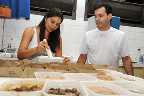
Unesp Public Domain ImageStudents with the geography program…Unesp Public Domain Image
Located in far western São Paulo, 558 kilometers from the state capital, the city of Presidente Prudente is home to one of Brazil’s top graduate programs in geography. The master’s and PhD programs in geography at the School of Sciences and Technology (FCT) of São Paulo State University (Unesp) received the highest grade on the latest two evaluations of the Brazilian Federal Agency for the Support and Evaluation of Graduate Education (Capes), a feat achieved by only two other geography programs nationwide, one at the University of São Paulo (USP) and the other at the Federal University of Rio de Janeiro (UFRJ). Grounded in six lines of research, the FCT program produced 30 dissertations and 28 theses last year. It focuses on investigating topics ranging from the expansion of mid-sized cities to the agrarian question and from the formation of urban heat islands to watershed management. “The professors of course have some theoretical and political disagreements, but the program’s success lies in a collective decision to respect differences and work together,” says Rosângela Hespanhol, FCT professor and coordinator of the Graduate Program in Geography. “Perhaps this is the way we’ve found to overcome the challenges that stem from not being located near a major urban center, a problem not faced by other groups working in the state of São Paulo.”
The FCT began its life in 1959 as an isolated institution for higher education, at first offering only undergraduate degrees in geography and education. Incorporated into Unesp in 1976, it currently has 12 programs. The Graduate Program in Geography began in 1988 at the master’s level and within just one decade had laid the foundations for attaining today’s level of excellence. “It was in the late 1990s that the Department of Geography stopped focusing on education alone and invested in research,” says Eliseu Savério Sposito, one of the program’s 25 faculty members. “A number of instructors had retired, and Unesp’s Office of the President was pushing for improvements to graduate programs and higher-impact research, so a kind of tacit agreement was reached among the remaining, younger faculty, who decided to join forces around research groups,” explains Sposito, leader of the Research Group on the Production of Space and Regional Redefinitions (GAsPERR), organized in 1993.
One example of the type of contributions made by GAsPERR can be seen in two FAPESP-funded thematic projects recently conducted by group researchers. One of these, led by Sposito from 2006 to 2011, addressed the role of mid-sized cities in the industrialization of rural São Paulo. It was found that the decentralization of industrial activities created hubs of development in rural São Paulo, accompanying the routes of major highways around cities like Ribeirão Preto, São José do Rio Preto, Bauru, Marília, Araçatuba, and Presidente Prudente. “Rural São Paulo achieved an economic importance that was not a concession made by Greater São Paulo. Many mid-sized cities became big consumer centers and played a proactive role in attracting industries and businesses.” The project yielded an eponymous book, O novo mapa da indústria no início do século XXI (The new map of industry in the early 21st century), edited by Sposito and released in 2015.
Another, ongoing thematic project, under the responsibility of Professor Maria Encarnação Beltrão Sposito, explores the economic logic of businesses that began identifying mid-sized towns in rural São Paulo as potential consumer markets in the 1990s and started competing there. “When they set up shop in rural towns, they both redefine their position in the urban network and also restructure urban space, and this has clear impacts on people’s spatial practices and consumer habits,” says Nécio Turra, current GAsPERR coordinator and one of the researchers associated with the project. One of the topics under study is the distribution of store branches and shopping centers within these cities and how this creates new consumer areas disputed by diverse publics. Businesses do not choose their locations randomly. “They occupy areas of easy access that can draw a higher-income public, which has the effect of pushing up surrounding land values and attracting residents with this profile. This changes how people move about the city,” he says.
“We’ve left behind a city model with just one downtown and gone to a more complex urban structure, leading people into more private spaces, where social interactions are mediated by consumption,” states Turra. “One of the ideas we’ve been studying is that social distances leave a more visible mark on city space, splitting apart groups that used to meet in traditional downtowns.” The research relies on currently available official data on cities, but investigators also venture into the field to observe real life. “Eighteen of us researchers recently spent a few days in Ribeirão Preto, interviewing people and visiting schools and shopping centers.” In addition to the group’s six researchers, there are another 70 people working on topics related to the project, including undergraduate research interns, master’s and doctoral candidates, and postdoctoral researchers.
The problems and challenges facing the Pontal do Paranapanema region motivate these research groups. “We are heavily involved in extension work and keep an eye on the demands of society,” says Antonio Cezar Leal, coordinator of the Academic Group on Environmental Management and Socio-Spatial Dynamics (GADIS), which is dedicated to research and extension activities in water management, environmental watershed planning, environmental education, and urban solid waste management. In 2007, the FCT signed a partnership agreement with the Aguapeí-Peixe Rivers and Pontal do Paranapanema Watershed Committees, which was later expanded to other rivers in the region; under its terms, the school trains professional personnel by providing graduate and extension courses, organizing events, preparing educational material, and conducting research on applied topics such as water resource planning and management. “All the groups with links to the Graduate Program in Geography were involved in this initiative by giving classes or doing research. And this joint work reaped rewards: the Watershed Committees and the State Water Resources Fund sponsored construction of a building at the FCT that now houses the Research Groups Center,” says Antonio Nivaldo Hespanhol, coordinator of the Regional Dynamics and Agriculture Studies Group (GEDRA), made up of six professors who are conducting over 20 projects on topics like family farming, the organization of small rural producers, government action in agriculture, and urban agriculture.
The issue of agrarian reform in the Pontal do Paranapanema region – where Presidente Prudente is the largest city – also motivates Unesp researchers. The region is known for the agrarian conflicts that took place on state-government-owned lands, which were occupied by large cotton farms in the 1940s and later gave way to extensive grazing. In addition to studying struggles for land, the Center for Studies, Research, and Projects in Agrarian Reform (NERA) keeps a database on land occupation and settlement in Brazil and advises organizations like Brazil’s Landless Workers Movement (MST).
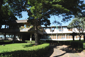
Unesp Public Domain Image…and School of Sciences and Technology building at Unesp-Presidente Prudente: the integration of research groups laid the foundation for a top-ranked graduate programUnesp Public Domain Image
Sugarcane
The Center for the Study of Labor Geography (CEGET), another research group, coordinates a thematic project as part of the FAPESP Program for Research on Bioenergy (BIOEN), which produces maps on the impact of the advance of sugarcane in the Pontal do Paranapanema region. The work is led by Professor Antonio Thomaz Júnior, who specializes in labor geography. “The same factors that drew cotton and ranching to Pontal – that is, the availability of very cheap land and water – drew the sugarcane agro-industry starting in the 2000s,” the researcher says. “Companies like the agro-industrial arm of the Odebrecht group were attracted to the region, and they don’t even need to get involved in conflicts over unsettled land because they just lease property.”
The studies led by Thomaz Júnior, in partnership with the GADIS research group, seek to estimate how much damage is caused to rural worker settlements in the vicinity by the application of pesticides to the sugarcane crop. “There are signs that rivers and people are being contaminated. Assessing this type of impact is one of the project’s goals,” says Thomaz Júnior, who has devoted his entire academic career to the agrarian issue in Pontal do Paranapanema.
The ties between geographers in Presidente Prudente and their colleagues abroad help account for the high ranking of its graduate program. “With the support of Capes and FAPESP, we regularly send students abroad on internships. Our researchers maintain good relations with groups in the United States, Portugal, France, England, and Spain,” says Rosângela Hespanhol, program coordinator. “We often receive visiting researchers from abroad to give lectures or teach short courses. Two Portuguese and one U.S. professor were recently here at the FCT-Unesp.”
The work of the Research Group on Surface, Water, and Atmosphere Interactions (GAIA) offers a fine example of internationalization. Coordinated by Professor Margarete Amorim, GAIA studies the formation of urban heat islands in medium and small cities, working in conjunction with French researchers. While Brazilian team members investigate heat islands in Presidente Prudente, French geographer Vincent Dubreuil, of the Université Rennes 2, studies the same phenomenon in a mid-sized town with a temperate climate: Rennes. “Until recently, you only talked about the formation of heat islands in large metropolises, but it proved possible to measure a temperature difference of up to 9 degrees Celsius between urban and rural areas in the mid-sized town of Presidente Prudente,” says Amorim. “In Rennes, the formation of heat islands is actually a positive thing, especially in the winter, and it only gets complicated when it’s associated with the problem of the atmospheric dispersion of pollutants.”
The project also involves collaboration with researchers in Spain and Portugal. “Under the partnership, we’ve been discussing data collection procedures and how to represent these data spatially, so they can be made available to government agencies,” says Amorim. The study seeks to identify more suitable construction materials and also define urban lot sizes and patterns of urban tree cover that can ameliorate thermal discomfort and other negative effects related to heat islands.
This is the fifth and final in a series of reports on the 40-year history of São Paulo State University – Unesp
Projects
1. Diagnosis and analysis of the daily evolution of urban heat islands in mid-sized cities, in tropical and temperate climates (nº 2014/16350-3); Grant Mechanism Regular research grant; Principal Investigator Margarete Cristiane de Costa Trindade Amorim (FCT-Unesp); Investment R$61,674.55.
2. Mapping and analysis of the territory of sugarcane hydro-agribusiness in the Pontal do Paranapanema region, São Paulo State, Brazil: Labor relations, conflict, land and water use, and environmental health (nº 2012/23959-9); Grant Mechanism Regular research grant – BIOEN Program – Thematic project; Principal Investigator Antonio Thomaz Júnior (FCT-Unesp); Investment R$1,007,620.30 (for the entire project).
3. Economic logic and contemporary spatial practices: medium cities and consumption (nº 2011/20155-3); Grant Mechanism Regular research grant – Thematic project; Principal Investigator Maria Encarnação Beltrão Sposito (FCT-Unesp); Investment R$377,748.65 (for the entire project).
4. The map of industry at the beginning of the 21st century: Different paradigms for territorial analysis of the economic dynamics in the State of São Paulo (nº 2004/16069-0); Grant Mechanism Regular research grant – Thematic project; Principal Investigator Eliseu Savério Sposito (FCT-Unesp); Investment R$188,217.15.