For a long time, in the field of archaeology, São Paulo was considered a state with almost no records of the past. “Until now, studies in the region had been isolated, without systematic research that would allow the identification of sites, in addition to the characterization and analysis of rupestrian records,” says archaeologist Marília Perazzo, a researcher on a postdoctoral fellowship at the Laboratory for Interdisciplinary Research in Evolution, Culture, and Environment of the Museum of Archaeology and Ethnology at the University of São Paulo (LEVOC-MAE-USP). “Our research fills a gap within the scope of archaeology in the state of São Paulo, enabling São Paulo to be put on the rupestrian map of Brazil.”
In the context of the project led by archaeologist Astolfo Araujo, Perazzo and colleagues from LEVOC have been surveying these areas since 2019 and have now created an interactive map of the archaeological sites with rupestrian records in the state of São Paulo. With 21 known sites when they started, in 2023 the team from MAE recorded another 33, totaling 54.
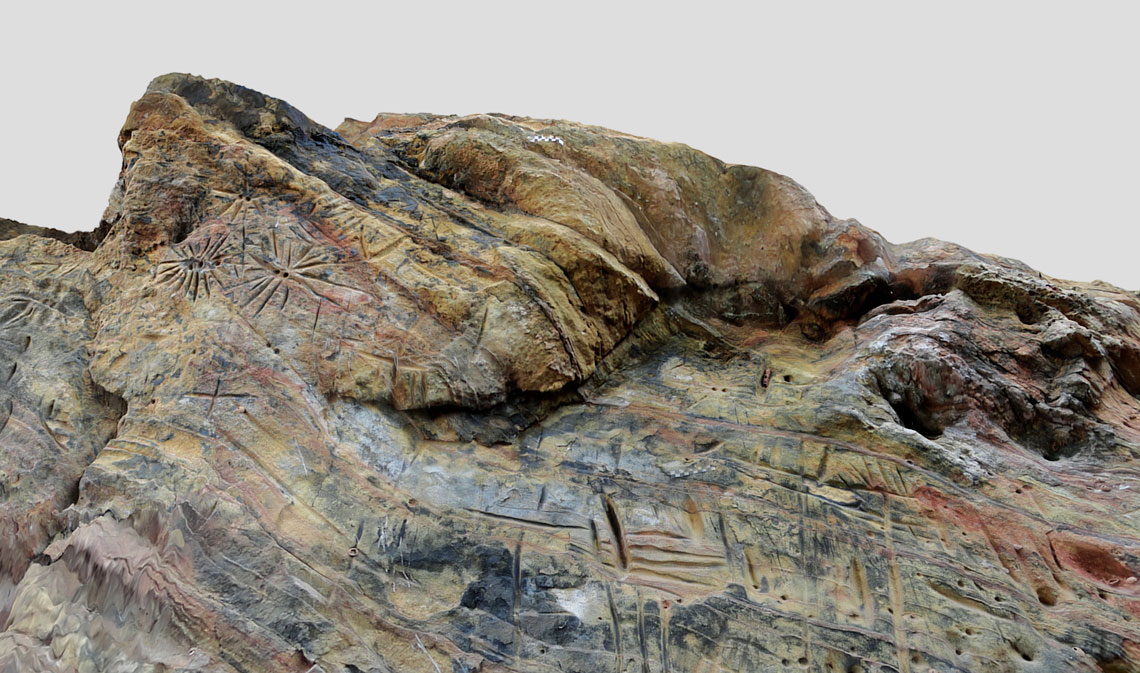
On the map, it is possible to see photographs of rocky panels, three-dimensional models, bibliographic references, dates, and other general information about the sites. The group used photogrammetry and laser scanning techniques to create digital replicas of the engravings and paintings that are on the site, and classify the sites into three categories: visited, not visited by the LEVOC team—but with records of its existence in the literature—and destroyed sites. The team has already processed 3D images for six of them.
The São Paulo map was inspired by the Summa Arqueológica project, of the Museum of the American Man Foundation (FUMDHAM), in São Raimundo Nonato, in the state of Piauí, headquarters of the National Institute of Archaeology, Paleontology, and Environment of the Semiarid Region (INAPAS), which is dedicated to mapping archaeological and paleontological information from the semiarid region of the Northeast of Brazil. The research center is one of the National Institutes of Science and Technology (INCT) funded by the Brazilian National Council for Scientific and Technological Development (CNPq). There are 2,172 recorded sites on the platform, which is being redesigned to be quicker, among other improvements.
“Mapping is a trend in the field of archaeology. Researchers have long-sought an interactive way of connecting the information that they gather with society, generating content for education and scientific dissemination,” says computer scientist Eduardo Krempser, a researcher from INAPAS and one of those responsible for the development of the Summa project and of the map of rupestrian records of São Paulo. “In the São Paulo case, we use robust technologies and programming languages, all with open access,” he says.
To supply the map, Krempser adopted a platform on which the researcher, upon returning from a field visit, inserts the collected data, which are made available in real time for the user of the map. “It stores the information from the collection in the field until its storage in a research institute or in a museum,” he says. “Therefore, it is possible to reconstruct the entire work process of the scientific finding.”
Personally, Perazzo has visited 39 sites in four years of research. “Some are very tiring to reach, you walk a lot,” says the archaeologist, who cannot choose a favorite but gets enchanted on every field trip. “When I arrive and see those figures it’s as if I hadn’t walked at all, I am refreshed and sit there for hours.”

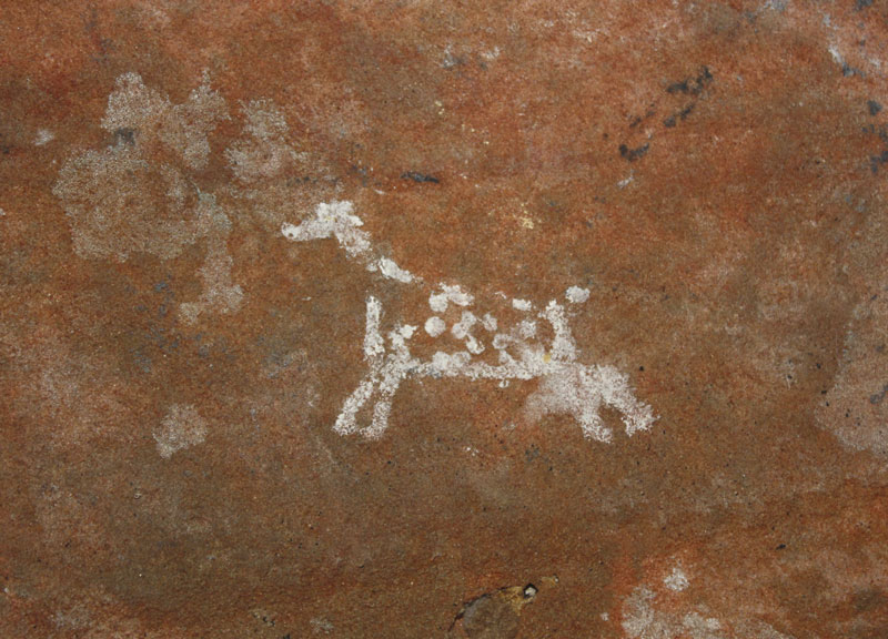
Marilia Perazzo/USPSites in Pedregulho, in the north of the state of São Paulo: rock paintings represent animalsMarilia Perazzo/USP
“It is very important that this work has been done at this time, because it records the existence of sites before their disappearance,” remarks archaeologist Daniela Cisneiros, coordinator of the Graduate Program in Archaeology at UFPE and a researcher at FUMDHAM who did not take part in the USP study. “Many of the São Paulo sites are in an advanced state of deterioration and are very fragile, in nonprotected areas. Knowledge about them can contribute towards their protection.”
Among the most impressive panels visited is the Pedra do Dioguinho in the municipality of Dourado, in the middle of the state, 280 kilometers from the state capital. Measuring 48 meters in length, it is considered the largest rock art panel in the state. There are types of graphics called tri-digits, which are line drawings that resemble bird footprints, as well as linear shapes, and figures in simple circles, semicircles, and dotted lines. In total, 16 graphic marks have been identified. “It is a beautiful site, one of the most significant in São Paulo,” states Perazzo.
The analyses indicate a date of around 4,000 years ago—which does not mean that human groups made records at the same time, warns the archaeologist. She highlights another two sites that the LEVOC team has been able to date: Abrigo do Alvo, in Analândia, and Abrigo de Itapeva (in the city of the same name). The first is the oldest that is known in the state, with rupestrian records from around 7,500 years ago; the second is estimated to be 4,700 years old.
It is difficult to pinpoint the meaning of the engravings and paintings, especially due to the lack of context. For this reason, the work of the researchers from USP is aimed more at cataloging, preservation, and typification. It is notable, however, that there may have been some type of intention on the part of whoever drew the scenes and shapes on the rocks. “The rupestrian records, whether paintings or engravings, are memory markers of the authorial groups,” Cisneiros adds.
In São Paulo, the engravings, carved directly into the rock, are more frequent than paintings, which involve pigments and are more prevalent in the Northeast. “In the Southeast, there is a dominance of geometrical shapes, with few scenes and more isolated graphisms: the figures are not very dynamic, they are more static,” analyzes the archaeologist from UFPE. A large part of the records in the Northeast are found on riverbanks out in the open, unlike the ones in São Paulo, which are mostly located in shelters protected by rock.
All the characteristics of the rupestrian records make Cisneiros think about the people that lived here thousands of years ago. “Coming into contact with this information, being able to see these engravings, for me, it is an encounter with ancestry, it goes far beyond a scientific discovery,” she reflects.
Project
Human occupation of southeastern South America throughout the Holocene: An interdisciplinary, multiscalar, and diachronic approach (nº 19/18664-9); Grant Mechanism Thematic Project; Principal Investigator Astolfo Gomes de Mello Araujo (USP); Investment R$2,236,584.53.
Scientific articles
AMARAL, M. P. V. et al. Registros rupestres na região central do estado de São Paulo: O Abrigo do Alvo, Analândia, São Paulo, Brasil. Boletim do Museu Paraense Emílio Goeldi. Vol. 17, no. 2. Online. Dec. 2022.
PERAZZO, M., et al. Caracterização e análise dos registros rupestres do sítio Santo Antônio, Serra Azul, SP – Brasil. FUMDHAMentos. Vol. XVIII, no. 2, pp. 73–101. May 2021.
