As Brazilian cities race to adapt to the climate emergency, new tools for urban tree management are emerging. One example is Arbolink, a platform developed by Piracicaba-based startup Propark in São Paulo State. It is designed for urban tree management based on data captured by satellites and vehicles equipped with computer vision. Another initiative, created by Kerno Geo Soluções in the city of São Paulo, offers a service that creates three-dimensional (3D) maps of tree roots without needing to excavate the ground.
Preserving the health of a tree’s root system is important to ensure its integrity, as shown in a 2024 article published in the journal Urban Forestry & Urban Greening by a group from the University of São Paulo (USP), the Federal University of São Paulo (UNIFESP), the Institute for Technological Research (IPT), and others. By analyzing data from 456 trees that fell in central São Paulo between 2016 and 2018, the researchers found that in 33% of cases, the problem was in the roots. In 46% of the incidents, the failure occurred in the branches, and in 21% it originated in the trunk.
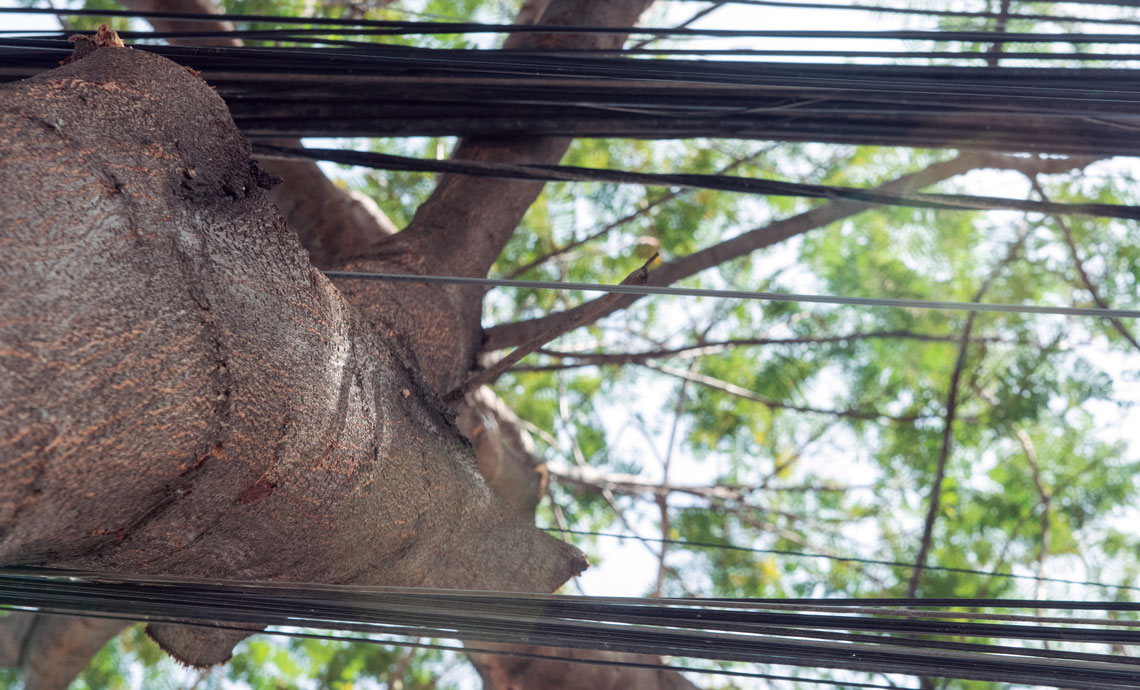
“In a city like São Paulo, water, gas, and internet providers are constantly installing underground pipes and cables. Oversight by public authorities is very limited. There are very few places where the cables are grounded. Those locations are better controlled, but the rest of the city is not. Trees are not the number one priority,” says geophysicist Vinicius Neris Santos, a partner at Kerno Geo Soluções. “When a root is cut, the consequence may only become apparent months or years later, whenever there are strong winds or heavy rains. It is therefore important to know the location and condition of the roots.”
The company’s technology, called Kerno Andas, maps tree root systems using a geophysical method used by other companies and institutions to detect buried water and sewage pipes, electrical cables, and gas lines. In roughly 45 minutes, the tool can map a 5 meter (m) by 5 m underground area around a tree, whether the surface is covered by grass, cement, asphalt, or soil. The ground-penetrating radar emits electromagnetic waves to reveal the spatial distribution, depth, and diameter of roots. It can detect roots at depths of up to approximately 2 m. The novel solution was developed with funding from the FAPESP Innovative Research in Small Businesses (PIPE) program.
As well as identifying root locations, the company plans to incorporate a root health assessment into its service, based on the results of Santos’s postdoctoral research at USP’s Luiz de Queiroz College of Agriculture (ESALQ). “We are working with the electromagnetic signal spectrum, which is capable of providing more detailed information about the roots based on the different frequencies involved,” says the researcher. The company’s clients include the Belo Horizonte city government and several tree management companies.
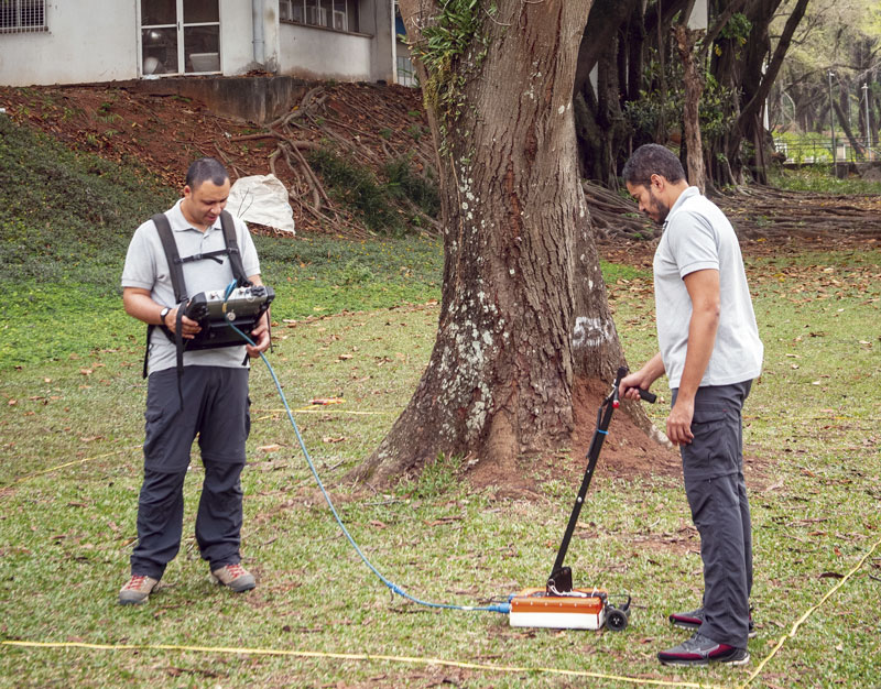
Léo Ramos Chaves / Pesquisa FAPESPTechnicians use Kerno Andas technology to create a 3D map of roots without excavating the groundLéo Ramos Chaves / Pesquisa FAPESP
Software and forest health
Companies and research institutes have also developed software to digitize urban tree management. The aim is for these tools to facilitate the creation and updating of inventories and to help manage pruning and planting. One recent example is the Arbolink system, developed by Propark. Used by municipal agencies in five states (São Paulo, Rio de Janeiro, Minas Gerais, Mato Grosso do Sul, and Rio Grande do Sul), the system is used to manage environmental licensing requests, making use of data generated by satellites and vehicles with computer vision, as well as information collected by technicians in the field.
“The platform has a robust database on tree species, which includes biomechanical characteristics. It provides a real-time overview of the urban forest, facilitating interoperability between municipal departments and public service providers,” explains agricultural engineer Marcelo Machado Leão, director of the company.
Arbolink was also designed to enable collaborative interaction by the public, who can request pruning services and report problems related to trees. It uses AI to assess and manage the risk of trees falling and to ensure proper planting, preventing future conflicts with urban infrastructure. “The system can be adapted to local municipal regulations and is receiving new modules and innovative features,” says Leão.
One of the new features under development is the capability to monitor and calculate ecosystem services, such as carbon balance. Another is the use of climate prediction algorithms for preventive risk management, which is important for helping cities prepare for increasingly frequent extreme weather events, such as gales and heavy rains. The innovation was funded by FAPESP’s PIPE program.
Another tool is Arbio, an urban governance platform designed to aid municipal tree inventory taking, developed by the São Paulo state government research institute (IPT). It has been used in São José dos Campos and São Caetano do Sul, both in the state of São Paulo, and IPT is in negotiations with Prodesp, the state technology company.
“The aim is for Arbio to be used across all 645 municipalities of São Paulo State. Talks are already underway,” says biologist Sérgio Brazolin, head of the Trees, Wood, and Furniture Laboratory at IPT. “What makes it unique is that it is built around a structural calculation model. The tool performs mathematical operations to determine the probability of a tree falling or breaking. Everything is based on plant data, such as size, location, and date of last pruning. Like Arbolink, it helps technicians make management decisions.”
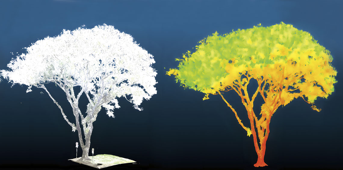
TreetronicsCloud of Lidar data points created by startup Treetronics shows whether a tree is likely to fallTreetronics
The next step, the biologist says, is to incorporate artificial intelligence into a new version of Arbio. The trend in this field is to automate the classification of trees according to their risk of falling or need for pruning. “Research is moving towards the use of image capture technologies, such as Lidar (light detection and ranging), and geoprocessing tools, to locate and measure trees. With historical data on tree falls and their relationship with wind and rain, we can use AI to create more accurate algorithms,” Brazolin explains.
At USP, a group led by biologist Marcos Buckeridge of the Institute of Biosciences and mechanical engineer Emílio Carlos Nelli Silva of the Polytechnic School (Poli) used topological optimization to support decisions on pruning and repruning. This method is used in engineering projects to find a design that maximizes structural performance. It is commonly used in the aerospace and automotive industries, among others. The team offers the service through their startup, Treetronics, founded in April this year.
To create the pruning algorithm, the researchers focused on the geometry and structural behavior of trees. “We applied a computational simulation methodology usually used in structural engineering,” says Silva. The natural development of a tree, the researchers explain, optimizes its structure by shaping the trunk and branches in a way that maximizes stability and resistance to external forces. The algorithm can be used with any type of tree.
“A tree is, by nature, an optimized structure. But if it is pruned improperly, it is weakened and loses this delicate balance, making it more likely to fall,” says the Poli engineer. In cities, there are several obstacles that stop roots and branches from growing optimally, such as compacted soil, overhead power lines, cement, paving stones, and pipelines. Changes in the surroundings also have an impact, such as the demolition or construction of buildings that affect wind strength and direction.
The Treetronics researchers use Lidar to capture the complex geometry of a tree and incorporate it into a computational model. Lidar technology, not yet widely accessible, is capable of performing a three-dimensional laser scan (see Pesquisa FAPESP issues 308 and 346) and generating a cloud of approximately 3 million data points for each plant.
“It creates a 3D image of the tree in just minutes. We feed the data into the computer and simulate the tree deforming under the forces of the wind. As well as improving pruning, we can assess whether a tree is likely to fall in the future,” says Silva. The models are still being refined, but negotiations to conduct tests and adopt the tool are underway with the local governments of São Paulo and other municipalities in São Paulo State.
Digital platform provides interactive maps with environmental and social data from Brazilian municipalities
Since 2024, public managers, researchers, and the general public have had access to UrbVerde, an online platform that provides environmental data for all 5,570 of Brazil’s municipalities, including interactive maps of green areas, comparative indicators, and integrated socioeconomic data. The project, funded by FAPESP’s Public Policy Research Program and the Brazilian National Council for Scientific and Technological Development (CNPq), involves approximately 50 researchers from 11 institutions. The Diadema city government and a consortium of municipalities in the ABC region of São Paulo are partners in the initiative.
Data such as vegetation cover indices, susceptibility to heat islands, and populations served by parks and plazas are gathered from satellite data and other sources, such as the IBGE Demographic Census and OpenStreetMap, a collaborative project based on detailed open information from world maps. “This online geographic information system aims to support urban planning, public policymaking, and climate adaptation in cities,” says Guilherme Bueno de Freitas, vice-coordinator at UrbVerde.
According to Freitas, despite having only been launched recently, the system is already being updated. “We are using Diadema as a pilot project to develop methodologies and indicators that will contribute to a climate action plan,” he explains. Among the developments the group plans to add to the maps are areas most susceptible to flooding, vulnerable to arboviruses, and at risk of food insecurity.
“We want to compile as much open and replicable information as possible, to increase the platform’s visibility. We want to reach small towns across the country, since they are the least likely to have access to any kind of socioenvironmental analysis,” says Freitas. The platform is available for free at www.urbverde.com.br.