
A Minas Gerais native from Uberaba and graduate of the Ouro Preto School of Mines (EM), Avelino Ignácio de Oliveira (1891–1970) worked at the National Petroleum Council in Brazil, established in 1938. A Niterói native and graduate of the Polytechnic School of Rio de Janeiro, Othon Henry Leonardos (1899–1977) was a professor and new addition at the National Museum of Brazil. For 20 years, the pair traversed the country on geological surveys and worked at the National Department of Mineral Production (DNPM). Years later, they reunited and created the first map drafted solely by Brazilians featuring large groups of rocks, also called geological structures, that make up the terrain, highlighting potential areas for oil exploration, a main priority of the New State (1937–1945).
Their work, titled Mapa geológico do Brasil e parte dos países vizinhos (Geological map of Brazil and part of neighboring countries), was published as an insert glued to the back cover of the book Geologia do Brasil (Geology of Brazil), coordinated by the two engineers and published by the Ministry of Agriculture in 1940. Of the 815 pages, 36 feature photos of fossils of mollusks, fish, or the mastodon Cuvieronius humboldti, discovered in the interior of Paraíba and Mato Grosso do Sul, respectively. The fossils help determine the age of the rocks.

Library of the Geosciences Institute of USPMap drafted by Avelino Oliveira and Othon Leonardos published as an insert in the book Geologia do Brasil (Geology of Brazil)Library of the Geosciences Institute of USP
In addition to identifying coal, manganese, iron, gold, copper, aluminum, and other mineral deposits, the book details the boundaries and types of rocks found in the geological structures described for all regions of the country. “The map and the book were a way of disseminating the still undervalued maps drafted over decades by the DNPM technicians,” says geologist Maria Margaret Lopes, from the Museum of Archaeology and Ethnology of the University of São Paulo (MAE-USP) and author of an article published in November in Earth Sciences History about the 1940 map. “It was also a way of showing that Brazilian geologists knew how to make maps, previously only made by foreigners.”
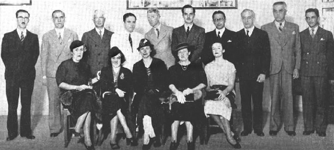
Association of Brazilian Geographers (AGB) Archive Meeting at the Association of Brazilian Geographers, date unknown: standing, from left to right, Leonardos is the sixth and Oliveira the eighthAssociation of Brazilian Geographers (AGB) Archive
According to her, the Brazilians also intended to complete the map by North American geologist John Casper Branner (1850–1922). Published in 1919 in The Geological Society of America Bulletin and in 1920 by the then Geological and Mineralogical Survey of Brazil, which transformed into the DNPM in 1934, the work contained blank areas, due to the difficulty accessing regions covered by forest, and already utilized fossils to estimate the age of sedimentary rocks.
“Branner and the North American geologist Orville Derby [1815–1915, first director of the Geological Survey of Brazil] traveled throughout the Amazon, but there were still expansive areas lacking information,” attests geologist Carlos Schobbenhaus Filho, of the Geological Survey of Brazil. Coauthor of the book Geologia do Brasil (Geology of Brazil; DNPM, 1984), he coordinated production of the Mapa geológico do Brasil (Geological map of Brazil; 1981), The Geological map of Brazil, 1:1 million scale (2004), and the most recent version of the geological map of South America, from 2019.

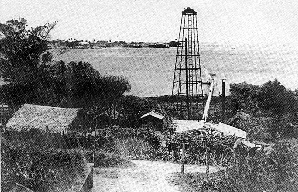
Petrobras Archive Men working on a rig in the Candeias field, in the interior of Bahia, in 1952Petrobras Archive
In a chapter of the book Geologia do continente sul-americano: Evolução da obra de Fernando Flávio Marques de Almeida (Geology of South America: Evolution of the work by Fernando Flávio Marques de Almeida; Beca, 2004), Schobbenhaus argues that the first geological map of Brazil was created by Austrian geologist Franz Foetterle (1823–1876). Published in 1854, in Vienna, it included neighboring countries and prioritized gold, silver, and iron deposits from metamorphic rocks in Minas Gerais.
In the 1940 map, the scale adopted, namely 1:7,000,000 (1 centimeter on the map is equivalent to 70 kilometers of real terrain), does not allow for much detail, “but the broad strokes are correct,” notes geologist Ana Maria Góes, of the Geosciences Institute of USP. “To the north and south of the Amazon sedimentary basin, you can clearly see, in red, the oldest rocks of the Amazonian Craton,” she notes (a craton is an ancient rocky block of the lithosphere, the outer layer of the earth’s surface). “To this day, we don’t have detailed knowledge of these areas, mainly because they are covered by the Amazon rainforest, with rare rocky outcrops.”
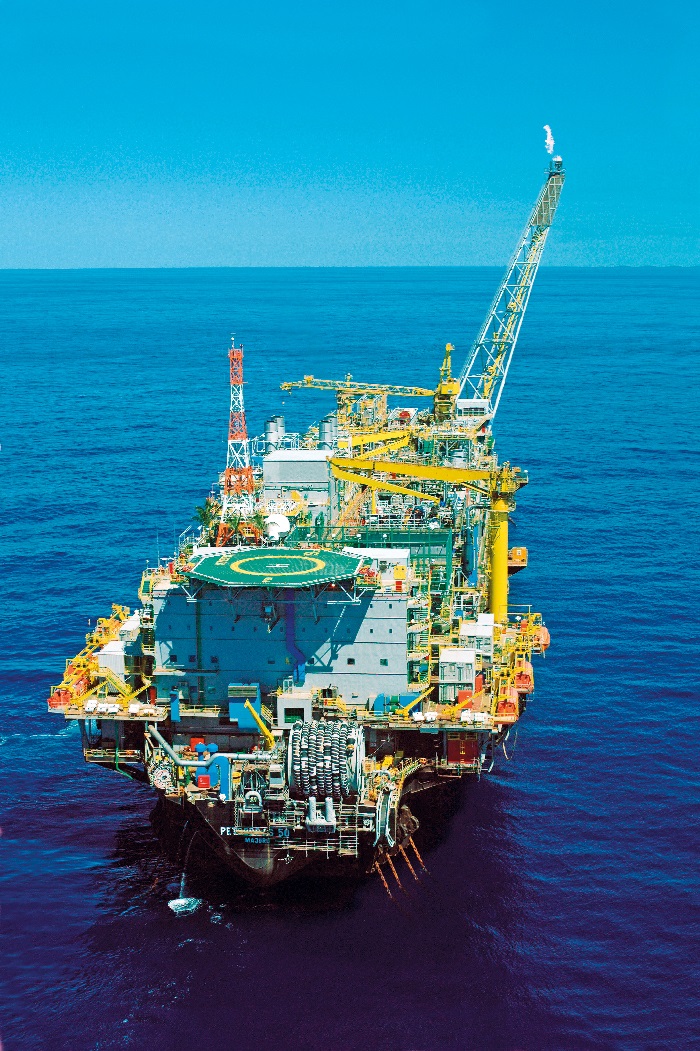
STR / AFP via Getty ImagesPetrobras platform in the Campos Basin, off the coast of Rio de JaneiroSTR / AFP via Getty Images
Map production intensified with the availability of geology courses, offered in Brazil starting in 1957 as a result of a commission appointed by then-President Juscelino Kubitschek (1902–1976) and headed by Leonardos. Mapping with aerial photographs, radar, and satellite images provided information that cartographers never could have imagined. “In the 1970s, the Radar in Amazon Project (RADAM) identified rivers measuring 100 kilometers in length, which we were seeing for the very first time,” says Schobbenhaus. At 82 years old, in his office at the Geological Survey headquarters, in Brasília, he is preparing a map of the most relevant places in the country’s geological history, which he intends to publish by the end of this year.
Oil
Mindful of growing interest in the so-called “black gold,” Oliveira had begun, in 1938, to prepare a map of potential oil sites in Brazil but had to halt his work because of changes in the direction of the DNPM. He resumed his work in late 1939, now alongside Leonardos, who spent the previous year exploring the Tocantins River to see if it was navigable, while carrying out geological surveys in the state of Goiás. With the support of the then Minister of Agriculture, Fernando Costa (1886–1946), the two engineers managed to obtain extra funding to increase the print run of the book containing the map to 2,000 copies. Half of the copies were sent to Lisbon, Porto, and other Portuguese cities as Brazil’s contribution to the celebrations commemorating Portugal’s foundation, in 1140, and independence from Spain, in 1640.
“Avelino and Othon wanted to help Portuguese geologists solve difficult problems and exploit subsoil resources in the African colonies,” commented Lopes. In the preface to the book, the two engineers argued: “Since we have had the good fortune, as of late, to find oil in the coastal Cretaceous strip, why shouldn’t the Portuguese also search for it along Angola’s seemingly similar coastline?” Fossils having been identified in sedimentary terrain on both sides of the Atlantic reinforced this possibility. Oil exploitation in Angola began in 1958 and is currently one of the country’s economic pillars.
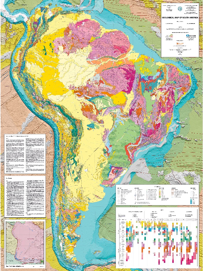
CPRMGeological map of South America in 2019CPRM
In Brazil, the search for fossil fuels began in the early twentieth century, but the first 51 wells drilled by government agencies from 1919 to 1930 were failures. Oil only flowed for the first time in January of 1939 from a well 210 meters deep, in the municipality of Lobato, near Salvador, Bahia. “There was only a hint of oil, but the propaganda was intense in order to restore the image of institutions that had worked for many years without success,” comments Lopes. Commercial-scale production was achieved two years later with a drilling well in Candeias, in the interior of Bahia.
Oliveira, Leonardos, and other experts studying the region were right in predicting the deposits found in the Bahian Recôncavo, according to Lopes. “In order to examine the possibility of oil in Acre and other border regions, they worked with geological survey teams from Peru, Bolivia, and Argentina, which had already found oil in nearby regions,” notes the researcher. Geological surveys indicate that there could be hydrocarbon reserves in Acre, but the potential impact on the environment and Indigenous territories prevent their exploration. “For a long time, geologists insisted on examining southern Brazil, where there were no reserves, because of the type of rocks found there.”
Lopes states that, since the 1920s, geologists had been considering the possibility of exploring oil in the municipality of Campos and off its coast, in Rio de Janeiro, but due to the lack of adequate technology and specialized teams, systematic research and exploration only began in the 1970s. Another large production area currently in operation, the Santos Basin, along the coast of São Paulo, began oil exploration in the 2000s.
Republish