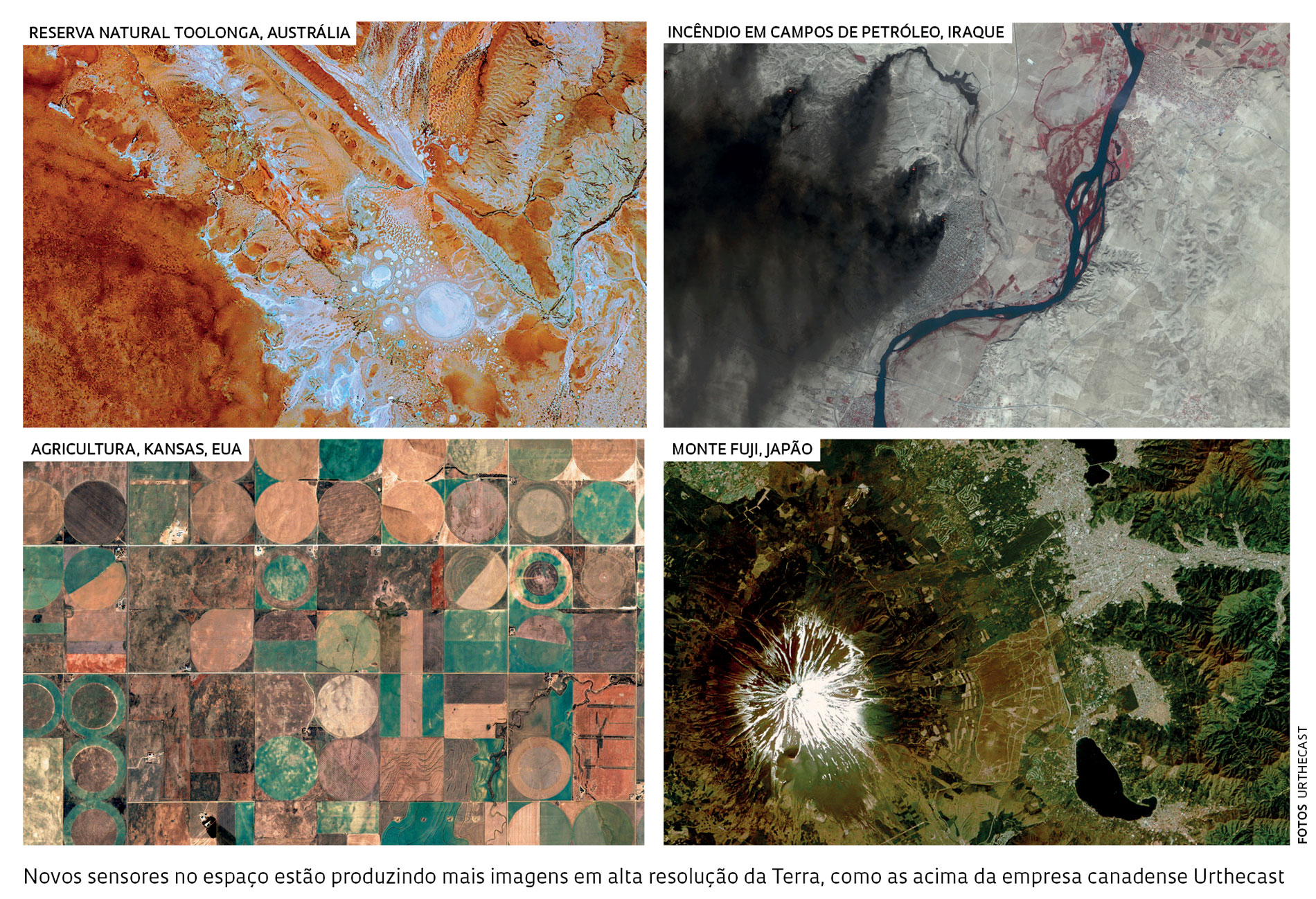
 Earth-observing satellites managed by companies are beginning to arouse interest among researchers. Finnish company Iceye has announced that this year it will launch the first in a series of 20 radar-equipped satellites that can capture images of the same location several times a day. The Scandinavian company is entering a market already populated with competitors such as U.S. firm XpressSAR and Canadian company Urthecast. In 2016, Argentine company Satellogic launched two 35-kilo satellites and became the first company to commercially explore hyperspectral images, which span several wavelengths. Some of the data have been offered to researchers free of charge. The scientific community views the development of commercial satellites with both relief and some reservations. They are relieved because new generations of government satellites are at risk of not making it past the design stage. One such example is NASA’s Pace, which is expected to provide hyperspectral images beginning in 2018. It may, however, be canceled due to cuts in the agency’s budget proposed by President Donald Trump. Their reservations stem from the fact that there are no assurances that companies will provide the specific data or historical series that researchers need. Andreas Kääb, a professor in the Department of Geosciences at the University of Oslo, Norway, told the journal Nature that, although companies may offer images, they rarely provide the raw satellite-captured data that researchers need for their studies.