During the last 30 years, both large and medium-sized Brazilian cities have undergone significant transformations, breaking with standards of form and usage that prevailed in the twentieth century. Studies conducted in 70 municipalities, from all regions of the country, show that during this period there was a proliferation of subdivisions and gated communities, while the appropriation of public space was also increased. Since 2006, the Landscaping Lab (Lab QUAPÁ) of the School of Architecture and Urbanism at the University of São Paulo (FAU-USP) has carried out national surveys to analyze how urban open spaces develop, proposing practical guidelines to municipalities on how to improve their use. “One of our findings is that populations in different cities end up occupying these spaces in different ways, from political and religious purposes to leisure and physical activities,” says Eugênio Fernandes Queiroga, a professor at FAU-USP and coordinator of a research project on the subject.
The research works with a concept of open space that includes not only areas of environmental conservation, but also terrain without buildings such as certain backyard spaces, airport runways, water and sewage treatment plants, and streets and avenues. According to the Brazilian Institute of Geography and Statistics (IBGE), in the 1970s the Brazilian urban population surpassed the rural population, with 56% of the inhabitants living in cities. At that time, Queiroga explains, the highest-quality open spaces were found mainly in elite neighborhoods, such as Casa Forte, in Recife, or Graça, in Salvador, and Jardim América, in São Paulo. Road systems were designed exclusively for the circulation of automotive vehicles, with no provisions for pedestrians and bicycles. “In the 21st century, there is a search for a more equitable distribution of public open spaces around the country,” the researcher summarizes, noting that some guidelines developed by the project regarding the use of open spaces were incorporated into São Paulo’s master plan in 2014.

Queiroga notes that in contrast to the previous era, today open spaces are beginning to spread to other parts of the cities. Some characteristics are common to almost every municipality analyzed, regardless of size, and are found in all the capital cities. One of these is that the streets function as the principal elements of the urban open space systems in the public sphere, except for in Florianópolis and Rio, where ample green areas exist. Along with the private open spaces, they constitute the majority of the unobstructed spaces in cities. “Although still a minority feature of the urban landscape, we’ve seen a proliferation of other categories of public open spaces across various parts of cities, which see common and shared use by the entire population, such as parks, squares, gardens, promenades, and margins,” the researcher observes.
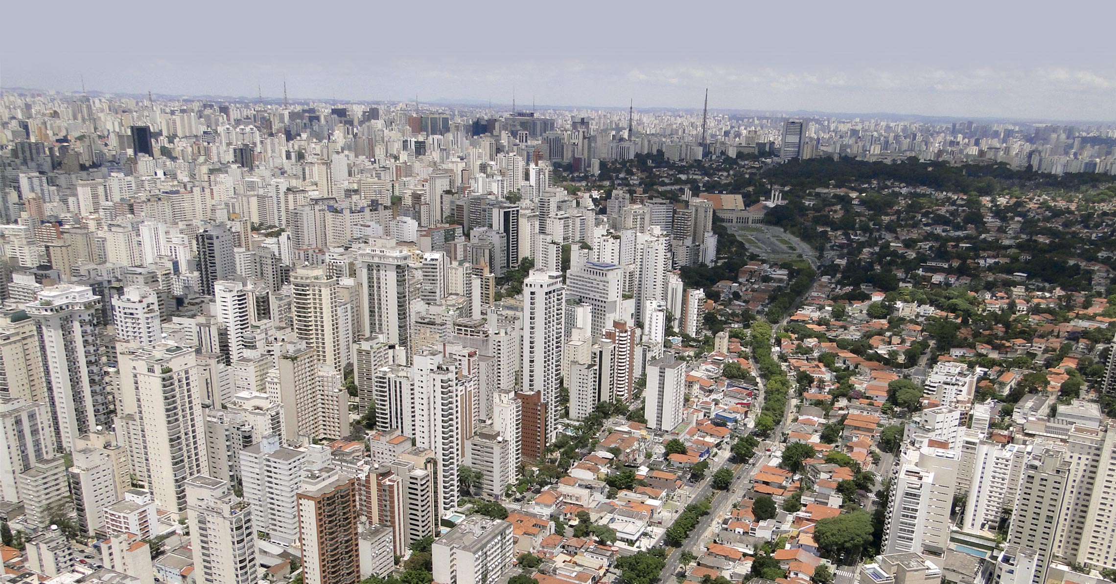
According to Queiroga, although verticalization is a growing part of the urban landscape, with the construction of buildings over four stories high becoming increasingly frequent, municipalities are still mainly horizontal. Buildings with up to three floors prevail in the studied regions. “Unlike one would imagine, in São Paulo, for example, fewer than 15% of city blocks are predominantly made up of buildings with more than four floors,” he says.

Afforestation within cities doesn’t generally exceed 10% of the empty space within city blocks, and large expanses of vegetative cover are common only in parks, squares, vacant lots, and environmental preservation areas. “Some exceptions can be found in elite neighborhoods that have wider sidewalks and, therefore, extended space for tree planting, such as the Jardim districts in São Paulo, the Jardim Oceânico district in Rio de Janeiro, and in the Jurerê district in Florianópolis,” he points out. On the other hand, in peripheral districts occupied mainly by the low-income population the open spaces tend to be limited to streets, small park squares, and soccer fields.
Another common trend identified by the project involves the increase of subdivisions (division of property into lots intended for construction) and gated communities and condominiums, which meet the demands of the middle- and upper-income strata of the population. “But this dynamic doesn’t necessarily mean that people have stopped frequenting public spaces. On the contrary, we found that it was accompanied by a greater appropriation of these spaces, for example, as happened after June 2013, when political demonstrations took place in the streets and squares of cities of all sizes,” Queiroga adds. In this respect, the study detected the creation of new spaces intended for public meetings and socializing, in addition to conventional areas such as city squares and parks.

In São Paulo, for example, Municipal Law No. 16,833 of February of this year transformed the elevated João Goulart avenue, the Minhocão, into a municipal park, increasing the already existing restriction on auto traffic and expanding the hours dedicated to recreational use. Prior to this, in June 2016, the city of São Paulo had created the Open Streets program, based on Federal Law No. 2,587, which had been enacted in January 2012 with the objective of promoting the sustainable development of the city and ensuring equity in the use of public space. Through this program, streets and avenues, such as Avenida Paulista, began to prohibit motorized traffic on some Sundays and holidays, a practice that is now in effect weekly, encouraging pedestrian traffic, physical activities, and leisure. “Viaducts or avenues that are turned into parks without losing their initial role, intended for the circulation of vehicles, exhibit levels of multifunctionality that were not foreseen in their initial designs,” notes Queiroga.
These examples are repeated in other locales, says Eneida Maria Souza Mendonça, a professor in the Department of Architecture and Urbanism at the Federal University of Espírito Santo (UFES). Since 2012, the city of Vitória, for example, has restricted the access of cars to only one side of an important avenue along Camburi beach, with the objective of stimulating sports and leisure pursuits. In Rio de Janeiro, squares, promenades, wide avenues, and especially viaducts, which offer protection against the sun, have also been used for holding fairs, events, and classes, explains Vera Tangari, a professor in the Department of Architecture Projects at the Federal University of Rio de Janeiro (UFRJ). The researcher points out that in Rio, the peripheries and hillside districts, where the low-income population is concentrated, grew more than the central districts. But this growth was not accompanied by the creation of new open spaces.

FAU-USP Landscaping Lab
Manaus (AM) maintains parks to avoid floods and clean up streamsFAU-USP Landscaping LabIn Florianópolis, beaches also perform an important role as open spaces geared towards leisure, says Alina Gonçalves Santiago, a professor in the postgraduate program in architecture and urbanism at the Federal University of Santa Catarina (UFSC). According to her, open areas like squares and parks don’t constitute even 1% of the total municipality. “And the city government justifies the low investments in such spaces because of the existence of beaches, which can fulfill the function of providing leisure spaces to the population,” she says. Despite this, Florianópolis, which is the capital of Santa Catarina State, has an extensive area of environmental preservation, up to about 50% of its land. Much of it, however, is disconnected from the urban grid and doesn’t provide access infrastructure, such as streets for automobiles, parking lots, or hiking trails.
The century of parks
Although the nineteenth century in Europe may be known as a period when urban parks were proliferating, in Brazil the development of these areas didn’t gain momentum until the second half of the twentieth century. Queiroga points to the creation of parks as another recent trend in the country and adds that this dynamic arises from the Federal Constitution of 1988, with its provisions regarding the creation of environmental conservation spaces within Brazilian cities. He observes that Goiânia is the capital that dedicated the most areas for parks in that century. “The abundance of parks occurred mainly in the state capitals, which then spread this culture of urban planning and landscaping to smaller cities,” he observes, noting that the study identified the existence of parks even in small municipalities such as Engenheiro Coelho, in the metropolitan region of Campinas, São Paulo State, which has about 20,000 inhabitants.

In Queiroga’s estimation, the creation of urban green areas generates, among other consequences, an appreciation for the idea of environmental conservation in society. However, for conservation to take place effectively, it is fundamental that green spaces provide access infrastructure. “It’s no use creating green areas and leaving them inaccessible, as is the case with the largest municipal park in São Paulo, Anhanguera Park, which has nine million square meters, but with a visiting area that’s less than one-third the size of Ibirapuera Park. No one can experience it like that,” he says.
The creation of public gardens results from differing motivations, varying according to the city. Thus, municipalities such as Curitiba (Paraná), Manaus (Amazonas), Rio Branco (Acre), and Sorocaba (São Paulo), developed their parks from the need to avoid flooding and clean up streams, explains Queiroga, while in Campo Grande (Mato Grosso do Sul) and Maringá (Paraná), these elements are the result of urban planning measures, which have set aside open spaces in anticipation of future endeavors. Maringá, for example, has had its open spaces planned since its foundation in 1947, when it determined sidewalk construction would be from three to five meters wide and reserved areas for afforestation, in addition to parks established as a conservation strategy for groundwater springs. Queiroga recalls that the Forest Code, updated by Federal Law No. 12.727, of 2012, stipulates that 30-meter margins should be left along the edges of rivers less than 10 meters wide. “The planning of Maringá goes beyond this and designates a reserve of 60 meters, which, over the years, allows for the construction of linear parks along the sides of its rivers,” the researcher observes, indicating Campo Grande as another city that planned its open spaces well. Since the 1960s, in addition to the areas reserved for the creation of parks, the municipality also designed extensive avenues, with median strips up to 20 meters wide, which, over time, made possible the construction of bicycle paths and pedestrian-only areas.

FAU-USP Landscaping Lab
Avenues in Campo Grande, Mato Grosso do Sul: median strips up to 20 meters wide permit the inclusion of bicycle pathsFAU-USP Landscaping LabAs a counterpoint, Queiroga observes that these two cities are a far cry from the situation in Brasília. In the federal capital, he notes, only the district included in the pilot plan was well planned. In the satellite city of Águas Claras, for example, most of the production of new urban spaces involved the construction of buildings with more than 20 stories, which offer internal recreation areas and narrow sidewalks inadequate for pedestrian circulation. Along the same lines, Belo Horizonte also has its planned open spaces mainly in its downtown area, notes Staël de Alvarenga Pereira Costa, a professor at the School of Architecture of the Federal University of Minas Gerais (UFMG). “But in peripheral districts, the only unobstructed areas are the streets and soccer fields.”
Silvio Soares Macedo of FAU-USP, the investigator responsible for coordinating the research project until 2016, says that in order to map out the open spaces the team used satellite images available on the internet, which were incorporated into a geo-referencing system. It was the responsibility of the project team—which in São Paulo alone comprised about 25 people, including professors, undergraduates, and graduate students—to identify the characteristics of each block in every city that was analyzed, including their levels of afforestation and the presence of buildings, gardens, or broad sidewalks.
The proliferation of gated communities was accompanied by increased occupation of public space
With the cartography ready, the FAU lab organized more than 40 workshops at partner universities, as well as with managers of municipal governments. As part of the activities, flyovers were done in the regions studied, in order to allow a closer analysis of the zones initially mapped by satellite. Coordination with city governments involved four cities in the state of São Paulo: Santos, São José dos Campos, Sorocaba, and São Paulo. “In these meetings, we showed the administrators responsible for urban development how they can use the data collected by the project to improve the open space systems in their cities, by developing master plans and using municipal legislation to regulate the operations of the principal agents of transformation in their regions,” Queiroga says.
One of the major accomplishments resulting from the meetings with municipal governments came to fruition in 2014, with the inclusion of concepts related to open-space systems into the master plan of São Paulo, ideas which go beyond simply creating green areas. “For example, we were able to stipulate that the São Paulo plan, a basic instrument of urban development policy, would determine the creation of spaces for public enjoyment on private properties. Today, real estate developers are required to reserve part of their projects for public use, creating, for example, pedestrian walkways and rest areas within the development projects they’ve undertaken,” he reports. This type of measure, explains Queiroga, takes into consideration increasing population densities, allowing new developments to accommodate growing pedestrian traffic in urban areas.

Off the charts
Macapá cannot easily be accessed by land, only by means of a few airlines or ferries, which is why the city has experienced to a far lesser degree the transformations identified in other regions of the country. Founded in the eighteenth century using a master plan drawn up in the colonial period, the capital of Amapá is considered a strategic site due to its location at the entrance of the Amazon River, offering inland waterway connections to Belém and Manaus, and access to the Atlantic Ocean. Pedro Mergulhão, a professor of architecture and urbanism at the Federal University of Amapá (UNIFAP), states that the city’s master plans were designed in harmony with the original, maintaining the width standards of the streets and blocks perpendicular to the Amazon River.
“Thus, part of the urban landscape from the colonial period has been preserved, including the squares and riverbanks that allow open access by the populace, unlike Belém, in Pará, which is built right up to the river’s edge,” he explains. As in most of the state, and unlike in other capitals, Macapá still has extensive unoccupied areas, which encourages the planning of open spaces capable of ensuring a better quality of life for its inhabitants.
Macapá (Amapá State) has extensive open spaces, encouraging the future creation of parks and recreation areas
Macedo, who began researching the subject in the mid-1990s, explains that up until then, urban development projects tended to value the creation of green areas. However, he argues that thinking about urban development from the standpoint of open spaces makes more sense, since these spaces are responsible for structuring the quality of life within cities, determining the incidence of light and air circulation. When analyzing cities from the standpoint of developing open spaces, Vera Tangari notes that the studies conducted by Lab QUAPÁ helped to create a Brazilian school of urban morphology. “Before, this field of study was interpreted through historical analyses of architecture, using the development of European cities as a parameter,” she says. In her view, analyses based on the evolution of open spaces provide a better understanding of the configuration of Brazilian cities, closer to Latin American municipalities. Based on these findings, the project’s researchers intend to create a Latin American observatory of the urban landscape.
Project
Systems of open space in the constitution of the contemporary urban form in Brazil: Production and appropriation—QUAPA-SEL II (2012–2018) (no. 11/51260-7); Grant Mechanism Thematic Project; Principal Investigator Eugênio Fernandes Queiroga (USP); Investment R$585,123.33.