
IBGE Collection
Posters advertising the censuses that count the number of Brazil’s inhabitants every 10 yearsIBGE CollectionUntil the 1930s, statistical records produced in Brazil were sporadic and inexact. Despite efforts to obtain standardized data on a regular basis to better understand Brazil from the geographical and cartographic standpoint, the country navigated the early decades of the 20th century without the benefit of an organized collection of information that depicted the actual size of its territory and its agricultural, manufacturing and commercial potential. It was the goal of modernizing, and above all centralizing, the tools used in studies and statistical surveys of various aspects of Brazilian life that led to the May 29, 1936 establishment of the Brazilian Institute for Geography and Statistics (IBGE), which is now turning 80.
The IBGE emerged within an historical context marked by the perceived need to promote national development, a process that would have to involve federal government leadership. This effort involved modernizing and centralizing technical tools, such as statistical data, at the federal level. The need for an agency that could house these data led Mário Augusto Teixeira de Freitas, then director of statistics at the Ministry of Education, to develop a territorial data management model in which operational decisions could be concentrated in a single coordinating body. “Establishment of IBGE, at the time known as the National Institute of Statistics (INE), represented a movement to revive Brazilian statistics in operational terms and expand data collection activities related to subjects of interest to this country,” says historian Nelson Senra, an agency researcher.

IBGE Collection
Campaign truck advertising the 1950 censusIBGE CollectionGeography was added to the INE within a few months after its establishment. In November 1936, during the National Statistics Convention, Ambassador José Carlos de Macedo Soares, then director of the Institute, underscored the need to draw up physical and political charts of state territories, indicating the boundaries of their municipalities. However, there was no agency exclusively devoted to producing geographical surveys and providing information about the location of areas to be covered by the censuses that could provide geographic data to the statistical surveys. In March 1937, the Brazilian Council of Geography (CBG) was established and later assumed responsibility for projects involving nationwide territorial reconnaissance.
“The CBG became part of the INE on January 26, 1938 and geography and cartography began to play an essential role in the quality of Brazilian statistical surveys,” says cartographic engineer Cláudio João dos Santos in the Department of Cartographic Engineering of the School of Engineering at the State University of Rio de Janeiro (UERJ).
According to Santos, the IBE was given such importance that then-president Getúlio Vargas (1882-1954) suggested the agency be set up at the Palácio do Catete in Rio de Janeiro, then headquarters of the executive branch and official presidential residence. In 1938, Vargas decreed that the 1,540 Brazilian municipalities must prepare maps of their territories. “Municipalities that did not submit maps by 1940 would have their territory annexed to the neighboring municipality,” Santos explains. “They all submitted their maps.” In those days, foreign geographers would come to Brazil to train the IBGE geographers, encouraging them to study abroad, especially in France, Germany and the United States. “This exchange resulted in geographic studies on different regions of Brazil,’ explains cartographic engineer Luiz Henrique Castiglione at the UERJ School of Engineering.
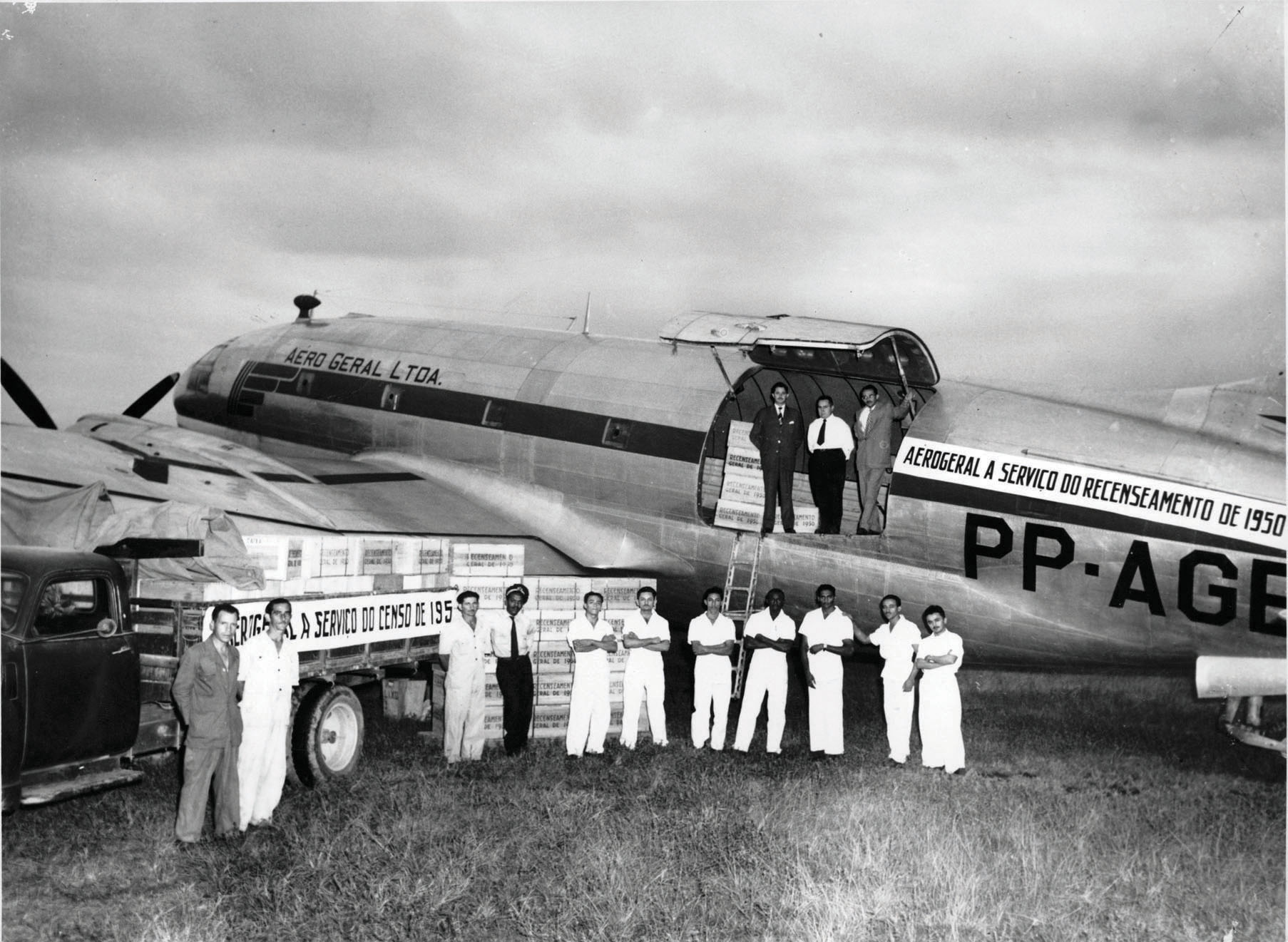
IBGE Collection
Census material ready to be sent to Goiás State a few days before work began in 1950IBGE CollectionIn 1941, Teixeira de Freitas drafted and submitted to Vargas the Basic Plan for Brazil, a document that presented a series of proposals regarding the Institute and national integration. Aspects of the plan included such things as administrative and territorial restructuring and moving the capital to the center of Brazil. In 1942, beginning with the official adoption of Brazil’s division into five geographic regions proposed by Rio de Janeiro engineer Fábio de Macedo Soares Guimarães (see Pesquisa FAPESP Issue nº 158), the IBGE expanded its activities to studies of human and regional geography. “We needed to rediscover Brazil and delve into all aspects of its reality that up to that point were unknown,” Senra says. To this end, IBGE adopted as its methodology field expeditions that would allow detailed observations of the process of territorial occupation and first-hand studies of how Brazilian spaces were being transformed.
In 1943, the expedition to Jalapão began a period of three decades of geographic excursions to study the region located in the area between the states of Goiás (currently the state of Tocantins) and Bahia. In 1949, the Institute signed an agreement with the São Francisco River Valley Commission to carry out geological surveys of the river basin and investigate potential sites for construction of the Paulo Afonso Hydroelectric Complex. In 1953, the Institute toured the entire transition area between the Amazon and the Central-West and Northeast regions, resulting in the study entitled Delimitação da Amazônia para fins de planejamento econômico [Delimitation of the Amazon Region for economic planning purposes], published in the Revista Brasileira de Geografia, a science journal published by the Institute from 1939-1996 that in August 2016 will be reintroduced to commemorate the 80th anniversary of IBGE.

IBGE collection
Recording data in 1940IBGE collectionThe IBGE’s demographic, social and economic studies have been instrumental in building its credibility and stature over the decades, this according to Simon Schwartzman, agency president from 1994-1998 and now a researcher at the Institute for Research on Work and Society. Beginning in the 1970s, the IBGE became a public foundation and began to focus on economic statistics, deploying new methods and technologies to generate data about all aspects of economic growth, size and distribution of the population, employment, education, income, price indices and national accounts.
With the large number of services offered, the acronym IBGE became well known to Brazilians thanks to the massive demographic censuses that count Brazil’s inhabitants every 10 years and gather specific information about population. “One of the merits of the institute over these 80 years has been its ability to constantly maintain technical and professional staff that enabled it to carry out its work, without interruptions or drastic changes in direction,” says Schwartzman. On the other hand, he adds that the IBGE became less important in terms of producing territorial maps and data, which are now published by large international companies, although it continues to produce maps and charts with the Brazilian Army Geographic Service.
Schwartzman says that the Institute’s main challenge in recent decades has been uncertainty with regard to funding, which sometimes prevents important work from being carried out. It recently had to cancel two large-scale research studies due to lack of funds as a result of budget cuts: the 2016 Agricultural Census and the 2016 Population Count, whose estimated costs were R$330.8 million and R$2.6 billion, respectively. Schwartzman thinks one area in which the agency could play a more prominent role is with regard to the environment, by combining geographic, climatic, economic and social data to monitor the status of Brazil’s environment.
Republish