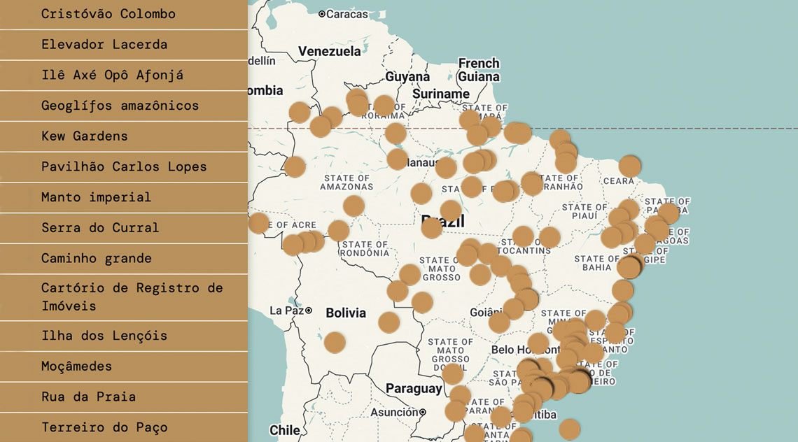
After spending more than 15 years waiting for a stalled land-demarcation process, the Borari Indigenous people of Alter do Chão, in Brazil’s northern state of Pará, decided in 2024 to map their territory themselves. Produced with technical support from the Federal University of Western Pará (UFOPA), the map documents rivers, trails, and sacred sites that are absent from official government maps. In a similar initiative in 2016, residents of the Poço da Draga coastal community in Fortaleza, Ceará, used smartphones and digital maps to document local housing and sanitation conditions. The data they collected contradicted official figures reported by the Brazilian Institute of Geography and Statistics (IBGE).
These initiatives are part of a global intellectual movement known as the spatial or cartographic turn. David Sperling—a professor at the Institute of Architecture and Urban Planning and deputy director of the Institute for Advanced Studies at the University of São Paulo (USP) in São Carlos—explores this movement in his book Cartografias críticas: Ensaios tecnopolíticos e geopoéticos (Critical cartographies: Technopolitical and geopoetic essays; Rio Books). Published in October, the volume grew out of Sperling’s habilitation thesis, defended in 2023. In the book, Sperling traces how, over the past four decades, maps—historically used as tools of territorial control by governments and military organizations (see Pesquisa FAPESP issue n° 318)—have been re-signified by communities, artists, and activists.
Traditionally, the most familiar types of maps depict political boundaries and administrative divisions, topography and natural features, or information on climate, population, and economic activity. “By contrast, contemporary maps falling under what we term as “augmented cartography” depart from this tradition by questioning the very nature and purpose of mapmaking,” Sperling explains.
These new practices can be classified into two dimensions, he elaborates. The first concerns mapmaking as a tool in territorial disputes with the state and large corporations, blending physical features with the cultural dimensions of resident communities. This approach treats maps as social constructions, emphasizing networks of socio-spatial relationships over geographic coordinates and political borders. The second dimension focuses on the symbolic and artistic uses of cartography, viewing maps as platforms for imagining and creating new worlds.
Pablo Ares, Iconoclasistas (https://iconoclasistas.net/) A graphic panel by the Argentine collective Iconoclasistas links economic, social, and cultural processes to grassroots initiatives in neighborhoods across Buenos AiresPablo Ares, Iconoclasistas (https://iconoclasistas.net/)
The spatial or cartographic turn movement began in the 1980s, Sperling continues, when a group of geographers, philosophers, architects, urban planners, and scholars in social studies began to question the idea that cartography was an objective science. One of the seminal works in this movement was the paper “Deconstructing the Map,” written by the British geographer Brian Harley (1932–1991) in 1989. In the essay, Harley builds on ideas from philosophers such as Michel Foucault (1926–1984) and Jacques Derrida (1930–2004), arguing that maps function as instruments of power and must be analyzed as much for what they omit as for what they depict. “During that decade, a perspective gained traction that viewed cartography as an ideological construction shaped by political and aesthetic choices,” Sperling notes. “In this sense, maps do not merely represent reality—they also produce it.”
A local watershed moment in this movement, according to geographer Renato Emerson Nascimento dos Santos of the Federal University of Rio de Janeiro (UFRJ), was the adoption of Brazil’s 1988 Constitution, which formally recognized the cultures, languages, customs, and traditions of the country’s Indigenous peoples. Then, in 1990, Convention No. 169 of the International Labour Organization (ILO) established the right to self-determination for traditional communities worldwide. In Brazil, these two developments paved the way for these groups to adopt new forms of mapmaking to represent their territories.
Against this backdrop, economist Henri Acselrad of the Federal University of Rio de Janeiro (UFRJ) notes that, beginning in the 1990s, a major wave of land demarcation and titling involving traditional communities and peoples emerged across multiple Latin American countries. “This was frequently linked to the growing adoption of practices known as participatory mapmaking or social cartography,” says Acselrad, who heads UFRJ’s Environmental, Economic, and Political Inequality research collective. “These initiatives represented a symbolic and political break with the state’s monopoly over cartography.”
According to Acselrad, rather than portraying territory with claims to objectivity—as if maps were mirrors of reality—these new mapmaking practices argue that maps should incorporate the elements that communities themselves deem meaningful. These may include, for example, areas regarded as sacred by Indigenous peoples, as well as stretches of rivers and lakes used for fishing. “In a philosophical sense, this kind of mapmaking goes beyond the mere representation of geographic space,” says geographer Gisele Girardi of the Federal University of Espírito Santo (UFES). “It becomes a research method that maps processes and connections, with a particular emphasis on reproducing subjectivity.”
Beyond these social and political movements, Santos of UFRJ points to technological advances since the 1980s as another major driver behind the expanding use and development of maps. “The landscape changed even more dramatically between the 1990s and 2000s with the widespread adoption of emerging technologies. Geographic Information Systems (GIS), Global Positioning System (GPS) devices, remote-sensing software, and open access to databases and imagery via the internet greatly expanded the toolsets available to communities,” he notes. As a result, Santos says, mapmaking—which had long been confined to state and military institutions—has been incorporated into local planning and territorial advocacy practices.
Quebradas Maps (https://quebradamaps.com.br) Quebrada Maps is a project dedicated to mapping São Paulo’s inner-city neighborhoodsQuebradas Maps (https://quebradamaps.com.br)
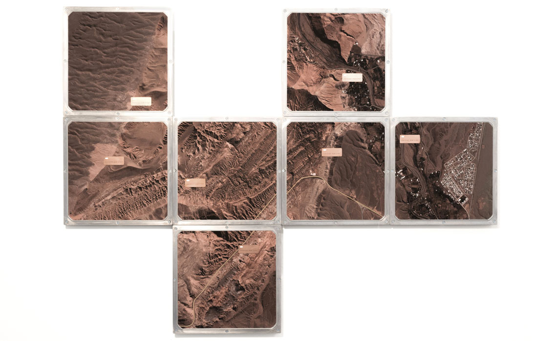
A case in point, Santos says, is the Grande Carajás Project, launched by Brazil’s federal government in 1982, which called for the construction of infrastructure to support large-scale mining across the Amazon, from Pará to Maranhão. The official map produced for the project ignored the presence of populations living in the region, including riverine communities, quilombolas, and Indigenous peoples. To challenge these omissions, anthropologist Alfredo Wagner Berno de Almeida of the State University of Amazonas (UEA) launched a project, called the New Social Cartography of the Amazon, in 2003, in collaboration with other Brazilian organizations.
A first in Brazil, the project supports traditional peoples and communities in producing their own maps using digital and geospatial tools. The team compiles records created from the perspectives of these communities to depict patterns of territorial occupation in the region while also serving as a tool to strengthen social movements. “When Indigenous and traditional peoples in the Amazon were erased from the official map produced for the Grande Carajás Project, they chose to create an alternative map as a way to make their presence visible and defend their territories,” Girardi explains.
Inspired by this experience, other communities have begun producing their own maps to challenge omissions in official maps. Geographer Dorival Bonfá Neto, now an educational affairs specialist at the Federal University of the South and Southeast of Pará (UNIFESSPA), has taken part in several such initiatives, supporting self-demarcation processes led by Indigenous communities in the Santarém region of Pará. One such project involved the Borari people of Alter do Chão, who had been waiting since 2009 for their territory to be officially demarcated by Brazil’s Indigenous authority, FUNAI. The official planning maps failed to include places central to community life, such as sacred sites and fishing areas along the Tapajós River.
Between early 2024 and February 2025, the Borari decided to develop an alternative map with technical support from the Center for Research on Space, Politics, and Social Emancipation (NEPES), affiliated with the geography program at the Federal University of Western Pará (UFOPA), where Neto was teaching at the time. Funded by the Brazilian National Council for Scientific and Technological Development (CNPq), the project combined drone surveys, image-based mapping, land-use documentation, and geographic data shaped by the memories and oral histories of local families. Drawing on this material, the team produced a new map self-demarcating the Borari Indigenous Land of Alter do Chão. The document has since been incorporated into FUNAI’s official demarcation process and may serve as evidence in legal actions, including petitions to Brazil’s Federal Public Prosecutor’s Office (MPF).

“Producing these kinds of maps helps shed light on long-marginalized territories and strengthen communities’ ability to recognize, name, and defend their own spaces,” says architect and urban planner Mariana Quezado Costa Lima, a doctoral researcher at the Federal University of Ceará (UFC). In her research, Costa Lima examines how urban communities in Fortaleza have used maps to defend their rights—whether by negotiating master plans, demanding infrastructure, or resisting forced displacement.
An example of this was seen in 2016, when residents of the Poço da Draga community in Fortaleza carried out their own census, collecting data on housing conditions, educational attainment, and household income. The results revealed clear discrepancies with official statistics. Another example, notes Costa Lima, is the Bom Jardim ZEIS Observatory, an organization formed by a cluster of historically overlooked communities on the southwestern outskirts of Fortaleza. Residents used maps to pressure local authorities to improve sanitation and housing conditions in the area.
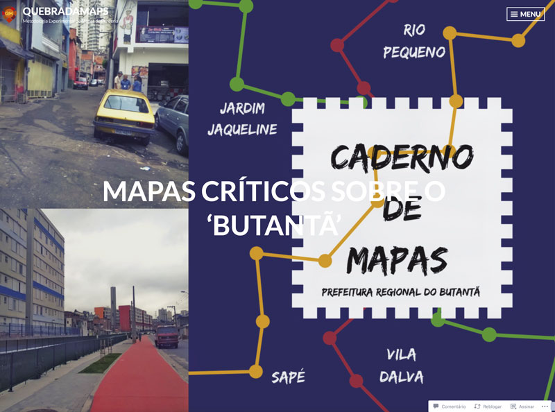
Girardi notes that mapping vulnerable areas has now been mainstreamed across Brazil, particularly through online platforms such as Google Maps and OpenStreetMap. One prominent example is Quebrada Maps, an initiative developed in São Paulo in 2015. The project collaborates with residents of inner-city neighborhoods to produce maps that foreground local culture, shared histories, and the challenges people face in these areas.
Clarissa Sampaio Freitas, a professor of architecture and urban planning at the Federal University of Ceará (UFC), explains that this kind of mapmaking often requires communities to collaborate with universities and nongovernmental organizations. “These institutions provide training workshops that teach residents how to use mapmaking tools, including software such as QGIS and Google Earth,” Freitas says, noting that Fortaleza has one of the highest proportions of informal settlements in Brazil.
Sperling points to similar initiatives in other countries, such as Iconoclasistas, launched in Argentina in 2006 to develop collaborative mapping methodologies with peripheral and Indigenous communities. The initiative offers training workshops and compiles and publishes the results of cooperative mapmaking processes that combine local and academic knowledge, often with support from cultural institutions and public universities. “Examples around the world include maps produced by skateboarders that rethink young people’s right to the city; maps knitted by groups of women to call attention to government neglect of neighborhoods affected by flooding; and online platforms used to combat sexual harassment and expose abuses committed by governments and corporations against minority populations,” says Girardi. Some of these experiences are documented in the book This Is Not an Atlas, published in 2018 by the German collective Kollektiv Orangotango.