 Exactly 62 years after breaking its colonial ties to England, the United States gave a clear demonstration of its wish to claim a place on the world stage and compete with the Europeans in exploring the world. Forged in the last quarter of the 18th century from 13 separatist colonies on North America’s east coast, the young nation sponsored its first scientific expedition, which would sail to every continent as it circumnavigated the globe. Over a four-year period (1838-1842), six sailing vessels, carrying 346 men, among them 40 officers, seven scientists and two artists, followed an itinerary that took them to every continent on the planet. No theory of evolution would result from the long trip, as would happen years after British naturalist Charles Darwin joined the HMS Beagle’s 1831 to 1836 trip around the world. But the undertaking served to establish the foundation for significant future research ideas, train technical specialists and most importantly, map out areas of interest for national expansion, especially along North America’s west coast.
“The expedition shows that an imperialistic culture could already be identified in the United States in the earliest incarnation of the national government,” according to historian Mary Anne Junqueira of the University of São Paulo (USP), who in late 2012 wrote her fellowship thesis on the naval adventure sponsored by the U.S. government. Titled “In Peace Time – The Scientific Voyage to Circumnavigate the Globe by the U. S. Exploring Expedition (1838-1842),” the thesis, partly funded by FAPESP, will be published in book form in 2015. Although little known among the public at large, including in the United States, the undertaking by the new nation was one of the most audacious technical and scientific expeditions to circumnavigate the globe completed in the first half of the 19th century. England and France, the two global powers at the time, conducted more trips of this kind, but they usually dedicated one or two ships to the enterprise. At the time, Spain also undertook global naval expeditions in an effort to keep an eye on its overseas colonies, as did Russia, also a nation on the rise in search of prestige and influence on an international scale. “The United States was in search of its place in the world, and the rivalry with European powers existed not just on land but also in international waters,” says Junqueira.

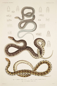
Prints: Reproduction of reports of the U.S. Exploring Expedition, 1844-1874Drawings of bat, bird and reptile species collected on the expedition: the trip yielded 40 tons of specimensPrints: Reproduction of reports of the U.S. Exploring Expedition, 1844-1874
Under the command of Charles Wilkes, a temperamental 42-year-old captain who traveled in the sloop-of-war Vincennes, the U.S. naval expedition set sail from the port of Norfolk, Virginia, on August 18,1838. The vessels sailed close to the island of Madeira, not far from Africa, and then headed for the southern part of the Americas. The first stop was Rio de Janeiro, which, according to Wilkes, was a society marked by the coexistence of backwardness and modernity and “mixed social classes” where “the vegetation seems to grab one’s attention more than anything else.” The expedition rounded South America and, in addition to Brazil, stopped in Argentina, Antarctica, Chile and Peru. It then crossed the South Pacific Ocean (Tahiti, Samoa), anchoring in Sydney, Australia, and visited another site in Antarctica. Next, the expedition headed up toward the North Pacific, mapping in great detail the west coast of North America before heading out again toward the Philippines and Singapore. Finally, it entered the Indian Ocean, rounded the Cape of Good Hope, in what is today South Africa, and headed back via the Atlantic Ocean. It returned to the mother country on June 10, 1842, when the vessels dropped anchor in New York harbor (see the expedition’s route).
The expedition arrived configured very differently from when it was launched. There were only three ships remaining: the Vincennes, the expedition’s lead vessel, and the brigs Porpoise and Oregon. The Oregon had been purchased during the voyage to replace the Relief, which proved to be slow and was sent back to the U.S. after the stop in Chile. Two of the ships, the Peacock and the Sea Gull, were shipwrecked during the trip. A third ship, the Flying Fish, was sold in Singapore owing to damage that would have prevented it from completing the global tour. The crew was also smaller than when the expedition first left Norfolk; however, the actual number is not known. The expedition brought back 40 tons of plant, animal and other specimens collected over the course of the trip. These specimens formed the basic initial collections of the Smithsonian Institution, a complex of museums established in Washington D.C. in 1846.
 SIL19-31-035, 8/6/03, 11:32 AM, 8C, 5590x7304 (138+264), 100%, WILKES, 1/50 s, R47.3, G33.2, B47.0The trip covered almost 140,000 kilometers, which is about 40% of the distance from the Earth to the moon, and its findings were recorded in a report consisting of 23 volumes, published over a 30-year period. Composed by Captain Wilkes himself, who faced a court martial (for abuse of authority aboard ship and murder of native peoples) soon after the expedition was completed but was never punished, the first five volumes went to press in 1844. They constitute the narrative of the naval expedition, and moreover, served as the basis of research conducted by the USP historian, who twice visited the U.S. to consult original manuscripts. “In my research, I also analyzed personal letters, specifically those of Captain Wilkes, official government documents, autobiographies, other trip-related materials and the report’s scientific works,” says Junqueira.
Written by specialists on board the ships, the 18 scientific volumes focused on different technical areas – among them, ethnography, geology, geography, botany, meteorology, zoology – taken up during the trip around the globe. It was not until 1874 that the last volume on physics, written by the captain of the Vincennes himself, was published as a book. The expedition’s scientific team was composed of naturalists Charles Pickering and Titian Ramsay Peale, ethnographer and linguist Horatio Hale, conchologist Joseph Pitty Couthouy, mineralogist James Dwight Dana, botanists William Rich and William Dunlop Brackenridge and artists Alfred T. Agate and Joseph Drayton, responsible for producing the images associated with the trip and its discoveries.
Under the responsibility of the Navy Department, which in peace time focused on this type of task, the exploratory expedition’s stated official goal was to redraw and correct old nautical maps and to draw new maps covering places on the globe that had not yet been scrutinized. Undoubtedly, having good maps appropriate for navigating was important for the U.S. to ensure the safety of its fleets of commercial and military vessels, which could then sail around obstacles at sea and choose the safest and most appropriate port in which to drop anchor. One of the expedition’s most important legacies was the production of 280 maps of islands in the Pacific Ocean, a region that was little known before then, and 180 nautical maps.

NOAACaptain Charles Wilkes: The temperamental 42-year-old commander of the expedition was court martialed after the trip was completed. He wrote five volumes of the narrative on the expedition around the globeNOAA
But the hidden agenda of the expedition was much broader: to build a national technical and scientific capacity, independent of the strategic knowledge dominated by the European powers, take on a geopolitical role in the world and search for new territories that could be annexed to U.S. territory. “Undertakings of this nature always had objectives that were not stated officially,” says the historian. “They dedicated a substantial amount of time to mapping the northwest coast of North America, mainly California and Oregon.” It is no coincidence that these regions, the former belonging to Mexico and the latter disputed by the English, were annexed to the United States six years after the expedition was completed. At that time, what was known as Oregon consisted of the entire west coast of North America, between present-day California and Canada, that is, it contained what are today the states of Oregon and Washington. It is worth remembering that at that time, the U.S. border barely reached the Rocky Mountains, in the western part of North America, giving it no access to the Pacific Ocean.
An unusual episode occurred in January of 1840 when one of the ships in the expedition, the Porpoise, came upon the corvettes Astrolabe and Zélée of the French mission led by Commander Jules Dumont d’Urville, close to Antarctica’s present day east coast. The encounter served to stir up the rivalry between the two powers located on either side of the Atlantic. The debate still rages about who discovered that Antarctica is not just a giant floating iceberg on the ocean (like the Arctic) bur rather a continent, a dry land mass covered with ice and snow. Wilkes mapped a 2400-kilometer section of the Antarctic coastline, a region now known as Wilkes Land, and claimed it for the United States. D’Urville, whose expedition was the first to calculate the location of the South Magnetic Pole, did the same, and found himself on dry land in Antarctica. The area where the French were was called Terre Adélie, a reference to Adele, Urville’s wife.

Reproduction of reports of the U.S. Exploring Expedition, 1844-1874Illustration of men measuring tree trunks in Oregon: region on the west coast of North America, at the time disputed by the English, was mapped by the expeditionReproduction of reports of the U.S. Exploring Expedition, 1844-1874
A specialist in U.S. history who is shaping the next generation of students in this area and is focused on this topic, Junqueira was surprised by the lack of publications of an academic nature or even for the general reader, on this important exploratory trip sponsored by the former English colony. “The expedition has been practically forgotten,” says the USP historian. Americans, always ready to sing their own praises, don’t usually have such a short memory for this immense an undertaking. Some experts say that in the first half of the 19th century, expeditions that circumnavigated the globe were comparable to today’s space missions, owing to their cost and risk. “At a time when a trip to the Pacific was equivalent to a modern space mission to the moon, an expedition of this type was a unique opportunity for scientists to investigate exotic habitats: tropical forests, volcanoes, tropical lakes, icebergs and deserts,” writes historian Nathaniel Philbrick, in his book Sea of Glory – America’s Voyage of Discovery – The U.S. Exploring Expedition, published in 2004. Intended for popular distribution, Philbrick’s book is the most well-known work on the expedition.
A direct beneficiary of the knowledge acquired and the specimens collected during the trip, the Smithsonian is an exception to the reigning silence related to this important expedition that circumnavigated the globe. In 1985, on the occasion of the 75th anniversary of the Natural History Museum, which is one of the museums in the complex maintained by the Smithsonian based in Washington, DC the book Magnificent voyagers: The U. S. Exploring Expedition, 1838-1842 by Herman Viola and Carolyn Margolis was published.

Reproduction of reports of the U.S. Exploring Expedition, 1844-1874Reproduction of the sailing ship Vincennes, the expedition’s lead vessel, and drawings of marine life collected: the trip covered 140,000 kilometersReproduction of reports of the U.S. Exploring Expedition, 1844-1874
In her study, Junqueira discusses the context of these expeditions that encircled the globe, attempts to understand the knowledge the United States sought to acquire with the trip and underscores U.S. interest in other countries in the Americas. She also offers some hypotheses to explain why Americans seem to have little interest in recalling the facts of the expedition. One hypothesis is related to the nature of Captain Wilkes, a controversial military man, who ended up being court martialed. But the historian tends toward a belief that the most decisive factor is of a different nature. “Events like the Mexican-American war from 1846 to 1848 and, mainly, the Civil War, from 1861 to 1865, required enormous effort from the wartime navy and energy from the U.S. population, relegating the expedition and its findings to oblivion,” says Junqueira. The Mexican-American war, for example, resulted in a 25% increase in U.S. territory, which reached the Pacific with the annexation of California.
From this perspective, the Wilkes expedition stands as an affirmation of the United States between 1830 and 1840, when the young republic was still an experiment in representative democracy and the national government was yet to be consolidated. According to Junqueira, in the midst of competing initiatives, the voyage around the globe led by the sailing ship Vincennes portrays a world of exchanges, interchanges and scientific work achieved across nations in the first half of the 19th century. All this happened at a pace that was gaining momentum, charting the course of globalization.
Project
In Peace Time – The Scientific Voyage to Circumnavigate the Globe by the U. S. Exploring Expedition (1838-1842) (nº 2014/50527-8); Grant mechanism Support for research publications – books, Brazil; Principal Investigator Mary Anne Junqueira (USP); Investment R$6,000.00 (FAPESP).